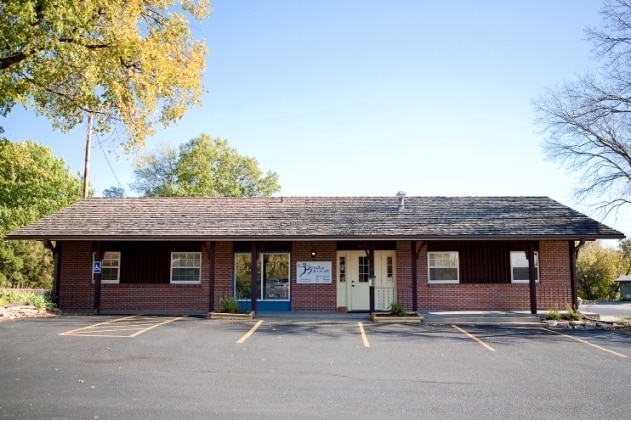
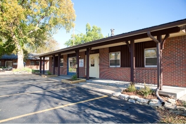
Property Record
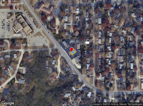
2308 Anderson Ave, Manhattan, KS 66502
NEARBY LISTINGS FOR SALE OR LEASE
Property Detail
2308 Anderson Ave
216-13-0-10-04-015.00-0
Professional Place Pud
Officebuilding
PROFESSIONAL PLACE PUD, LOT 5, LOT 5
X
Riley
20149C0455F
Kansas
2024
5
2025
0.07 AC
000304
Other Market Areas
1,800 SF
Manhattan, KS
DEMOGRAPHICS near 2308 Anderson Ave
1 Mile
3 Mile
5 Mile
2024 Total Population
14,258
54,775
59,847
2029 Population
14,389
54,815
60,138
Pop Growth 2024-2029
+ 0.92%
+ 0.07%
+ 0.49%
Average Age
29
33
33
2024 Total Households
4,880
21,713
23,678
HH Growth 2024-2029
+ 1.43%
0.00%
+ 0.35%
Median Household Inc
$45,699
$56,472
$58,295
Avg Household Size
2.10
2.20
2.20
2024 Avg HH Vehicles
2.00
2.00
2.00
Median Home Value
$217,688
$228,312
$232,484
Median Year Built
1974
1982
1983
Nearby Places
Map Layers
Map Styles
 Street
 Aerial
- Restaurants
- Banks
- Shops
- Fitness
- Groceries
PUBLIC TRANSPORTATION
AIRPORT
Manhattan Regional
DRIVE
WALK
Distance
Manhattan Regional
17 min
8.5 mi
Freight Ports
Tulsa Port Of Catoosa
DRIVE
WALK
Distance
Tulsa Port Of Catoosa
334 min
279.8 mi
Nearby Properties
Address
Land Use
TOTAL SIZE
Lot Size
Zoning
Address
Land Use
TOTAL SIZE
Lot Size
Zoning
45.61 AC
U
Address
Land Use
TOTAL SIZE
Lot Size
Zoning
4,748,887 SF
261.83 AC
U
Address
Land Use
TOTAL SIZE
Lot Size
Zoning
125.53 AC
U
Address
Land Use
TOTAL SIZE
Lot Size
Zoning
1,084,753 SF
69.85 AC
U
Address
Land Use
TOTAL SIZE
Lot Size
Zoning
518,756 SF
11.88 AC
U
Address
Land Use
TOTAL SIZE
Lot Size
Zoning
69,440 SF
27.76 AC
U
Address
Land Use
TOTAL SIZE
Lot Size
Zoning
41,664 SF
22.69 AC
U
Address
Land Use
TOTAL SIZE
Lot Size
Zoning
132.41 AC
U
Address
Land Use
TOTAL SIZE
Lot Size
Zoning
347,291 SF
21.20 AC
R
Address
Land Use
TOTAL SIZE
Lot Size
Zoning
114,793 SF
9.46 AC
U
Address
Land Use
TOTAL SIZE
Lot Size
Zoning
13,351 SF
23.80 AC
R1
Address
Land Use
TOTAL SIZE
Lot Size
Zoning
10,315 SF
128.74 AC
U
Address
Land Use
TOTAL SIZE
Lot Size
Zoning
77,295 SF
4.30 AC
U
Address
Land Use
TOTAL SIZE
Lot Size
Zoning
95,188 SF
6.34 AC
R1
Address
Land Use
TOTAL SIZE
Lot Size
Zoning
29,816 SF
2.09 AC
C4
Address
Land Use
TOTAL SIZE
Lot Size
Zoning
126,616 SF
33.30 AC
R1
Address
Land Use
TOTAL SIZE
Lot Size
Zoning
126,616 SF
28.60 AC
R1
Address
Land Use
TOTAL SIZE
Lot Size
Zoning
1,920 SF
4.47 AC
Address
Land Use
TOTAL SIZE
Lot Size
Zoning
71,182 SF
11.80 AC
R
Address
Land Use
TOTAL SIZE
Lot Size
Zoning
40,076 SF
1.27 AC
PUD
Address
Land Use
TOTAL SIZE
Lot Size
Zoning
89,898 SF
5.48 AC
R3
Address
Land Use
TOTAL SIZE
Lot Size
Zoning
46,653 SF
0.85 AC
U
Address
Land Use
TOTAL SIZE
Lot Size
Zoning
91,968 SF
5.69 AC
PUD
Address
Land Use
TOTAL SIZE
Lot Size
Zoning
71,899 SF
5.50 AC
R
Address
Land Use
TOTAL SIZE
Lot Size
Zoning
32,402 SF
5.76 AC
R
Address
Land Use
TOTAL SIZE
Lot Size
Zoning
34,319 SF
1.77 AC
C1
Address
Land Use
TOTAL SIZE
Lot Size
Zoning
67,276 SF
9 AC
R
Address
Land Use
TOTAL SIZE
Lot Size
Zoning
72,326 SF
4.83 AC
R
Address
Land Use
TOTAL SIZE
Lot Size
Zoning
44,800 SF
4.49 AC
Address
Land Use
TOTAL SIZE
Lot Size
Zoning
9,754 SF
2 AC
PUD
The World's #1 Commercial Real Estate Marketplace
Connect with us
© 2025 CoStar Group
The information above has been obtained from sources believed reliable. While we do not doubt its accuracy we have not verified it and make no guarantee, warranty or representation about it. It is your responsibility to independently confirm its accuracy and completeness. Any projections, opinions, assumptions, or estimates used are for example only and do not represent the current or future performance of the property. The value of this transaction to you depends on tax and other factors which should be evaluated by your tax, financial, and legal advisors. You and your advisors should conduct a careful, independent investigation of the property to determine to your satisfaction the suitability of the property for your needs.