Property Record
231 Beverly Rd, Greenville, SC 29609


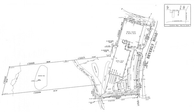
Property Detail
231 Beverly Rd
Greenville-Anderson-Greer, SC
PT.22,PT.23
P009.01-01-009.01
Greenville
Lightindustrial
South Carolina
S1
009.01
B and X Area of moderate flood hazard, usually the area between the limits of the 100-year and 500-year floods.
5.83 AC
2025
Rt 29 Rutherford Rd
2025
Greenville/Spartanburg
001600
NEARBY LISTINGS FOR SALE OR LEASE
DEMOGRAPHICS near 231 Beverly Rd
1 mile
3 mile
5 mile
2025 Total Population
6,250
61,891
170,724
2030 Population
6,763
66,687
184,439
Pop Growth 2025-2030
+ 8.21%
+ 7.75%
+ 8.03%
Average Age
39
39
39
2025 Total Households
2,469
25,881
72,542
HH Growth 2025-2030
+ 8.42%
+ 8.05%
+ 8.45%
Median Household Inc
$80,798
$71,442
$69,363
Avg Household Size
2.40
2.20
2.20
2025 Avg HH Vehicles
2.00
2.00
2.00
Median Home Value
$317,732
$349,288
$336,334
Median Year Built
1981
1976
1981
Nearby Places
Map Layers
Map Styles
 Street
 Aerial
Layers
 Traffic
 Biking
Places
Listings with unknown addresses are not visible on the map
- Restaurants
- Banks
- Shops
- Fitness
- Groceries
PUBLIC TRANSPORTATION
COMMUTER RAIL
Drive
Walk
Distance
11 min
4.3 mi
AIRPORT
Greenville Spartanburg International
Drive
Walk
Distance
Greenville Spartanburg International
22 min
11.9 mi
SALE & LEASE HISTORY
LISTING DATE
SALE/LEASE

Mar 20, 2019
For Sale
Feb 04, 2021
For Lease
Nearby Properties
Address
Land Use
TOTAL SIZE
Lot Size
Zoning
Address
Land Use
TOTAL SIZE
Lot Size
Zoning
14.41 AC
RM2
Address
Land Use
TOTAL SIZE
Lot Size
Zoning
97.93 AC
OD
Address
Land Use
TOTAL SIZE
Lot Size
Zoning
22.19 AC
R12
Address
Land Use
TOTAL SIZE
Lot Size
Zoning
12.01 AC
RM2
Address
Land Use
TOTAL SIZE
Lot Size
Zoning
11.82 AC
RM2
Address
Land Use
TOTAL SIZE
Lot Size
Zoning
9.13 AC
RM2
Address
Land Use
TOTAL SIZE
Lot Size
Zoning
8.94 AC
RM2
Address
Land Use
TOTAL SIZE
Lot Size
Zoning
10 AC
RM
Address
Land Use
TOTAL SIZE
Lot Size
Zoning
28.88 AC
RM
Address
Land Use
TOTAL SIZE
Lot Size
Zoning
6.91 AC
RM
Address
Land Use
TOTAL SIZE
Lot Size
Zoning
10.59 AC
RM2
Address
Land Use
TOTAL SIZE
Lot Size
Zoning
5.61 AC
RM2
Address
Land Use
TOTAL SIZE
Lot Size
Zoning
30.52 AC
C2
Address
Land Use
TOTAL SIZE
Lot Size
Zoning
26.30 AC
R20
Address
Land Use
TOTAL SIZE
Lot Size
Zoning
85.24 AC
C2,R12
Address
Land Use
TOTAL SIZE
Lot Size
Zoning
19.31 AC
R6
Address
Land Use
TOTAL SIZE
Lot Size
Zoning
9.23 AC
C3
Address
Land Use
TOTAL SIZE
Lot Size
Zoning
8.40 AC
I1
Address
Land Use
TOTAL SIZE
Lot Size
Zoning
10.40 AC
R6
Address
Land Use
TOTAL SIZE
Lot Size
Zoning
7.35 AC
C3
Address
Land Use
TOTAL SIZE
Lot Size
Zoning
14.35 AC
I1
Address
Land Use
TOTAL SIZE
Lot Size
Zoning
160.49 AC
Address
Land Use
TOTAL SIZE
Lot Size
Zoning
4.20 AC
C2
Address
Land Use
TOTAL SIZE
Lot Size
Zoning
Address
Land Use
TOTAL SIZE
Lot Size
Zoning
19.79 AC
S1
Address
Land Use
TOTAL SIZE
Lot Size
Zoning
11.64 AC
R6
Address
Land Use
TOTAL SIZE
Lot Size
Zoning
3.23 AC
OD
Address
Land Use
TOTAL SIZE
Lot Size
Zoning
5.79 AC
C2
Address
Land Use
TOTAL SIZE
Lot Size
Zoning
0.92 AC
C2
Address
Land Use
TOTAL SIZE
Lot Size
Zoning
8.95 AC
OD
The World's #1 Commercial Real Estate Marketplace
Connect with us
© 2026 CoStar Group
The information above has been obtained from sources believed reliable. While we do not doubt its accuracy we have not verified it and make no guarantee, warranty or representation about it. It is your responsibility to independently confirm its accuracy and completeness. Any projections, opinions, assumptions, or estimates used are for example only and do not represent the current or future performance of the property. The value of this transaction to you depends on tax and other factors which should be evaluated by your tax, financial, and legal advisors. You and your advisors should conduct a careful, independent investigation of the property to determine to your satisfaction the suitability of the property for your needs.