Property Record
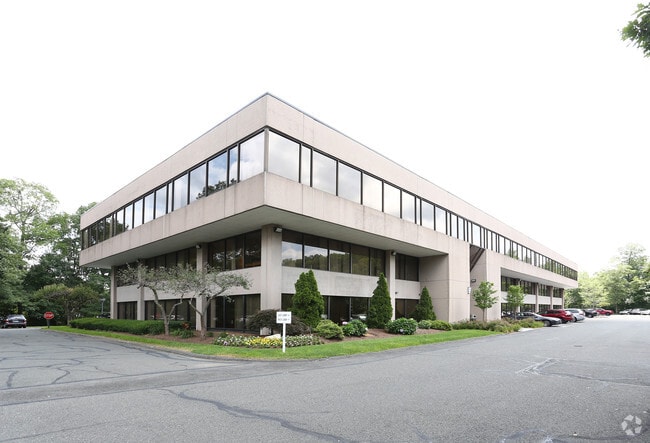
231 Farmington Ave, Farmington, CT 06032


This Property Is For Sale
Current Lease Availabilities
NEARBY LISTINGS FOR SALE OR LEASE
Property Detail
231 Farmington Ave
Officebuilding
Hartford
X
Connecticut
09003C0481F
4.09 AC
2025
Farmington
2025
Hartford
460100
Hartford-West Hartford-East Hartford, CT
47,151 SF
FARM-000067-000000-000010B
DEMOGRAPHICS near 231 Farmington Ave
1 Mile
3 Mile
5 Mile
2024 Total Population
3,148
41,389
178,512
2029 Population
3,143
41,197
177,295
Pop Growth 2024-2029
(0.16%)
(0.46%)
(0.68%)
Average Age
46
43
41
2024 Total Households
1,390
16,986
71,935
HH Growth 2024-2029
(0.29%)
(0.48%)
(0.71%)
Median Household Inc
$120,197
$112,087
$78,192
Avg Household Size
2.20
2.40
2.30
2024 Avg HH Vehicles
2.00
2.00
2.00
Median Home Value
$460,194
$344,659
$292,620
Median Year Built
1978
1961
1957
Nearby Places
Map Layers
Map Styles
 Street
 Aerial
- Restaurants
- Banks
- Shops
- Fitness
- Groceries
PUBLIC TRANSPORTATION
COMMUTER RAIL
Hartford (Hartford Line - Hartford Line)
DRIVE
WALK
Distance
Hartford (Hartford Line - Hartford Line)
11 min
6.5 mi
Hartford Amtrak Station (Amtrak Hartford Line - Amtrak, Northeast Regional - Amtrak, Valley Flyer - Amtrak, Vermonter - Amtrak)
DRIVE
WALK
Distance
Hartford Amtrak Station (Amtrak Hartford Line - Amtrak, Northeast Regional - Amtrak, Valley Flyer - Amtrak, Vermonter - Amtrak)
11 min
6.7 mi
AIRPORT
Bradley International
DRIVE
WALK
Distance
Bradley International
43 min
19.8 mi
Freight Ports
Port of New Haven
DRIVE
WALK
Distance
Port of New Haven
49 min
35.7 mi
Nearby Properties
Address
Land Use
TOTAL SIZE
Lot Size
Zoning
Address
Land Use
TOTAL SIZE
Lot Size
Zoning
61.11 AC
R20
Address
Land Use
TOTAL SIZE
Lot Size
Zoning
20.61 AC
R-10,S
Address
Land Use
TOTAL SIZE
Lot Size
Zoning
19.60 AC
S2
Address
Land Use
TOTAL SIZE
Lot Size
Zoning
191,718 SF
16 AC
R40
Address
Land Use
TOTAL SIZE
Lot Size
Zoning
23.62 AC
A3
Address
Land Use
TOTAL SIZE
Lot Size
Zoning
28 AC
CR
Address
Land Use
TOTAL SIZE
Lot Size
Zoning
0.01 AC
PR
Address
Land Use
TOTAL SIZE
Lot Size
Zoning
14.68 AC
SIF
Address
Land Use
TOTAL SIZE
Lot Size
Zoning
11.16 AC
R30
Address
Land Use
TOTAL SIZE
Lot Size
Zoning
138,582 SF
23.64 AC
BR
Address
Land Use
TOTAL SIZE
Lot Size
Zoning
162,470 SF
27.10 AC
R40
Address
Land Use
TOTAL SIZE
Lot Size
Zoning
16.94 AC
C1
Address
Land Use
TOTAL SIZE
Lot Size
Zoning
215,215 SF
42 AC
R-10,R
Address
Land Use
TOTAL SIZE
Lot Size
Zoning
120,310 SF
13.43 AC
BR
Address
Land Use
TOTAL SIZE
Lot Size
Zoning
8.87 AC
BS,R-1
Address
Land Use
TOTAL SIZE
Lot Size
Zoning
13.13 AC
SDD/BG
Address
Land Use
TOTAL SIZE
Lot Size
Zoning
78,132 SF
11.76 AC
S2
Address
Land Use
TOTAL SIZE
Lot Size
Zoning
173,619 SF
20 AC
SA
Address
Land Use
TOTAL SIZE
Lot Size
Zoning
365.02 AC
CR
Address
Land Use
TOTAL SIZE
Lot Size
Zoning
10.10 AC
RDM
Address
Land Use
TOTAL SIZE
Lot Size
Zoning
59.40 AC
RA
Address
Land Use
TOTAL SIZE
Lot Size
Zoning
190,192 SF
8.60 AC
R-10
Address
Land Use
TOTAL SIZE
Lot Size
Zoning
121,775 SF
19.61 AC
PR
Address
Land Use
TOTAL SIZE
Lot Size
Zoning
1,678 AC
R-20,R
Address
Land Use
TOTAL SIZE
Lot Size
Zoning
8.51 AC
S2
Address
Land Use
TOTAL SIZE
Lot Size
Zoning
155,962 SF
15.35 AC
B2
Address
Land Use
TOTAL SIZE
Lot Size
Zoning
199,354 SF
SDD/BC
Address
Land Use
TOTAL SIZE
Lot Size
Zoning
80,420 SF
18 AC
R-10
Address
Land Use
TOTAL SIZE
Lot Size
Zoning
150,988 SF
12.68 AC
SDD/BG
Address
Land Use
TOTAL SIZE
Lot Size
Zoning
131,861 SF
130 AC
SDD/RM
The World's #1 Commercial Real Estate Marketplace
Connect with us
© 2026 CoStar Group
The information above has been obtained from sources believed reliable. While we do not doubt its accuracy we have not verified it and make no guarantee, warranty or representation about it. It is your responsibility to independently confirm its accuracy and completeness. Any projections, opinions, assumptions, or estimates used are for example only and do not represent the current or future performance of the property. The value of this transaction to you depends on tax and other factors which should be evaluated by your tax, financial, and legal advisors. You and your advisors should conduct a careful, independent investigation of the property to determine to your satisfaction the suitability of the property for your needs.