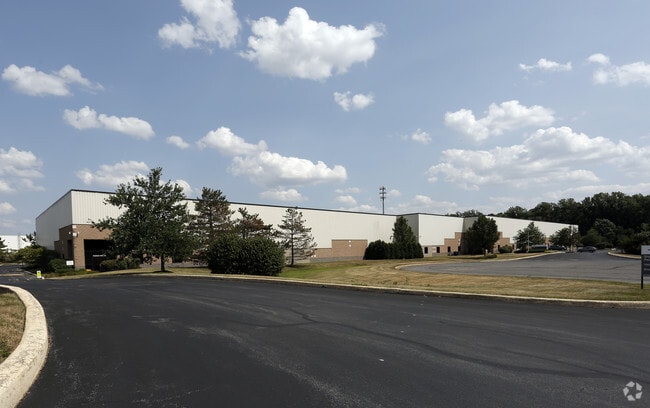
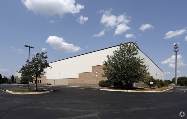
Property Record
231 Lake Dr, Newark, DE 19702

Property Detail
231 Lake Dr
11-021.00-029
New Castle
Lightindustrial
Delaware
BP
17
AE The base floodplain where base flood elevations are provided. AE Zones are now used on new format FIRMs instead of A1-A30 Zones.
10.25 AC
2025
New Castle County
2025
Philadelphia
014814
Philadelphia-Camden-Wilmington, PA-NJ-DE-MD
131,726 SF
NEARBY LISTINGS FOR SALE OR LEASE
DEMOGRAPHICS near 231 Lake Dr
1 mile
3 mile
5 mile
2025 Total Population
2,971
45,910
144,598
2030 Population
3,073
46,996
149,339
Pop Growth 2025-2030
+ 3.43%
+ 2.37%
+ 3.28%
Average Age
40
40
38
2025 Total Households
1,034
17,363
52,421
HH Growth 2025-2030
+ 3.58%
+ 2.46%
+ 3.47%
Median Household Inc
$115,259
$95,689
$86,806
Avg Household Size
2.80
2.60
2.60
2025 Avg HH Vehicles
2.00
2.00
2.00
Median Home Value
$406,422
$366,686
$347,532
Median Year Built
1994
1991
1990
Nearby Places
Map Layers
Map Styles
 Street
 Aerial
Layers
 Traffic
 Biking
Places
Listings with unknown addresses are not visible on the map
- Restaurants
- Banks
- Shops
- Fitness
- Groceries
PUBLIC TRANSPORTATION
COMMUTER RAIL
Newark (R2 - Southeastern Pennsylvania Transportation Authority Regional Rail (SEPTA Regional Rail))
Drive
Walk
Distance
Newark (R2 - Southeastern Pennsylvania Transportation Authority Regional Rail (SEPTA Regional Rail))
8 min
4.6 mi
Churchmans Crossing (R2 - Southeastern Pennsylvania Transportation Authority Regional Rail (SEPTA Regional Rail))
Drive
Walk
Distance
Churchmans Crossing (R2 - Southeastern Pennsylvania Transportation Authority Regional Rail (SEPTA Regional Rail))
15 min
9.1 mi
Freight Ports
Port of Wilmington, RI
Drive
Walk
Distance
Port of Wilmington, RI
25 min
16.5 mi
SALE & LEASE HISTORY
LISTING DATE
SALE/LEASE

Sep 24, 2016
For Lease
Sep 24, 2016
For Sale
Nearby Properties
Address
Land Use
TOTAL SIZE
Lot Size
Zoning
Address
Land Use
TOTAL SIZE
Lot Size
Zoning
Address
Land Use
TOTAL SIZE
Lot Size
Zoning
Address
Land Use
TOTAL SIZE
Lot Size
Zoning
226,878 SF
73.68 AC
CR
Address
Land Use
TOTAL SIZE
Lot Size
Zoning
161,018 SF
97.88 AC
OR
Address
Land Use
TOTAL SIZE
Lot Size
Zoning
766,520 SF
69.52 AC
BI
Address
Land Use
TOTAL SIZE
Lot Size
Zoning
59.70 AC
BP
Address
Land Use
TOTAL SIZE
Lot Size
Zoning
343,216 SF
27.10 AC
ST
Address
Land Use
TOTAL SIZE
Lot Size
Zoning
200,880 SF
49.83 AC
R3
Address
Land Use
TOTAL SIZE
Lot Size
Zoning
385,350 SF
43.51 AC
OR
Address
Land Use
TOTAL SIZE
Lot Size
Zoning
Address
Land Use
TOTAL SIZE
Lot Size
Zoning
266,818 SF
64.16 AC
BP
Address
Land Use
TOTAL SIZE
Lot Size
Zoning
Address
Land Use
TOTAL SIZE
Lot Size
Zoning
293,376 SF
149.74 AC
I
Address
Land Use
TOTAL SIZE
Lot Size
Zoning
281.01 AC
BP
Address
Land Use
TOTAL SIZE
Lot Size
Zoning
930 SF
52.69 AC
S
Address
Land Use
TOTAL SIZE
Lot Size
Zoning
15,168 SF
7.85 AC
NCAP
Address
Land Use
TOTAL SIZE
Lot Size
Zoning
392,955 SF
16.87 AC
NCAP
Address
Land Use
TOTAL SIZE
Lot Size
Zoning
20,250 SF
71.16 AC
S
Address
Land Use
TOTAL SIZE
Lot Size
Zoning
2,040 SF
15.38 AC
NCAP
Address
Land Use
TOTAL SIZE
Lot Size
Zoning
Address
Land Use
TOTAL SIZE
Lot Size
Zoning
263,500 SF
15.28 AC
BI
Address
Land Use
TOTAL SIZE
Lot Size
Zoning
91,473 SF
59.44 AC
S
Address
Land Use
TOTAL SIZE
Lot Size
Zoning
294,288 SF
22.25 AC
NCAP
Address
Land Use
TOTAL SIZE
Lot Size
Zoning
82,688 SF
11.30 AC
BI
Address
Land Use
TOTAL SIZE
Lot Size
Zoning
267,840 SF
20.35 AC
BI
Address
Land Use
TOTAL SIZE
Lot Size
Zoning
47.77 AC
OR
Address
Land Use
TOTAL SIZE
Lot Size
Zoning
153,556 SF
30.12 AC
OR
Address
Land Use
TOTAL SIZE
Lot Size
Zoning
132,816 SF
7.11 AC
NCPUD
Address
Land Use
TOTAL SIZE
Lot Size
Zoning
145.78 AC
BP
Address
Land Use
TOTAL SIZE
Lot Size
Zoning
205,955 SF
24.91 AC
BI
The World's #1 Commercial Real Estate Marketplace
Connect with us
© 2026 CoStar Group
The information above has been obtained from sources believed reliable. While we do not doubt its accuracy we have not verified it and make no guarantee, warranty or representation about it. It is your responsibility to independently confirm its accuracy and completeness. Any projections, opinions, assumptions, or estimates used are for example only and do not represent the current or future performance of the property. The value of this transaction to you depends on tax and other factors which should be evaluated by your tax, financial, and legal advisors. You and your advisors should conduct a careful, independent investigation of the property to determine to your satisfaction the suitability of the property for your needs.