Property Record
231 Main St, Mashpee, MA 02649


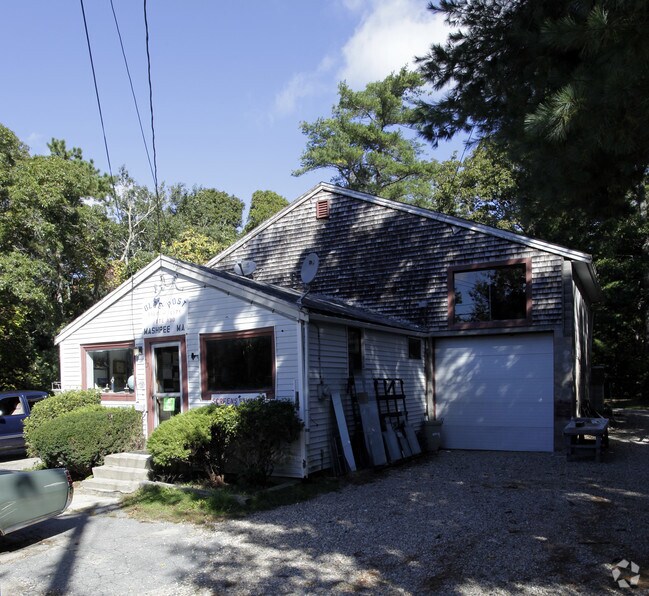
Property Detail
231 Main St
Autorepair
Barnstable
R5
Massachusetts
B and X Area of moderate flood hazard, usually the area between the limits of the 100-year and 500-year floods.
0.22 AC
2025
Other Market Areas
2025
Barnstable Town, MA
015001
MASH-000037-000035
1,504 SF
NEARBY LISTINGS FOR SALE OR LEASE
-
-
View all Mashpee listings for sale on LoopNet.com
DEMOGRAPHICS near 231 Main St
1 mile
3 mile
5 mile
2025 Total Population
3,196
18,981
40,079
2030 Population
3,104
18,475
39,234
Pop Growth 2025-2030
(2.88%)
(2.67%)
(2.11%)
Average Age
45
48
48
2025 Total Households
1,267
7,994
16,771
HH Growth 2025-2030
(3.16%)
(2.85%)
(2.06%)
Median Household Inc
$95,464
$100,810
$106,488
Avg Household Size
2.50
2.30
2.30
2025 Avg HH Vehicles
2.00
2.00
2.00
Median Home Value
$480,286
$626,778
$655,546
Median Year Built
1986
1986
1985
Nearby Places
Map Layers
Map Styles
 Street
 Aerial
Transit
 Traffic
 Biking
Places
Listings with unknown addresses are not visible on the map
- Restaurants
- Banks
- Shops
- Fitness
- Groceries
PUBLIC TRANSPORTATION
AIRPORT
Martha's Vineyard
Drive
Walk
Distance
Martha's Vineyard
90 min
30.4 mi
Freight Ports
Port of New Bedford Harbor
Drive
Walk
Distance
Port of New Bedford Harbor
63 min
41.9 mi
Nearby Properties
Address
Land Use
TOTAL SIZE
Lot Size
Zoning
Address
Land Use
TOTAL SIZE
Lot Size
Zoning
12,713 SF
29.28 AC
C1
Address
Land Use
TOTAL SIZE
Lot Size
Zoning
10.94 AC
R3
Address
Land Use
TOTAL SIZE
Lot Size
Zoning
9 AC
C1
Address
Land Use
TOTAL SIZE
Lot Size
Zoning
15.10 AC
C1
Address
Land Use
TOTAL SIZE
Lot Size
Zoning
24.40 AC
R3
Address
Land Use
TOTAL SIZE
Lot Size
Zoning
73.40 AC
R-2
Address
Land Use
TOTAL SIZE
Lot Size
Zoning
65,930 SF
3.97 AC
C1
Address
Land Use
TOTAL SIZE
Lot Size
Zoning
24.50 AC
C2
Address
Land Use
TOTAL SIZE
Lot Size
Zoning
27.80 AC
R3
Address
Land Use
TOTAL SIZE
Lot Size
Zoning
13.30 AC
I1
Address
Land Use
TOTAL SIZE
Lot Size
Zoning
8,544 SF
20.31 AC
R3
Address
Land Use
TOTAL SIZE
Lot Size
Zoning
6.27 AC
R3
Address
Land Use
TOTAL SIZE
Lot Size
Zoning
8,910 SF
31.84 AC
R5
Address
Land Use
TOTAL SIZE
Lot Size
Zoning
Address
Land Use
TOTAL SIZE
Lot Size
Zoning
7.55 AC
VB-A;S
Address
Land Use
TOTAL SIZE
Lot Size
Zoning
69,251 SF
7.06 AC
S&D;RF
Address
Land Use
TOTAL SIZE
Lot Size
Zoning
158.42 AC
R
Address
Land Use
TOTAL SIZE
Lot Size
Zoning
5.13 AC
Address
Land Use
TOTAL SIZE
Lot Size
Zoning
229.61 AC
R3
Address
Land Use
TOTAL SIZE
Lot Size
Zoning
22.50 AC
R
Address
Land Use
TOTAL SIZE
Lot Size
Zoning
250.40 AC
R5
Address
Land Use
TOTAL SIZE
Lot Size
Zoning
33.20 AC
R5
Address
Land Use
TOTAL SIZE
Lot Size
Zoning
21,396 SF
1.90 AC
C1
Address
Land Use
TOTAL SIZE
Lot Size
Zoning
3.37 AC
C1
Address
Land Use
TOTAL SIZE
Lot Size
Zoning
36,419 SF
7.29 AC
R3
Address
Land Use
TOTAL SIZE
Lot Size
Zoning
3.37 AC
Address
Land Use
TOTAL SIZE
Lot Size
Zoning
7.54 AC
R
Address
Land Use
TOTAL SIZE
Lot Size
Zoning
3.15 AC
R
Address
Land Use
TOTAL SIZE
Lot Size
Zoning
6.73 AC
R
Address
Land Use
TOTAL SIZE
Lot Size
Zoning
30 AC
The World's #1 Commercial Real Estate Marketplace
Connect with us
© 2026 CoStar Group
The information above has been obtained from sources believed reliable. While we do not doubt its accuracy we have not verified it and make no guarantee, warranty or representation about it. It is your responsibility to independently confirm its accuracy and completeness. Any projections, opinions, assumptions, or estimates used are for example only and do not represent the current or future performance of the property. The value of this transaction to you depends on tax and other factors which should be evaluated by your tax, financial, and legal advisors. You and your advisors should conduct a careful, independent investigation of the property to determine to your satisfaction the suitability of the property for your needs.