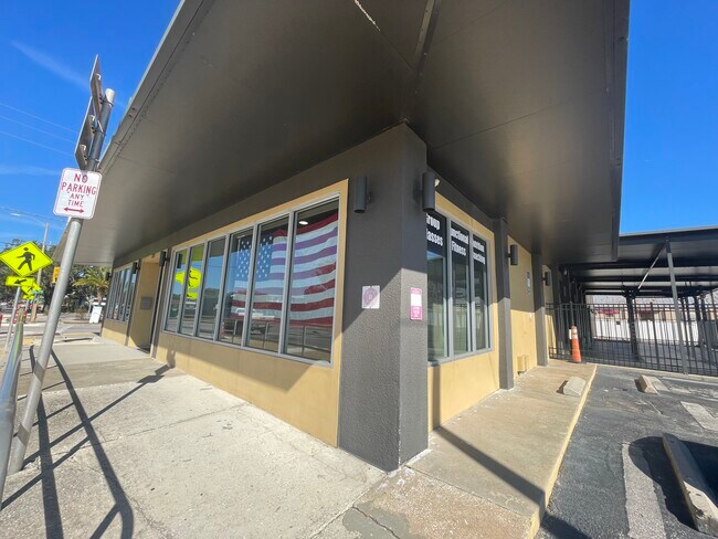
Property Record
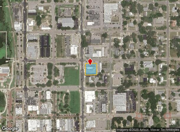
231 N Grove St, Eustis, FL 32726

NEARBY LISTINGS FOR SALE OR LEASE
Property Detail
231 N Grove St
Orlando-Kissimmee-Sanford, FL
Eustis
11-19-26-0100-029-00500
EUSTIS LOTS 5 6 7 8 & N 1/2 OF ALLEY S OF SAID LOTS BLK 29 PB 1 PG 79 ORB 4882 PG 285
Bowlingalley
Lake
X
Florida
12069C0356E
5
2024
0.40 AC
2026
Lake County
030206
Orlando
6,480 SF
DEMOGRAPHICS near 231 N Grove St
1 mile
3 mile
5 mile
2024 Total Population
6,401
32,576
71,419
2029 Population
7,466
37,807
83,359
Pop Growth 2024-2029
+ 16.64%
+ 16.06%
+ 16.72%
Average Age
41
43
45
2024 Total Households
2,512
13,478
30,420
HH Growth 2024-2029
+ 16.56%
+ 15.82%
+ 16.58%
Median Household Inc
$45,656
$56,661
$60,220
Avg Household Size
2.40
2.40
2.30
2024 Avg HH Vehicles
2.00
2.00
2.00
Median Home Value
$182,897
$230,673
$248,721
Median Year Built
1961
1981
1985
Nearby Places
Map Layers
Map Styles
 Street
 Aerial
Transit
 Traffic
 Biking
Places
Listings with unknown addresses are not visible on the map
- Restaurants
- Banks
- Shops
- Fitness
- Groceries
PUBLIC TRANSPORTATION
AIRPORT
Orlando Sanford International
Drive
Walk
Distance
Orlando Sanford International
56 min
35.2 mi
Freight Ports
Port Canaveral
Drive
Walk
Distance
Port Canaveral
115 min
92.2 mi
SALE & LEASE HISTORY
LISTING DATE
SALE/LEASE

Sep 23, 2016
For Sale
Oct 18, 2023
For Lease
Feb 05, 2025
For Lease
Nearby Properties
Address
Land Use
TOTAL SIZE
Lot Size
Zoning
Address
Land Use
TOTAL SIZE
Lot Size
Zoning
730,215 SF
151.42 AC
PD
Address
Land Use
TOTAL SIZE
Lot Size
Zoning
302,511 SF
23.16 AC
Address
Land Use
TOTAL SIZE
Lot Size
Zoning
278,266 SF
23.85 AC
PD
Address
Land Use
TOTAL SIZE
Lot Size
Zoning
226,508 SF
19.15 AC
Address
Land Use
TOTAL SIZE
Lot Size
Zoning
158,442 SF
17.50 AC
MCI
Address
Land Use
TOTAL SIZE
Lot Size
Zoning
267,107 SF
20.40 AC
R1
Address
Land Use
TOTAL SIZE
Lot Size
Zoning
85,539 SF
9.39 AC
Address
Land Use
TOTAL SIZE
Lot Size
Zoning
5,154 SF
52.23 AC
Address
Land Use
TOTAL SIZE
Lot Size
Zoning
204,433 SF
28.43 AC
R1
Address
Land Use
TOTAL SIZE
Lot Size
Zoning
135,298 SF
9.22 AC
SR
Address
Land Use
TOTAL SIZE
Lot Size
Zoning
190,551 SF
20.31 AC
GC
Address
Land Use
TOTAL SIZE
Lot Size
Zoning
36,261 SF
6.27 AC
PD
Address
Land Use
TOTAL SIZE
Lot Size
Zoning
71,076 SF
1.42 AC
Address
Land Use
TOTAL SIZE
Lot Size
Zoning
174,744 SF
38.45 AC
GI
Address
Land Use
TOTAL SIZE
Lot Size
Zoning
79,296 SF
8.54 AC
R3
Address
Land Use
TOTAL SIZE
Lot Size
Zoning
129,512 SF
15 AC
Address
Land Use
TOTAL SIZE
Lot Size
Zoning
94,435 SF
8.16 AC
GC
Address
Land Use
TOTAL SIZE
Lot Size
Zoning
50,754 SF
17.31 AC
R1
Address
Land Use
TOTAL SIZE
Lot Size
Zoning
106,175 SF
8.10 AC
UR
Address
Land Use
TOTAL SIZE
Lot Size
Zoning
77,567 SF
5.14 AC
UR
Address
Land Use
TOTAL SIZE
Lot Size
Zoning
100,117 SF
7.45 AC
GC
Address
Land Use
TOTAL SIZE
Lot Size
Zoning
116,261 SF
5.66 AC
Address
Land Use
TOTAL SIZE
Lot Size
Zoning
60,476 SF
6.76 AC
MCR
Address
Land Use
TOTAL SIZE
Lot Size
Zoning
70,525 SF
37.62 AC
R2
Address
Land Use
TOTAL SIZE
Lot Size
Zoning
44,275 SF
22.50 AC
C1
Address
Land Use
TOTAL SIZE
Lot Size
Zoning
12,573 SF
43.71 AC
A
Address
Land Use
TOTAL SIZE
Lot Size
Zoning
2,000 SF
44.77 AC
CFD
Address
Land Use
TOTAL SIZE
Lot Size
Zoning
4,800 SF
55.94 AC
RMRP
Address
Land Use
TOTAL SIZE
Lot Size
Zoning
59,200 SF
7.66 AC
C3
Address
Land Use
TOTAL SIZE
Lot Size
Zoning
46,374 SF
6.96 AC
GC
The World's #1 Commercial Real Estate Marketplace
Connect with us
© 2026 CoStar Group
The information above has been obtained from sources believed reliable. While we do not doubt its accuracy we have not verified it and make no guarantee, warranty or representation about it. It is your responsibility to independently confirm its accuracy and completeness. Any projections, opinions, assumptions, or estimates used are for example only and do not represent the current or future performance of the property. The value of this transaction to you depends on tax and other factors which should be evaluated by your tax, financial, and legal advisors. You and your advisors should conduct a careful, independent investigation of the property to determine to your satisfaction the suitability of the property for your needs.