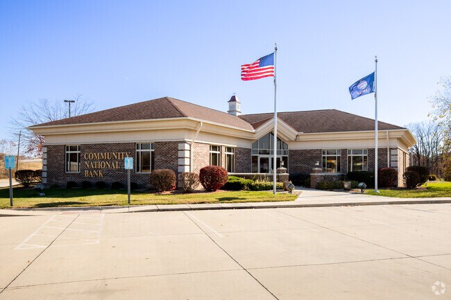
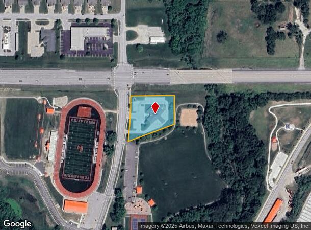
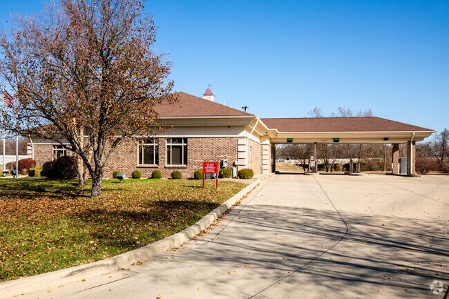
Property Record
231 N Main St, Tonganoxie, KS 66086
NEARBY LISTINGS FOR SALE OR LEASE
-
-
View all Tonganoxie listings for sale on LoopNet.com
Property Detail
231 N Main St
192-09-0-10-02-001.02-0
S09, T11, R21E, ACRES 1.32, PT NE1/4; BEG SE COR INTER 24/40 & MAIN ST, SLY267, NE287.1,N167.2,E258 TO POB
Financialbuilding
Leavenworth
AE
Kansas
20103C0302G
1.32 AC
2024
Leavenworth County
2025
Kansas City
071800
Kansas City, MO-KS
4,970 SF
DEMOGRAPHICS near 231 N Main St
1 Mile
3 Mile
5 Mile
2024 Total Population
3,543
7,402
9,542
2029 Population
3,666
7,625
9,795
Pop Growth 2024-2029
+ 3.47%
+ 3.01%
+ 2.65%
Average Age
39
40
40
2024 Total Households
1,327
2,756
3,526
HH Growth 2024-2029
+ 3.62%
+ 3.16%
+ 2.81%
Median Household Inc
$72,338
$78,953
$85,631
Avg Household Size
2.60
2.60
2.70
2024 Avg HH Vehicles
2.00
2.00
2.00
Median Home Value
$195,473
$246,996
$294,430
Median Year Built
1980
1989
1989
Nearby Places
Map Layers
Map Styles
 Street
 Aerial
- Restaurants
- Banks
- Shops
- Fitness
- Groceries
PUBLIC TRANSPORTATION
AIRPORT
Kansas City International
DRIVE
WALK
Distance
Kansas City International
48 min
37.2 mi
Nearby Properties
Address
Land Use
TOTAL SIZE
Lot Size
Zoning
Address
Land Use
TOTAL SIZE
Lot Size
Zoning
386,537 SF
50 AC
Address
Land Use
TOTAL SIZE
Lot Size
Zoning
132,621 SF
54.37 AC
Address
Land Use
TOTAL SIZE
Lot Size
Zoning
198,100 SF
50.07 AC
Address
Land Use
TOTAL SIZE
Lot Size
Zoning
29,804 SF
18.95 AC
Address
Land Use
TOTAL SIZE
Lot Size
Zoning
50,275 SF
4.94 AC
Address
Land Use
TOTAL SIZE
Lot Size
Zoning
20,246 SF
10.78 AC
Address
Land Use
TOTAL SIZE
Lot Size
Zoning
20,417 SF
15.42 AC
Address
Land Use
TOTAL SIZE
Lot Size
Zoning
10,488 SF
2 AC
Address
Land Use
TOTAL SIZE
Lot Size
Zoning
32,036 SF
9.40 AC
Address
Land Use
TOTAL SIZE
Lot Size
Zoning
12,595 SF
9.90 AC
Address
Land Use
TOTAL SIZE
Lot Size
Zoning
16,725 SF
32.87 AC
Address
Land Use
TOTAL SIZE
Lot Size
Zoning
8,675 SF
1.08 AC
Address
Land Use
TOTAL SIZE
Lot Size
Zoning
12.68 AC
Address
Land Use
TOTAL SIZE
Lot Size
Zoning
14,444 SF
0.56 AC
Address
Land Use
TOTAL SIZE
Lot Size
Zoning
103.47 AC
Address
Land Use
TOTAL SIZE
Lot Size
Zoning
9,690 SF
1.89 AC
Address
Land Use
TOTAL SIZE
Lot Size
Zoning
5,000 SF
1.73 AC
Address
Land Use
TOTAL SIZE
Lot Size
Zoning
6,664 SF
1 AC
Address
Land Use
TOTAL SIZE
Lot Size
Zoning
183.16 AC
Address
Land Use
TOTAL SIZE
Lot Size
Zoning
10,000 SF
1.60 AC
Address
Land Use
TOTAL SIZE
Lot Size
Zoning
6.22 AC
Address
Land Use
TOTAL SIZE
Lot Size
Zoning
1,980 SF
1.26 AC
Address
Land Use
TOTAL SIZE
Lot Size
Zoning
7,665 SF
19.47 AC
Address
Land Use
TOTAL SIZE
Lot Size
Zoning
6,944 SF
0.36 AC
Address
Land Use
TOTAL SIZE
Lot Size
Zoning
5,325 SF
1 AC
Address
Land Use
TOTAL SIZE
Lot Size
Zoning
27,620 SF
10.69 AC
Address
Land Use
TOTAL SIZE
Lot Size
Zoning
1,200 SF
14.75 AC
Address
Land Use
TOTAL SIZE
Lot Size
Zoning
24,725 SF
4.17 AC
Address
Land Use
TOTAL SIZE
Lot Size
Zoning
12,760 SF
2.46 AC
Address
Land Use
TOTAL SIZE
Lot Size
Zoning
33,424 SF
2.32 AC
The World's #1 Commercial Real Estate Marketplace
Connect with us
© 2026 CoStar Group
The information above has been obtained from sources believed reliable. While we do not doubt its accuracy we have not verified it and make no guarantee, warranty or representation about it. It is your responsibility to independently confirm its accuracy and completeness. Any projections, opinions, assumptions, or estimates used are for example only and do not represent the current or future performance of the property. The value of this transaction to you depends on tax and other factors which should be evaluated by your tax, financial, and legal advisors. You and your advisors should conduct a careful, independent investigation of the property to determine to your satisfaction the suitability of the property for your needs.