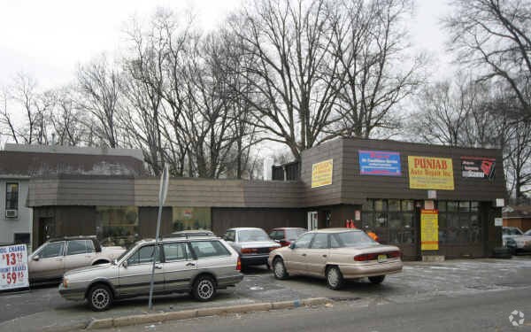
Property Record
231 State Route 27, Iselin, NJ 08830


Save to a Folder
{{folder.Name}}
{{folder.ListingIds.length}} Properties
{{folder.ListingIds.length}} Property
Create a New Folder
Property Detail
231 State Route 27
25-00438-0000-00021
40.0X158 IRR
Servicestation
Middlesex
R27A1
New Jersey
B and X Area of moderate flood hazard, usually the area between the limits of the 100-year and 500-year floods.
21
2025
0.14 AC
2026
North Edison/Woodbridge
002500
Northern New Jersey
1,360 SF
Lakewood-New Brunswick, NJ
NEARBY LISTINGS FOR SALE OR LEASE
DEMOGRAPHICS near 231 State Route 27
1 mile
3 mile
5 mile
2025 Total Population
16,980
155,223
345,197
2030 Population
17,646
162,005
359,559
Pop Growth 2025-2030
+ 3.92%
+ 4.37%
+ 4.16%
Average Age
42
41
41
2025 Total Households
5,347
54,737
120,857
HH Growth 2025-2030
+ 4.08%
+ 4.49%
+ 4.35%
Median Household Inc
$123,721
$120,920
$112,518
Avg Household Size
3.10
2.80
2.80
2025 Avg HH Vehicles
2.00
2.00
2.00
Median Home Value
$477,210
$485,624
$486,556
Median Year Built
1958
1964
1964
Nearby Places
Map Layers
Map Styles
 Street
 Aerial
Layers
 Traffic
 Biking
Places
Listings with unknown addresses are not visible on the map
- Restaurants
- Banks
- Shops
- Fitness
- Groceries
PUBLIC TRANSPORTATION
TRANSIT/SUBWAY
Metropark (Northeast Corridor Line - NJ Transit Commuter Rail (NJ Transit))
Drive
Walk
Distance
Metropark (Northeast Corridor Line - NJ Transit Commuter Rail (NJ Transit))
1 min
11 min
0.4 mi
COMMUTER RAIL
Drive
Walk
Distance
1 min
10 min
0.3 mi
Metropark (Northeast Corridor Line - NJ Transit Commuter Rail (NJ Transit))
Drive
Walk
Distance
Metropark (Northeast Corridor Line - NJ Transit Commuter Rail (NJ Transit))
3 min
10 min
0.5 mi
AIRPORT
Newark Liberty International
Drive
Walk
Distance
Newark Liberty International
25 min
17.5 mi
LaGuardia
Drive
Walk
Distance
LaGuardia
60 min
36.8 mi
John F Kennedy International
Drive
Walk
Distance
John F Kennedy International
66 min
39.3 mi
Freight Ports
New York Container Terminal
Drive
Walk
Distance
New York Container Terminal
24 min
12.1 mi
Nearby Properties
Address
Land Use
TOTAL SIZE
Lot Size
Zoning
Address
Land Use
TOTAL SIZE
Lot Size
Zoning
37.46 AC
EI
Address
Land Use
TOTAL SIZE
Lot Size
Zoning
65.84 AC
PB
Address
Land Use
TOTAL SIZE
Lot Size
Zoning
80,000 SF
23.37 AC
R50
Address
Land Use
TOTAL SIZE
Lot Size
Zoning
0.14 AC
C-4
Address
Land Use
TOTAL SIZE
Lot Size
Zoning
0.66 AC
C-4
Address
Land Use
TOTAL SIZE
Lot Size
Zoning
96.22 AC
RA
Address
Land Use
TOTAL SIZE
Lot Size
Zoning
191.81 AC
R75
Address
Land Use
TOTAL SIZE
Lot Size
Zoning
5,645 SF
91.16 AC
O
Address
Land Use
TOTAL SIZE
Lot Size
Zoning
65.20 AC
Address
Land Use
TOTAL SIZE
Lot Size
Zoning
43.63 AC
MF
Address
Land Use
TOTAL SIZE
Lot Size
Zoning
5.83 AC
RO
Address
Land Use
TOTAL SIZE
Lot Size
Zoning
15.55 AC
Address
Land Use
TOTAL SIZE
Lot Size
Zoning
19.50 AC
LR
Address
Land Use
TOTAL SIZE
Lot Size
Zoning
6.10 AC
RO
Address
Land Use
TOTAL SIZE
Lot Size
Zoning
22.50 AC
LR
Address
Land Use
TOTAL SIZE
Lot Size
Zoning
Address
Land Use
TOTAL SIZE
Lot Size
Zoning
26.50 AC
LR
Address
Land Use
TOTAL SIZE
Lot Size
Zoning
11.49 AC
RO
Address
Land Use
TOTAL SIZE
Lot Size
Zoning
74.58 AC
B4
Address
Land Use
TOTAL SIZE
Lot Size
Zoning
261,144 SF
10.14 AC
OR
Address
Land Use
TOTAL SIZE
Lot Size
Zoning
26 AC
R1
Address
Land Use
TOTAL SIZE
Lot Size
Zoning
10.91 AC
OR
Address
Land Use
TOTAL SIZE
Lot Size
Zoning
1.27 AC
Address
Land Use
TOTAL SIZE
Lot Size
Zoning
22 AC
P
Address
Land Use
TOTAL SIZE
Lot Size
Zoning
2,795 SF
137.05 AC
Address
Land Use
TOTAL SIZE
Lot Size
Zoning
20.27 AC
PB
Address
Land Use
TOTAL SIZE
Lot Size
Zoning
7.16 AC
Address
Land Use
TOTAL SIZE
Lot Size
Zoning
10,173 SF
14.04 AC
OR
Address
Land Use
TOTAL SIZE
Lot Size
Zoning
17.63 AC
LR
Address
Land Use
TOTAL SIZE
Lot Size
Zoning
270,312 SF
8.10 AC
OR
The World's #1 Commercial Real Estate Marketplace
Connect with us
© 2026 CoStar Group
The information above has been obtained from sources believed reliable. While we do not doubt its accuracy we have not verified it and make no guarantee, warranty or representation about it. It is your responsibility to independently confirm its accuracy and completeness. Any projections, opinions, assumptions, or estimates used are for example only and do not represent the current or future performance of the property. The value of this transaction to you depends on tax and other factors which should be evaluated by your tax, financial, and legal advisors. You and your advisors should conduct a careful, independent investigation of the property to determine to your satisfaction the suitability of the property for your needs.