Property Record
2311 Perkins Pl, Silver Spring, MD 20910


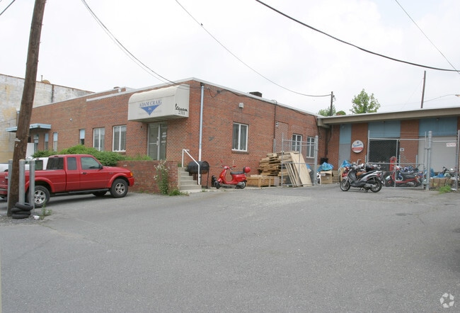
Property Detail
2311 Perkins Pl
13-01409006
3585 590 PT LT5 LT 1 6 P B & M ADD LINDEN
Warehouse
Montgomery
IM2.5
Maryland
B and X Area of moderate flood hazard, usually the area between the limits of the 100-year and 500-year floods.
4
2024
0.44 AC
2025
Silver Spring
702700
Washington, DC
13,534 SF
Washington-Arlington-Alexandria, DC-VA-MD-WV
NEARBY LISTINGS FOR SALE OR LEASE
-
-
-
2201-2353 Distribution Cir
Silver Spring, MD 20910
$19.35 - $22.50 SF/YR
1,360 - 5,440 SF
Industrial
-
-
-
-
-
View all Silver Spring listings for sale on LoopNet.com
DEMOGRAPHICS near 2311 Perkins Pl
1 mile
3 mile
5 mile
2025 Total Population
20,623
211,036
591,775
2030 Population
21,268
218,955
611,276
Pop Growth 2025-2030
+ 3.13%
+ 3.75%
+ 3.30%
Average Age
39
40
40
2025 Total Households
7,995
86,034
227,412
HH Growth 2025-2030
+ 3.16%
+ 3.99%
+ 3.69%
Median Household Inc
$118,791
$125,712
$122,580
Avg Household Size
2.50
2.40
2.50
2025 Avg HH Vehicles
2.00
1.00
1.00
Median Home Value
$717,068
$707,060
$613,980
Median Year Built
1959
1960
1960
Nearby Places
Map Layers
Map Styles
 Street
 Aerial
Layers
 Traffic
 Biking
Places
Listings with unknown addresses are not visible on the map
- Restaurants
- Banks
- Shops
- Fitness
- Groceries
PUBLIC TRANSPORTATION
COMMUTER RAIL
Drive
Walk
Distance
7 min
2.6 mi
Drive
Walk
Distance
9 min
2.6 mi
AIRPORT
Ronald Reagan Washington Ntl
Drive
Walk
Distance
Ronald Reagan Washington Ntl
32 min
13.4 mi
Washington Dulles International
Drive
Walk
Distance
Washington Dulles International
45 min
29.4 mi
Baltimore/Washington International Thurgood Marshall
Drive
Walk
Distance
Baltimore/Washington International Thurgood Marshall
42 min
31.2 mi
Freight Ports
Port of Baltimore
Drive
Walk
Distance
Port of Baltimore
46 min
33.9 mi
Nearby Properties
Address
Land Use
TOTAL SIZE
Lot Size
Zoning
Address
Land Use
TOTAL SIZE
Lot Size
Zoning
70,860 SF
1,616.16 AC
R-1A;UNZON
Address
Land Use
TOTAL SIZE
Lot Size
Zoning
4,400,000 SF
7.92 AC
R60
Address
Land Use
TOTAL SIZE
Lot Size
Zoning
788,000 SF
CR5
Address
Land Use
TOTAL SIZE
Lot Size
Zoning
775,490 SF
14.21 AC
R60
Address
Land Use
TOTAL SIZE
Lot Size
Zoning
1,775,186 SF
75.19 AC
GR1.5
Address
Land Use
TOTAL SIZE
Lot Size
Zoning
579,243 SF
1.89 AC
CR8.0
Address
Land Use
TOTAL SIZE
Lot Size
Zoning
750,000 SF
3.48 AC
CR5.0
Address
Land Use
TOTAL SIZE
Lot Size
Zoning
362,643 SF
CR
Address
Land Use
TOTAL SIZE
Lot Size
Zoning
1,144,541 SF
30.46 AC
CR2.5
Address
Land Use
TOTAL SIZE
Lot Size
Zoning
919,016 SF
3.25 AC
CR5.0
Address
Land Use
TOTAL SIZE
Lot Size
Zoning
287,183 SF
0.59 AC
CR5
Address
Land Use
TOTAL SIZE
Lot Size
Zoning
451,948 SF
1.08 AC
CR5.0
Address
Land Use
TOTAL SIZE
Lot Size
Zoning
115.87 AC
R60
Address
Land Use
TOTAL SIZE
Lot Size
Zoning
575,000 SF
110.35 AC
R60
Address
Land Use
TOTAL SIZE
Lot Size
Zoning
505,000 SF
1.97 AC
CR8.0
Address
Land Use
TOTAL SIZE
Lot Size
Zoning
487,112 SF
3.19 AC
CR3.0
Address
Land Use
TOTAL SIZE
Lot Size
Zoning
302,861 SF
16.30 AC
R-1A
Address
Land Use
TOTAL SIZE
Lot Size
Zoning
730,384 SF
CR5.0
Address
Land Use
TOTAL SIZE
Lot Size
Zoning
364,000 SF
CR6.0
Address
Land Use
TOTAL SIZE
Lot Size
Zoning
400,000 SF
0.93 AC
CR5.0
Address
Land Use
TOTAL SIZE
Lot Size
Zoning
128,125 SF
6.82 AC
CR3.0
Address
Land Use
TOTAL SIZE
Lot Size
Zoning
200,908 SF
0.70 AC
CBDC
Address
Land Use
TOTAL SIZE
Lot Size
Zoning
327,408 SF
1.30 AC
CR
Address
Land Use
TOTAL SIZE
Lot Size
Zoning
327,311 SF
1.83 AC
CR2.5
Address
Land Use
TOTAL SIZE
Lot Size
Zoning
366,915 SF
1.30 AC
CR5.0
Address
Land Use
TOTAL SIZE
Lot Size
Zoning
383,000 SF
2.29 AC
WR-3;WR-4
Address
Land Use
TOTAL SIZE
Lot Size
Zoning
298,708 SF
1.14 AC
CR8.0
Address
Land Use
TOTAL SIZE
Lot Size
Zoning
802,366 SF
2.51 AC
CBD2
Address
Land Use
TOTAL SIZE
Lot Size
Zoning
14.89 AC
R-1A
Address
Land Use
TOTAL SIZE
Lot Size
Zoning
305,000 SF
1.62 AC
CR5.0
The World's #1 Commercial Real Estate Marketplace
Connect with us
© 2026 CoStar Group
The information above has been obtained from sources believed reliable. While we do not doubt its accuracy we have not verified it and make no guarantee, warranty or representation about it. It is your responsibility to independently confirm its accuracy and completeness. Any projections, opinions, assumptions, or estimates used are for example only and do not represent the current or future performance of the property. The value of this transaction to you depends on tax and other factors which should be evaluated by your tax, financial, and legal advisors. You and your advisors should conduct a careful, independent investigation of the property to determine to your satisfaction the suitability of the property for your needs.