Property Record
23110 Fm 521 Rd, Angleton, TX 77515


Property Detail
23110 Fm 521 Rd
Houston-Pasadena-The Woodlands, TX
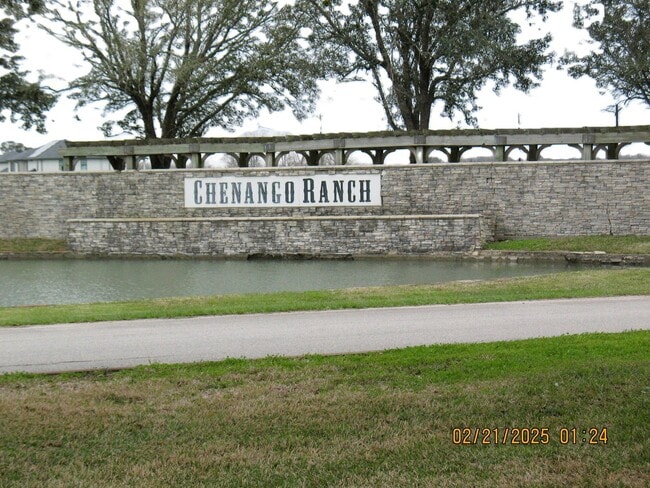
CHENANGO RANCH SEC 1 (A0071-A0122-A0144) BLK 5 LOT 17
2618-1005-017
BRAZORIA
Agriculturalland
Texas
C and X Area of minimal flood hazard, usually depicted on FIRMs as above the 500-year flood level.
17
2024
5.02 AC
2025
Southwest Far
661901
Houston
NEARBY LISTINGS FOR SALE OR LEASE
DEMOGRAPHICS near 23110 Fm 521 Rd
1 mile
3 mile
5 mile
2025 Total Population
338
3,158
12,069
2030 Population
386
3,411
13,182
Pop Growth 2025-2030
+ 14.20%
+ 8.01%
+ 9.22%
Average Age
39
43
43
2025 Total Households
109
720
2,795
HH Growth 2025-2030
+ 13.76%
+ 9.31%
+ 11.41%
Median Household Inc
$89,374
$78,872
$87,866
Avg Household Size
3.00
2.90
2.80
2025 Avg HH Vehicles
2.00
2.00
2.00
Median Home Value
$364,999
$259,689
$266,320
Median Year Built
2004
1988
1993
Nearby Places
Map Layers
Map Styles
 Street
 Aerial
Layers
 Traffic
 Biking
Places
Listings with unknown addresses are not visible on the map
- Restaurants
- Banks
- Shops
- Fitness
- Groceries
PUBLIC TRANSPORTATION
AIRPORT
William P Hobby
Drive
Walk
Distance
William P Hobby
51 min
35.1 mi
Freight Ports
Port Freeport
Drive
Walk
Distance
Port Freeport
36 min
26.6 mi
Nearby Properties
Address
Land Use
TOTAL SIZE
Lot Size
Zoning
Address
Land Use
TOTAL SIZE
Lot Size
Zoning
336 SF
26.79 AC
0040
Address
Land Use
TOTAL SIZE
Lot Size
Zoning
63,810 SF
3.85 AC
Address
Land Use
TOTAL SIZE
Lot Size
Zoning
15.45 AC
Address
Land Use
TOTAL SIZE
Lot Size
Zoning
74,700 SF
15.46 AC
0007
Address
Land Use
TOTAL SIZE
Lot Size
Zoning
111,638 SF
363.32 AC
0035
Address
Land Use
TOTAL SIZE
Lot Size
Zoning
21,409 SF
206.75 AC
0005
Address
Land Use
TOTAL SIZE
Lot Size
Zoning
22,062 SF
10.13 AC
Address
Land Use
TOTAL SIZE
Lot Size
Zoning
32,980 SF
10.98 AC
Address
Land Use
TOTAL SIZE
Lot Size
Zoning
129.90 AC
0002
Address
Land Use
TOTAL SIZE
Lot Size
Zoning
76.70 AC
Address
Land Use
TOTAL SIZE
Lot Size
Zoning
418.56 AC
Address
Land Use
TOTAL SIZE
Lot Size
Zoning
7,000 SF
8.25 AC
Address
Land Use
TOTAL SIZE
Lot Size
Zoning
39.99 AC
0003
Address
Land Use
TOTAL SIZE
Lot Size
Zoning
86,370 SF
31.09 AC
0047
Address
Land Use
TOTAL SIZE
Lot Size
Zoning
37,560 SF
4.49 AC
Address
Land Use
TOTAL SIZE
Lot Size
Zoning
1,256.37 AC
0017
Address
Land Use
TOTAL SIZE
Lot Size
Zoning
162.61 AC
Address
Land Use
TOTAL SIZE
Lot Size
Zoning
18,150 SF
9.96 AC
0222
Address
Land Use
TOTAL SIZE
Lot Size
Zoning
43,900 SF
13.96 AC
Address
Land Use
TOTAL SIZE
Lot Size
Zoning
50.35 AC
0046
Address
Land Use
TOTAL SIZE
Lot Size
Zoning
208.06 AC
0039
Address
Land Use
TOTAL SIZE
Lot Size
Zoning
30,614 SF
38.32 AC
0014
Address
Land Use
TOTAL SIZE
Lot Size
Zoning
8,775 SF
3.97 AC
Address
Land Use
TOTAL SIZE
Lot Size
Zoning
24.24 AC
0036
Address
Land Use
TOTAL SIZE
Lot Size
Zoning
11,492 SF
11 AC
0036
Address
Land Use
TOTAL SIZE
Lot Size
Zoning
39.32 AC
Address
Land Use
TOTAL SIZE
Lot Size
Zoning
10,912 SF
135.07 AC
Address
Land Use
TOTAL SIZE
Lot Size
Zoning
4,610 SF
1.06 AC
Address
Land Use
TOTAL SIZE
Lot Size
Zoning
3,807 SF
5.05 AC
Address
Land Use
TOTAL SIZE
Lot Size
Zoning
5,000 SF
37.46 AC
0043
The World's #1 Commercial Real Estate Marketplace
Connect with us
© 2026 CoStar Group
The information above has been obtained from sources believed reliable. While we do not doubt its accuracy we have not verified it and make no guarantee, warranty or representation about it. It is your responsibility to independently confirm its accuracy and completeness. Any projections, opinions, assumptions, or estimates used are for example only and do not represent the current or future performance of the property. The value of this transaction to you depends on tax and other factors which should be evaluated by your tax, financial, and legal advisors. You and your advisors should conduct a careful, independent investigation of the property to determine to your satisfaction the suitability of the property for your needs.