Property Record
2313 Ferry St, Anderson, CA 96007

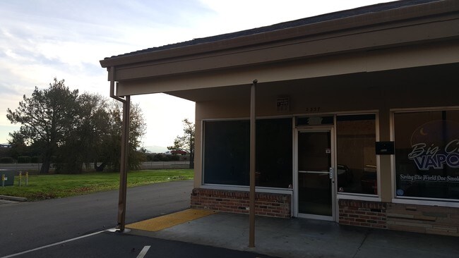
Property Detail
2313 Ferry St
201-170-036-000
Shasta
Multifamilydwelling
California
B and X Area of moderate flood hazard, usually the area between the limits of the 100-year and 500-year floods.
3
2024
0.18 AC
2025
Redding/Chico
012101
Other Market Areas
2,372 SF
Redding, CA
NEARBY LISTINGS FOR SALE OR LEASE
DEMOGRAPHICS near 2313 Ferry St
1 mile
3 mile
5 mile
2025 Total Population
7,174
17,230
26,306
2030 Population
7,182
17,153
26,010
Pop Growth 2025-2030
+ 0.11%
(0.45%)
(1.13%)
Average Age
39
41
41
2025 Total Households
2,848
6,893
10,396
HH Growth 2025-2030
+ 0.07%
(0.49%)
(1.14%)
Median Household Inc
$48,636
$62,322
$72,595
Avg Household Size
2.40
2.50
2.50
2025 Avg HH Vehicles
2.00
2.00
2.00
Median Home Value
$278,671
$284,134
$297,661
Median Year Built
1986
1978
1978
Nearby Places
Map Layers
Map Styles
 Street
 Aerial
Layers
 Traffic
 Biking
Places
Listings with unknown addresses are not visible on the map
- Restaurants
- Banks
- Shops
- Fitness
- Groceries
PUBLIC TRANSPORTATION
AIRPORT
Redding Regional
Drive
Walk
Distance
Redding Regional
7 min
4.3 mi
Freight Ports
Port of Richmond
Drive
Walk
Distance
Port of Richmond
218 min
194.2 mi
SALE & LEASE HISTORY
LISTING DATE
SALE/LEASE

Feb 28, 2017
For Lease
Nearby Properties
Address
Land Use
TOTAL SIZE
Lot Size
Zoning
Address
Land Use
TOTAL SIZE
Lot Size
Zoning
373 SF
113.03 AC
Address
Land Use
TOTAL SIZE
Lot Size
Zoning
Address
Land Use
TOTAL SIZE
Lot Size
Zoning
34.66 AC
M
Address
Land Use
TOTAL SIZE
Lot Size
Zoning
37,651 SF
26.49 AC
M-L
Address
Land Use
TOTAL SIZE
Lot Size
Zoning
167,617 SF
14.60 AC
Address
Land Use
TOTAL SIZE
Lot Size
Zoning
183,907 SF
11.52 AC
Address
Land Use
TOTAL SIZE
Lot Size
Zoning
86,112 SF
4.21 AC
Address
Land Use
TOTAL SIZE
Lot Size
Zoning
183,907 SF
7.98 AC
Address
Land Use
TOTAL SIZE
Lot Size
Zoning
16,623 SF
1.16 AC
Address
Land Use
TOTAL SIZE
Lot Size
Zoning
2.88 AC
Address
Land Use
TOTAL SIZE
Lot Size
Zoning
42,472 SF
3.20 AC
Address
Land Use
TOTAL SIZE
Lot Size
Zoning
Address
Land Use
TOTAL SIZE
Lot Size
Zoning
58,261 SF
2.50 AC
Address
Land Use
TOTAL SIZE
Lot Size
Zoning
7.34 AC
F-1
Address
Land Use
TOTAL SIZE
Lot Size
Zoning
19,031 SF
3.15 AC
Address
Land Use
TOTAL SIZE
Lot Size
Zoning
3.54 AC
Address
Land Use
TOTAL SIZE
Lot Size
Zoning
5.20 AC
Address
Land Use
TOTAL SIZE
Lot Size
Zoning
32,400 SF
6.64 AC
Address
Land Use
TOTAL SIZE
Lot Size
Zoning
1,472 SF
7.59 AC
M-L
Address
Land Use
TOTAL SIZE
Lot Size
Zoning
972 SF
6.12 AC
Address
Land Use
TOTAL SIZE
Lot Size
Zoning
5,637 SF
2 AC
Address
Land Use
TOTAL SIZE
Lot Size
Zoning
1.60 AC
Address
Land Use
TOTAL SIZE
Lot Size
Zoning
26,142 SF
1.60 AC
Address
Land Use
TOTAL SIZE
Lot Size
Zoning
25,273 SF
1.22 AC
Address
Land Use
TOTAL SIZE
Lot Size
Zoning
6,167 SF
2.28 AC
Address
Land Use
TOTAL SIZE
Lot Size
Zoning
6,960 SF
1 AC
Address
Land Use
TOTAL SIZE
Lot Size
Zoning
4,676 SF
2.06 AC
Address
Land Use
TOTAL SIZE
Lot Size
Zoning
2,268 SF
7.43 AC
M-L
Address
Land Use
TOTAL SIZE
Lot Size
Zoning
54,824 SF
3.47 AC
Address
Land Use
TOTAL SIZE
Lot Size
Zoning
9.89 AC
F-1
The World's #1 Commercial Real Estate Marketplace
Connect with us
© 2026 CoStar Group
The information above has been obtained from sources believed reliable. While we do not doubt its accuracy we have not verified it and make no guarantee, warranty or representation about it. It is your responsibility to independently confirm its accuracy and completeness. Any projections, opinions, assumptions, or estimates used are for example only and do not represent the current or future performance of the property. The value of this transaction to you depends on tax and other factors which should be evaluated by your tax, financial, and legal advisors. You and your advisors should conduct a careful, independent investigation of the property to determine to your satisfaction the suitability of the property for your needs.