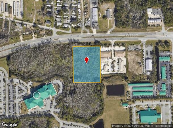
Property Record
2315 E Moody Blvd, Bunnell, FL 32110


NEARBY LISTINGS FOR SALE OR LEASE
Property Detail
2315 E Moody Blvd
Deltona-Daytona Beach-Ormond Beach, FL
Bunnell Dev Co
11-12-30-0650-000D0-0041
3.22 AC BUNNELL DEV CO SUBD NLY 400 TR 5 BLK D & A STRIP LYING NLY THEREOF AND SLY OF SR 100 AND BEING A PORTION OF TR 15 BLK A OR 879 PG 1299 OR 1862/328 OR 1869/325-CD OR 2323/1492-RDMN TINA PEARSON SHEETS TRUSTEE
Commercialacreage
Flagler
X
Florida
12035C0226E
41
2024
3.22 AC
2025
Daytona Area
060206
Other Market Areas
DEMOGRAPHICS near 2315 E Moody Blvd
1 Mile
3 Mile
5 Mile
2024 Total Population
3,086
26,017
56,093
2029 Population
3,743
31,842
68,655
Pop Growth 2024-2029
+ 21.29%
+ 22.39%
+ 22.39%
Average Age
46
45
45
2024 Total Households
1,269
10,250
22,137
HH Growth 2024-2029
+ 20.57%
+ 21.72%
+ 21.65%
Median Household Inc
$49,753
$56,981
$61,735
Avg Household Size
2.30
2.50
2.50
2024 Avg HH Vehicles
1.00
2.00
2.00
Median Home Value
$287,593
$256,537
$255,684
Median Year Built
2000
2004
2002
Nearby Places
Map Layers
Map Styles
 Street
 Aerial
- Restaurants
- Banks
- Shops
- Fitness
- Groceries
PUBLIC TRANSPORTATION
AIRPORT
Daytona Beach International
DRIVE
WALK
Distance
Daytona Beach International
36 min
28.0 mi
Freight Ports
Jacksonville Port
DRIVE
WALK
Distance
Jacksonville Port
88 min
74.1 mi
SALE & LEASE HISTORY
LISTING DATE
SALE/LEASE

Sep 24, 2016
For Sale
Nearby Properties
Address
Land Use
TOTAL SIZE
Lot Size
Zoning
Address
Land Use
TOTAL SIZE
Lot Size
Zoning
913,614 SF
85.53 AC
PSP
Address
Land Use
TOTAL SIZE
Lot Size
Zoning
320,259 SF
83.19 AC
P
Address
Land Use
TOTAL SIZE
Lot Size
Zoning
217,927 SF
1,165.37 AC
I-C
Address
Land Use
TOTAL SIZE
Lot Size
Zoning
280,742 SF
16.06 AC
MPD
Address
Land Use
TOTAL SIZE
Lot Size
Zoning
225,108 SF
41.71 AC
MPD
Address
Land Use
TOTAL SIZE
Lot Size
Zoning
236,316 SF
61.38 AC
PSP
Address
Land Use
TOTAL SIZE
Lot Size
Zoning
138,991 SF
18.66 AC
P
Address
Land Use
TOTAL SIZE
Lot Size
Zoning
141,171 SF
8.18 AC
MPD
Address
Land Use
TOTAL SIZE
Lot Size
Zoning
121,173 SF
10 AC
AC
Address
Land Use
TOTAL SIZE
Lot Size
Zoning
64,208 SF
8.41 AC
PSP
Address
Land Use
TOTAL SIZE
Lot Size
Zoning
76,544 SF
48.85 AC
R/C
Address
Land Use
TOTAL SIZE
Lot Size
Zoning
124,911 SF
10.18 AC
PUD
Address
Land Use
TOTAL SIZE
Lot Size
Zoning
220,314 SF
17.41 AC
MPD
Address
Land Use
TOTAL SIZE
Lot Size
Zoning
82,459 SF
4.09 AC
MPD
Address
Land Use
TOTAL SIZE
Lot Size
Zoning
208,450 SF
11.85 AC
MPD
Address
Land Use
TOTAL SIZE
Lot Size
Zoning
68,684 SF
9.68 AC
MPD
Address
Land Use
TOTAL SIZE
Lot Size
Zoning
89,590 SF
9.90 AC
B-1
Address
Land Use
TOTAL SIZE
Lot Size
Zoning
42,025 SF
15.64 AC
MPD
Address
Land Use
TOTAL SIZE
Lot Size
Zoning
35,243 SF
8.45 AC
COM-3
Address
Land Use
TOTAL SIZE
Lot Size
Zoning
28,591 SF
3.84 AC
PUD
Address
Land Use
TOTAL SIZE
Lot Size
Zoning
59,889 SF
0.75 AC
R-3A
Address
Land Use
TOTAL SIZE
Lot Size
Zoning
54,500 SF
4.95 AC
COM-2
Address
Land Use
TOTAL SIZE
Lot Size
Zoning
47,264 SF
10.20 AC
MPD
Address
Land Use
TOTAL SIZE
Lot Size
Zoning
50,497 SF
9.74 AC
MPD
Address
Land Use
TOTAL SIZE
Lot Size
Zoning
67,008 SF
5.34 AC
B-1
Address
Land Use
TOTAL SIZE
Lot Size
Zoning
27.22 AC
MPD
Address
Land Use
TOTAL SIZE
Lot Size
Zoning
47,573 SF
18.48 AC
MPD
Address
Land Use
TOTAL SIZE
Lot Size
Zoning
79,814 SF
9.09 AC
MPD
Address
Land Use
TOTAL SIZE
Lot Size
Zoning
140,302 SF
13.08 AC
MPD
The World's #1 Commercial Real Estate Marketplace
Connect with us
© 2025 CoStar Group
The information above has been obtained from sources believed reliable. While we do not doubt its accuracy we have not verified it and make no guarantee, warranty or representation about it. It is your responsibility to independently confirm its accuracy and completeness. Any projections, opinions, assumptions, or estimates used are for example only and do not represent the current or future performance of the property. The value of this transaction to you depends on tax and other factors which should be evaluated by your tax, financial, and legal advisors. You and your advisors should conduct a careful, independent investigation of the property to determine to your satisfaction the suitability of the property for your needs.