Property Record
2315 Myron Dr, Raleigh, NC 27607


NEARBY LISTINGS FOR SALE OR LEASE
Property Detail
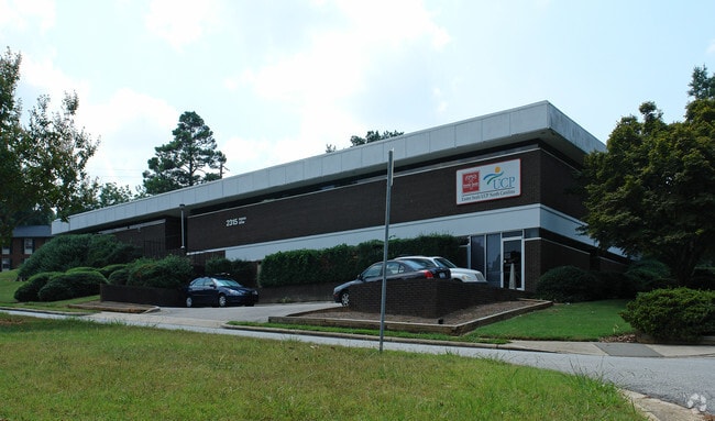
2315 Myron Dr
Raleigh-Cary, NC
Howard W Jones & Richard F Boo
0795.17-01-8532-000
LO6 PROP OF JONES-BOOTH BM1965-00063
Officebuilding
Wake
X
North Carolina
3720079500K
6
0
0.52 AC
2025
West Raleigh
052504
Raleigh/Durham
9,466 SF
DEMOGRAPHICS near 2315 Myron Dr
1 Mile
3 Mile
5 Mile
2024 Total Population
7,776
88,897
240,487
2029 Population
8,614
96,703
261,689
Pop Growth 2024-2029
+ 10.78%
+ 8.78%
+ 8.82%
Average Age
41
36
37
2024 Total Households
3,599
38,022
109,365
HH Growth 2024-2029
+ 10.81%
+ 9.39%
+ 9.14%
Median Household Inc
$90,271
$76,805
$75,805
Avg Household Size
2.10
2.00
2.00
2024 Avg HH Vehicles
2.00
2.00
2.00
Median Home Value
$615,684
$602,261
$437,833
Median Year Built
1990
1988
1989
Nearby Places
Map Layers
Map Styles
 Street
 Aerial
- Restaurants
- Banks
- Shops
- Fitness
- Groceries
PUBLIC TRANSPORTATION
COMMUTER RAIL
Raleigh Union Station (Piedmont - North Carolina by Train (NC Train))
DRIVE
WALK
Distance
Raleigh Union Station (Piedmont - North Carolina by Train (NC Train))
11 min
5.9 mi
Cary Station (Piedmont - North Carolina by Train (NC Train))
DRIVE
WALK
Distance
Cary Station (Piedmont - North Carolina by Train (NC Train))
14 min
7.4 mi
AIRPORT
Raleigh-Durham International
DRIVE
WALK
Distance
Raleigh-Durham International
17 min
10.2 mi
Nearby Properties
Address
Land Use
TOTAL SIZE
Lot Size
Zoning
Address
Land Use
TOTAL SIZE
Lot Size
Zoning
5,616,802 SF
507.97 AC
OX-12
Address
Land Use
TOTAL SIZE
Lot Size
Zoning
1,801,169 SF
59.60 AC
OX-12
Address
Land Use
TOTAL SIZE
Lot Size
Zoning
770,311 SF
80.70 AC
PD
Address
Land Use
TOTAL SIZE
Lot Size
Zoning
854,180 SF
210.81 AC
OX-4
Address
Land Use
TOTAL SIZE
Lot Size
Zoning
294,812 SF
999.47 AC
AP
Address
Land Use
TOTAL SIZE
Lot Size
Zoning
613,087 SF
266.85 AC
PD
Address
Land Use
TOTAL SIZE
Lot Size
Zoning
1,810,132 SF
OX-12
Address
Land Use
TOTAL SIZE
Lot Size
Zoning
12,850 SF
96.80 AC
OX-12
Address
Land Use
TOTAL SIZE
Lot Size
Zoning
2,804,942 SF
57.23 AC
CX-12
Address
Land Use
TOTAL SIZE
Lot Size
Zoning
403,230 SF
197.34 AC
IX-3
Address
Land Use
TOTAL SIZE
Lot Size
Zoning
1,039,527 SF
22.85 AC
OX-7
Address
Land Use
TOTAL SIZE
Lot Size
Zoning
524,391 SF
4.13 AC
NX-5
Address
Land Use
TOTAL SIZE
Lot Size
Zoning
834,950 SF
3.91 AC
OX-12
Address
Land Use
TOTAL SIZE
Lot Size
Zoning
426,539 SF
2.90 AC
NX-5
Address
Land Use
TOTAL SIZE
Lot Size
Zoning
613,248 SF
2.20 AC
IND-2
Address
Land Use
TOTAL SIZE
Lot Size
Zoning
482,597 SF
36.39 AC
RX-4
Address
Land Use
TOTAL SIZE
Lot Size
Zoning
580,268 SF
9.02 AC
PD
Address
Land Use
TOTAL SIZE
Lot Size
Zoning
931,884 SF
10.21 AC
CMP
Address
Land Use
TOTAL SIZE
Lot Size
Zoning
378,159 SF
22.40 AC
OX-7
Address
Land Use
TOTAL SIZE
Lot Size
Zoning
495,697 SF
9.11 AC
OX-5
Address
Land Use
TOTAL SIZE
Lot Size
Zoning
390,365 SF
3.70 AC
OX-5
Address
Land Use
TOTAL SIZE
Lot Size
Zoning
332,378 SF
2.83 AC
NX-5
Address
Land Use
TOTAL SIZE
Lot Size
Zoning
437,167 SF
2.61 AC
CX-7
Address
Land Use
TOTAL SIZE
Lot Size
Zoning
278,041 SF
9.98 AC
NX-4
Address
Land Use
TOTAL SIZE
Lot Size
Zoning
308,622 SF
14.34 AC
CX-5
Address
Land Use
TOTAL SIZE
Lot Size
Zoning
366,905 SF
11.24 AC
OX-5
Address
Land Use
TOTAL SIZE
Lot Size
Zoning
350,189 SF
15.77 AC
PD
Address
Land Use
TOTAL SIZE
Lot Size
Zoning
233,771 SF
6.09 AC
RX-4
Address
Land Use
TOTAL SIZE
Lot Size
Zoning
211,387 SF
36.72 AC
OX-3
Address
Land Use
TOTAL SIZE
Lot Size
Zoning
404,712 SF
24.95 AC
RX-3
The World's #1 Commercial Real Estate Marketplace
Connect with us
© 2026 CoStar Group
The information above has been obtained from sources believed reliable. While we do not doubt its accuracy we have not verified it and make no guarantee, warranty or representation about it. It is your responsibility to independently confirm its accuracy and completeness. Any projections, opinions, assumptions, or estimates used are for example only and do not represent the current or future performance of the property. The value of this transaction to you depends on tax and other factors which should be evaluated by your tax, financial, and legal advisors. You and your advisors should conduct a careful, independent investigation of the property to determine to your satisfaction the suitability of the property for your needs.