Property Record
2315 W Gordon Ave, Albany, GA 31707


NEARBY LISTINGS FOR SALE OR LEASE
-
-
View all Albany listings for sale on LoopNet.com
Property Detail
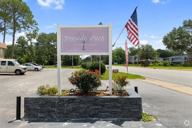
2315 W Gordon Ave
00240-00001-005
West Gordon Ave
Apartment
Dougherty
AE
Georgia
13095C0105E
13.77 AC
2025
Albany/Southwest
2024
Other Market Areas
001100
Albany, GA
32,432 SF
DEMOGRAPHICS near 2315 W Gordon Ave
1 Mile
3 Mile
5 Mile
2024 Total Population
4,194
30,856
62,365
2029 Population
3,917
29,359
59,784
Pop Growth 2024-2029
(6.60%)
(4.85%)
(4.14%)
Average Age
37
39
39
2024 Total Households
1,694
13,252
26,239
HH Growth 2024-2029
(6.61%)
(4.90%)
(4.28%)
Median Household Inc
$40,298
$42,889
$45,941
Avg Household Size
2.30
2.30
2.30
2024 Avg HH Vehicles
1.00
2.00
2.00
Median Home Value
$71,246
$117,154
$136,051
Median Year Built
1973
1972
1975
Nearby Places
Map Layers
Map Styles
 Street
 Aerial
- Restaurants
- Banks
- Shops
- Fitness
- Groceries
PUBLIC TRANSPORTATION
AIRPORT
Southwest Georgia Regional
DRIVE
WALK
Distance
Southwest Georgia Regional
7 min
2.8 mi
Freight Ports
Port of Panama City
DRIVE
WALK
Distance
Port of Panama City
229 min
157.6 mi
SALE & LEASE HISTORY
LISTING DATE
SALE/LEASE

Nov 21, 2017
For Sale
Nearby Properties
Address
Land Use
TOTAL SIZE
Lot Size
Zoning
Address
Land Use
TOTAL SIZE
Lot Size
Zoning
186,956 SF
29.23 AC
R6
Address
Land Use
TOTAL SIZE
Lot Size
Zoning
232,840 SF
49.88 AC
M1
Address
Land Use
TOTAL SIZE
Lot Size
Zoning
5,200 SF
883.86 AC
Address
Land Use
TOTAL SIZE
Lot Size
Zoning
9,676 SF
10.73 AC
R6
Address
Land Use
TOTAL SIZE
Lot Size
Zoning
9.37 AC
C3
Address
Land Use
TOTAL SIZE
Lot Size
Zoning
21,144 SF
11.79 AC
R6
Address
Land Use
TOTAL SIZE
Lot Size
Zoning
51,552 SF
13.26 AC
R6
Address
Land Use
TOTAL SIZE
Lot Size
Zoning
32,000 SF
14.19 AC
R1A
Address
Land Use
TOTAL SIZE
Lot Size
Zoning
19,104 SF
10.81 AC
R6
Address
Land Use
TOTAL SIZE
Lot Size
Zoning
204,625 SF
27.28 AC
M1
Address
Land Use
TOTAL SIZE
Lot Size
Zoning
30,190 SF
212.69 AC
C5
Address
Land Use
TOTAL SIZE
Lot Size
Zoning
21,572 SF
5.27 AC
C1
Address
Land Use
TOTAL SIZE
Lot Size
Zoning
5,100 SF
18.93 AC
R6
Address
Land Use
TOTAL SIZE
Lot Size
Zoning
146,281 SF
17.87 AC
M1
Address
Land Use
TOTAL SIZE
Lot Size
Zoning
127,194 SF
15.01 AC
C2
Address
Land Use
TOTAL SIZE
Lot Size
Zoning
30,026 SF
34.47 AC
M1
Address
Land Use
TOTAL SIZE
Lot Size
Zoning
14,336 SF
8.91 AC
R6
Address
Land Use
TOTAL SIZE
Lot Size
Zoning
109,570 SF
18.45 AC
Address
Land Use
TOTAL SIZE
Lot Size
Zoning
8,556 SF
10.12 AC
R6
Address
Land Use
TOTAL SIZE
Lot Size
Zoning
16,800 SF
4.76 AC
C2
Address
Land Use
TOTAL SIZE
Lot Size
Zoning
40,915 SF
6.99 AC
C1
Address
Land Use
TOTAL SIZE
Lot Size
Zoning
56,008 SF
24.76 AC
Address
Land Use
TOTAL SIZE
Lot Size
Zoning
26,792 SF
3.28 AC
C2
Address
Land Use
TOTAL SIZE
Lot Size
Zoning
56,117 SF
7.01 AC
C7
Address
Land Use
TOTAL SIZE
Lot Size
Zoning
6,222 SF
5.50 AC
C3
Address
Land Use
TOTAL SIZE
Lot Size
Zoning
4,680 SF
8.49 AC
C-2
Address
Land Use
TOTAL SIZE
Lot Size
Zoning
42,560 SF
11.48 AC
R6
Address
Land Use
TOTAL SIZE
Lot Size
Zoning
21,402 SF
5.32 AC
M1
Address
Land Use
TOTAL SIZE
Lot Size
Zoning
24,867 SF
1.94 AC
C7
Address
Land Use
TOTAL SIZE
Lot Size
Zoning
18,972 SF
10 AC
R6
The World's #1 Commercial Real Estate Marketplace
Connect with us
© 2026 CoStar Group
The information above has been obtained from sources believed reliable. While we do not doubt its accuracy we have not verified it and make no guarantee, warranty or representation about it. It is your responsibility to independently confirm its accuracy and completeness. Any projections, opinions, assumptions, or estimates used are for example only and do not represent the current or future performance of the property. The value of this transaction to you depends on tax and other factors which should be evaluated by your tax, financial, and legal advisors. You and your advisors should conduct a careful, independent investigation of the property to determine to your satisfaction the suitability of the property for your needs.