Property Record
2316 Norman Rd, Lancaster, PA 17601


NEARBY LISTINGS FOR SALE OR LEASE
Property Detail
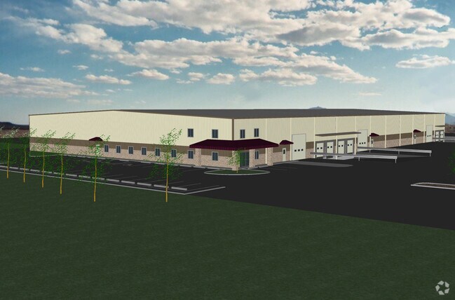
2316 Norman Rd
310-35556-0-0000
Organic Plant Food Co Tracts
Shipyard
Lancaster
X
Pennsylvania
42071C0379F
2.78 AC
2024
Lancaster County
2025
Philadelphia
013203
Lancaster, PA
30,000 SF
DEMOGRAPHICS near 2316 Norman Rd
1 Mile
3 Mile
5 Mile
2024 Total Population
844
23,226
90,260
2029 Population
846
23,526
91,285
Pop Growth 2024-2029
+ 0.24%
+ 1.29%
+ 1.14%
Average Age
37
40
40
2024 Total Households
276
8,788
33,449
HH Growth 2024-2029
+ 0.36%
+ 1.39%
+ 1.15%
Median Household Inc
$59,478
$79,808
$78,403
Avg Household Size
2.80
2.60
2.50
2024 Avg HH Vehicles
2.00
2.00
2.00
Median Home Value
$333,783
$335,576
$319,891
Median Year Built
1972
1982
1971
Nearby Places
Map Layers
Map Styles
 Street
 Aerial
- Restaurants
- Banks
- Shops
- Fitness
- Groceries
PUBLIC TRANSPORTATION
COMMUTER RAIL
DRIVE
WALK
Distance
15 min
7.4 mi
AIRPORT
Harrisburg International
DRIVE
WALK
Distance
Harrisburg International
50 min
37.4 mi
Freight Ports
Port Newark Container Terminal
DRIVE
WALK
Distance
Port Newark Container Terminal
82 min
45.9 mi
SALE & LEASE HISTORY
LISTING DATE
SALE/LEASE

Aug 09, 2017
For Lease
Nearby Properties
Address
Land Use
TOTAL SIZE
Lot Size
Zoning
Address
Land Use
TOTAL SIZE
Lot Size
Zoning
403,771 SF
106.93 AC
Address
Land Use
TOTAL SIZE
Lot Size
Zoning
2,615,989 SF
147.50 AC
I
Address
Land Use
TOTAL SIZE
Lot Size
Zoning
610,108 SF
39.96 AC
C-2
Address
Land Use
TOTAL SIZE
Lot Size
Zoning
419,136 SF
34.11 AC
Address
Land Use
TOTAL SIZE
Lot Size
Zoning
333,301 SF
24.15 AC
MU
Address
Land Use
TOTAL SIZE
Lot Size
Zoning
322,380 SF
33.29 AC
R-3
Address
Land Use
TOTAL SIZE
Lot Size
Zoning
289,398 SF
35.20 AC
C-2
Address
Land Use
TOTAL SIZE
Lot Size
Zoning
21.41 AC
Address
Land Use
TOTAL SIZE
Lot Size
Zoning
323,300 SF
21.60 AC
C-2
Address
Land Use
TOTAL SIZE
Lot Size
Zoning
302,460 SF
51.80 AC
R4
Address
Land Use
TOTAL SIZE
Lot Size
Zoning
125,153 SF
24.10 AC
Address
Land Use
TOTAL SIZE
Lot Size
Zoning
198,492 SF
24.74 AC
R-2
Address
Land Use
TOTAL SIZE
Lot Size
Zoning
63,514 SF
177.90 AC
R-1
Address
Land Use
TOTAL SIZE
Lot Size
Zoning
1,137,774 SF
54.21 AC
SM
Address
Land Use
TOTAL SIZE
Lot Size
Zoning
74,841 SF
16.20 AC
R-1
Address
Land Use
TOTAL SIZE
Lot Size
Zoning
251,051 SF
31.10 AC
R-3
Address
Land Use
TOTAL SIZE
Lot Size
Zoning
137,933 SF
16.11 AC
Address
Land Use
TOTAL SIZE
Lot Size
Zoning
111,896 SF
8.30 AC
Address
Land Use
TOTAL SIZE
Lot Size
Zoning
19.29 AC
Address
Land Use
TOTAL SIZE
Lot Size
Zoning
258,104 SF
31.40 AC
I
Address
Land Use
TOTAL SIZE
Lot Size
Zoning
83,728 SF
2.70 AC
C-2
Address
Land Use
TOTAL SIZE
Lot Size
Zoning
172,408 SF
13.70 AC
R-3
Address
Land Use
TOTAL SIZE
Lot Size
Zoning
70,314 SF
3.20 AC
C-2
Address
Land Use
TOTAL SIZE
Lot Size
Zoning
251,531 SF
42.54 AC
Address
Land Use
TOTAL SIZE
Lot Size
Zoning
71,600 SF
15.20 AC
C-2
Address
Land Use
TOTAL SIZE
Lot Size
Zoning
246,116 SF
16.30 AC
R-2
Address
Land Use
TOTAL SIZE
Lot Size
Zoning
142,393 SF
22 AC
I
Address
Land Use
TOTAL SIZE
Lot Size
Zoning
109,200 SF
12.97 AC
R-2
Address
Land Use
TOTAL SIZE
Lot Size
Zoning
142,463 SF
12.70 AC
SM
Address
Land Use
TOTAL SIZE
Lot Size
Zoning
36,494 SF
7 AC
R-2
The World's #1 Commercial Real Estate Marketplace
Connect with us
© 2025 CoStar Group
The information above has been obtained from sources believed reliable. While we do not doubt its accuracy we have not verified it and make no guarantee, warranty or representation about it. It is your responsibility to independently confirm its accuracy and completeness. Any projections, opinions, assumptions, or estimates used are for example only and do not represent the current or future performance of the property. The value of this transaction to you depends on tax and other factors which should be evaluated by your tax, financial, and legal advisors. You and your advisors should conduct a careful, independent investigation of the property to determine to your satisfaction the suitability of the property for your needs.