Property Record
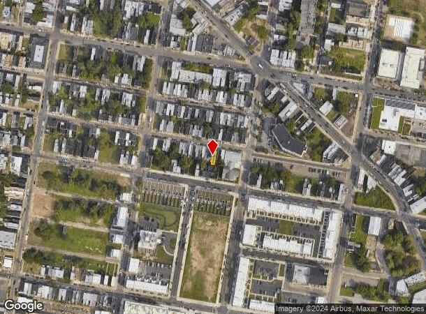
2316 Turner St, Philadelphia, PA 19121

NEARBY LISTINGS FOR SALE OR LEASE
-
-
-
-
-
-
-
-
-
No Photo
-
-
-
-
-
-
-
-
-
-
-
-
-
-
-
-
View all Philadelphia listings for sale on LoopNet.com
Property Detail
2316 Turner St
Philadelphia-Camden-Wilmington, PA-NJ-DE-MD
2316 Turner St
291234200
Philadelphia
Townhouserowhouse
Pennsylvania
X
0.02 AC
42045C0150F
Northwest Philadelphia
1,968 SF
Philadelphia
DEMOGRAPHICS near 2316 Turner St
1 Mile
3 Mile
5 Mile
2024 Total Population
84,146
490,370
1,086,332
2029 Population
83,919
483,231
1,062,238
Pop Growth 2024-2029
(0.27%)
(1.46%)
(2.22%)
Average Age
34
36
37
2024 Total Households
33,659
219,842
453,010
HH Growth 2024-2029
(0.53%)
(1.83%)
(2.47%)
Median Household Inc
$46,029
$55,763
$51,897
Avg Household Size
2.20
2.00
2.20
2024 Avg HH Vehicles
1.00
1.00
1.00
Median Home Value
$281,393
$305,767
$232,944
Median Year Built
1953
1952
1948
Nearby Places
Map Layers
Map Styles
 Street
 Aerial
- Restaurants
- Banks
- Shops
- Fitness
- Groceries
PUBLIC TRANSPORTATION
TRANSIT/SUBWAY
Cecil B Moore (Broad Street Line - Southeastern Pennsylvania Transportation Authority Rapid Transit (SEPTA Subway & Trolley))
DRIVE
WALK
Distance
Cecil B Moore (Broad Street Line - Southeastern Pennsylvania Transportation Authority Rapid Transit (SEPTA Subway & Trolley))
3 min
18 min
0.9 mi
Girard (BSS) (Broad Street Line - Southeastern Pennsylvania Transportation Authority Rapid Transit (SEPTA Subway & Trolley))
DRIVE
WALK
Distance
Girard (BSS) (Broad Street Line - Southeastern Pennsylvania Transportation Authority Rapid Transit (SEPTA Subway & Trolley))
4 min
20 min
1.0 mi
COMMUTER RAIL
Temple University (R1 - Southeastern Pennsylvania Transportation Authority Regional Rail (SEPTA Regional Rail), R2 - Southeastern Pennsylvania Transportation Authority Regional Rail (SEPTA Regional Rail), R3 - Southeastern Pennsylvania Transportation Authority Regional Rail (SEPTA Regional Rail), R5 - Southeastern Pennsylvania Transportation Authority Regional Rail (SEPTA Regional Rail), R6 - Southeastern Pennsylvania Transportation Authority Regional Rail (SEPTA Regional Rail), R7 - Southeastern Pennsylvania Transportation Authority Regional Rail (SEPTA Regional Rail), R8 - Southeastern Pennsylvania Transportation Authority Regional Rail (SEPTA Regional Rail))
DRIVE
WALK
Distance
Temple University (R1 - Southeastern Pennsylvania Transportation Authority Regional Rail (SEPTA Regional Rail), R2 - Southeastern Pennsylvania Transportation Authority Regional Rail (SEPTA Regional Rail), R3 - Southeastern Pennsylvania Transportation Authority Regional Rail (SEPTA Regional Rail), R5 - Southeastern Pennsylvania Transportation Authority Regional Rail (SEPTA Regional Rail), R6 - Southeastern Pennsylvania Transportation Authority Regional Rail (SEPTA Regional Rail), R7 - Southeastern Pennsylvania Transportation Authority Regional Rail (SEPTA Regional Rail), R8 - Southeastern Pennsylvania Transportation Authority Regional Rail (SEPTA Regional Rail))
6 min
2.0 mi
North Philadelphia (Broad Street Line - Southeastern Pennsylvania Transportation Authority Rapid Transit (SEPTA Subway & Trolley))
DRIVE
WALK
Distance
North Philadelphia (Broad Street Line - Southeastern Pennsylvania Transportation Authority Rapid Transit (SEPTA Subway & Trolley))
7 min
2.1 mi
AIRPORT
Philadelphia International
DRIVE
WALK
Distance
Philadelphia International
25 min
14.2 mi
Trenton Mercer
DRIVE
WALK
Distance
Trenton Mercer
52 min
35.0 mi
Freight Ports
South Jersey Port
DRIVE
WALK
Distance
South Jersey Port
12 min
5.5 mi
SALE & LEASE HISTORY
LISTING DATE
SALE/LEASE

Aug 04, 2019
For Sale
Apr 08, 2020
For Sale
Nearby Properties
Address
Land Use
TOTAL SIZE
Lot Size
Zoning
Address
Land Use
TOTAL SIZE
Lot Size
Zoning
1,449,928 SF
1.22 AC
CMX5
Address
Land Use
TOTAL SIZE
Lot Size
Zoning
1,076,400 SF
5 AC
CMX4
Address
Land Use
TOTAL SIZE
Lot Size
Zoning
1,200,021 SF
0.69 AC
CMX5
Address
Land Use
TOTAL SIZE
Lot Size
Zoning
26,690 SF
500 AC
SPINS
Address
Land Use
TOTAL SIZE
Lot Size
Zoning
1,103,300 SF
1.18 AC
CMX5
Address
Land Use
TOTAL SIZE
Lot Size
Zoning
1,464,000 SF
0.76 AC
CMX5
Address
Land Use
TOTAL SIZE
Lot Size
Zoning
319,590 SF
0.87 AC
I2
Address
Land Use
TOTAL SIZE
Lot Size
Zoning
760,635 SF
0.77 AC
CMX5
Address
Land Use
TOTAL SIZE
Lot Size
Zoning
1,179,072 SF
8.90 AC
RM4
Address
Land Use
TOTAL SIZE
Lot Size
Zoning
1,296,804 SF
2.71 AC
I2
Address
Land Use
TOTAL SIZE
Lot Size
Zoning
782,208 SF
0.68 AC
CMX5
Address
Land Use
TOTAL SIZE
Lot Size
Zoning
2,215,276 SF
2.46 AC
CMX5
Address
Land Use
TOTAL SIZE
Lot Size
Zoning
880,950 SF
27.71 AC
SPENT
Address
Land Use
TOTAL SIZE
Lot Size
Zoning
624,696 SF
5.79 AC
CMX4
Address
Land Use
TOTAL SIZE
Lot Size
Zoning
1,200,000 SF
1.78 AC
CMX5
Address
Land Use
TOTAL SIZE
Lot Size
Zoning
1,075,580 SF
2.65 AC
CMX5
Address
Land Use
TOTAL SIZE
Lot Size
Zoning
468,307 SF
2.45 AC
CMX4
Address
Land Use
TOTAL SIZE
Lot Size
Zoning
500,165 SF
2.16 AC
SPPOA
Address
Land Use
TOTAL SIZE
Lot Size
Zoning
1,152,520 SF
1.49 AC
CMX5
Address
Land Use
TOTAL SIZE
Lot Size
Zoning
696,920 SF
10.55 AC
SPINS
Address
Land Use
TOTAL SIZE
Lot Size
Zoning
1,143,040 SF
0.81 AC
CMX5
Address
Land Use
TOTAL SIZE
Lot Size
Zoning
738,750 SF
1.19 AC
CMX5
Address
Land Use
TOTAL SIZE
Lot Size
Zoning
700,000 SF
7.88 AC
CMX5
Address
Land Use
TOTAL SIZE
Lot Size
Zoning
1,102,992 SF
2.14 AC
CMX5
Address
Land Use
TOTAL SIZE
Lot Size
Zoning
1.88 AC
SPINS
Address
Land Use
TOTAL SIZE
Lot Size
Zoning
738,207 SF
0.89 AC
CMX5
Address
Land Use
TOTAL SIZE
Lot Size
Zoning
665,742 SF
0.98 AC
CMX4
Address
Land Use
TOTAL SIZE
Lot Size
Zoning
1,152,480 SF
1.48 AC
CMX5
Address
Land Use
TOTAL SIZE
Lot Size
Zoning
1,011,079 SF
5.82 AC
CMX5
Address
Land Use
TOTAL SIZE
Lot Size
Zoning
677,140 SF
0.53 AC
CMX5
The World's #1 Commercial Real Estate Marketplace
Connect with us
© 2026 CoStar Group
The information above has been obtained from sources believed reliable. While we do not doubt its accuracy we have not verified it and make no guarantee, warranty or representation about it. It is your responsibility to independently confirm its accuracy and completeness. Any projections, opinions, assumptions, or estimates used are for example only and do not represent the current or future performance of the property. The value of this transaction to you depends on tax and other factors which should be evaluated by your tax, financial, and legal advisors. You and your advisors should conduct a careful, independent investigation of the property to determine to your satisfaction the suitability of the property for your needs.