Property Record
2317 N Frederic St, Burbank, CA 91504
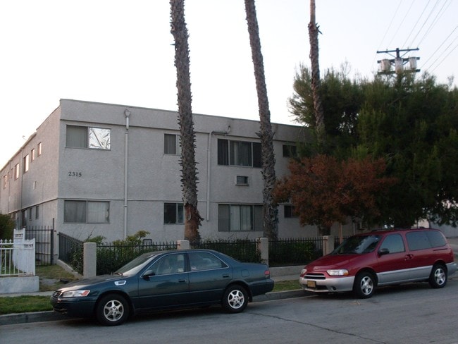


Property Detail
2317 N Frederic St
2466-014-024
TRACT NO 4615 LOT 91
Multifamilydwelling
Los Angeles
BUR4*
California
B and X Area of moderate flood hazard, usually the area between the limits of the 100-year and 500-year floods.
91
2025
0.34 AC
2025
Vega
310501
Los Angeles
9,092 SF
Los Angeles-Long Beach-Glendale, CA
NEARBY LISTINGS FOR SALE OR LEASE
DEMOGRAPHICS near 2317 N Frederic St
1 mile
3 mile
5 mile
2025 Total Population
20,757
200,813
446,630
2030 Population
20,527
199,623
444,049
Pop Growth 2025-2030
(1.11%)
(0.59%)
(0.58%)
Average Age
41
40
41
2025 Total Households
7,506
73,892
170,377
HH Growth 2025-2030
(1.43%)
(0.80%)
(0.78%)
Median Household Inc
$96,416
$83,930
$86,055
Avg Household Size
2.70
2.60
2.50
2025 Avg HH Vehicles
2.00
2.00
2.00
Median Home Value
$990,397
$942,227
$945,668
Median Year Built
1957
1963
1964
Nearby Places
Map Layers
Map Styles
 Street
 Aerial
Layers
 Traffic
 Biking
Places
Listings with unknown addresses are not visible on the map
- Restaurants
- Banks
- Shops
- Fitness
- Groceries
PUBLIC TRANSPORTATION
COMMUTER RAIL
Burbank Airport - North (Av Line) Metrolink Station (Metrolink Antelope Valley Line - Metrolink Trains)
Drive
Walk
Distance
Burbank Airport - North (Av Line) Metrolink Station (Metrolink Antelope Valley Line - Metrolink Trains)
1 min
16 min
0.9 mi
Burbank-Bob Hope Airport (Ventura County Line - Southern California Regional Rail Authority (Metrolink))
Drive
Walk
Distance
Burbank-Bob Hope Airport (Ventura County Line - Southern California Regional Rail Authority (Metrolink))
3 min
1.4 mi
AIRPORT
Bob Hope
Drive
Walk
Distance
Bob Hope
6 min
3.1 mi
Los Angeles International
Drive
Walk
Distance
Los Angeles International
40 min
27.4 mi
Long Beach (Daugherty Field)
Drive
Walk
Distance
Long Beach (Daugherty Field)
47 min
33.8 mi
Freight Ports
Port of Long Beach
Drive
Walk
Distance
Port of Long Beach
48 min
36.6 mi
SALE & LEASE HISTORY
LISTING DATE
SALE/LEASE

May 30, 2017
For Sale
Feb 26, 2018
For Sale
Feb 01, 2017
For Sale
Nearby Properties
Address
Land Use
TOTAL SIZE
Lot Size
Zoning
Address
Land Use
TOTAL SIZE
Lot Size
Zoning
735,900 SF
34.87 AC
BUPD*
Address
Land Use
TOTAL SIZE
Lot Size
Zoning
616,662 SF
19.66 AC
BUM1*
Address
Land Use
TOTAL SIZE
Lot Size
Zoning
690,600 SF
6.57 AC
LACM
Address
Land Use
TOTAL SIZE
Lot Size
Zoning
489,466 SF
2.90 AC
BUM1
Address
Land Use
TOTAL SIZE
Lot Size
Zoning
452,048 SF
21.58 AC
BCCM
Address
Land Use
TOTAL SIZE
Lot Size
Zoning
43,558 SF
30.11 AC
BUMI-C2*
Address
Land Use
TOTAL SIZE
Lot Size
Zoning
1,328,547 SF
39.36 AC
BUPD
Address
Land Use
TOTAL SIZE
Lot Size
Zoning
432,232 SF
7.17 AC
BUM2
Address
Land Use
TOTAL SIZE
Lot Size
Zoning
362,863 SF
1.82 AC
BUMZ
Address
Land Use
TOTAL SIZE
Lot Size
Zoning
346,186 SF
11.72 AC
BUM2*
Address
Land Use
TOTAL SIZE
Lot Size
Zoning
232,965 SF
3.78 AC
LAC4
Address
Land Use
TOTAL SIZE
Lot Size
Zoning
558,532 SF
5.20 AC
BUC4*
Address
Land Use
TOTAL SIZE
Lot Size
Zoning
660,463 SF
6.88 AC
BUR4*
Address
Land Use
TOTAL SIZE
Lot Size
Zoning
612,976 SF
3.53 AC
BUC2*
Address
Land Use
TOTAL SIZE
Lot Size
Zoning
227,746 SF
4.03 AC
LAC4
Address
Land Use
TOTAL SIZE
Lot Size
Zoning
151,704 SF
1 AC
BUC4*
Address
Land Use
TOTAL SIZE
Lot Size
Zoning
BURAILROAD
Address
Land Use
TOTAL SIZE
Lot Size
Zoning
279,574 SF
4.01 AC
BUM2*
Address
Land Use
TOTAL SIZE
Lot Size
Zoning
201,944 SF
1.14 AC
LAC4
Address
Land Use
TOTAL SIZE
Lot Size
Zoning
299,864 SF
1.29 AC
BUC3
Address
Land Use
TOTAL SIZE
Lot Size
Zoning
132,652 SF
0.76 AC
LAC2
Address
Land Use
TOTAL SIZE
Lot Size
Zoning
252,974 SF
2.86 AC
BUC4
Address
Land Use
TOTAL SIZE
Lot Size
Zoning
221,276 SF
1.37 AC
LAC4
Address
Land Use
TOTAL SIZE
Lot Size
Zoning
126,652 SF
0.93 AC
BUC3
Address
Land Use
TOTAL SIZE
Lot Size
Zoning
106,988 SF
1.45 AC
BUM2*
Address
Land Use
TOTAL SIZE
Lot Size
Zoning
BURAILROAD
Address
Land Use
TOTAL SIZE
Lot Size
Zoning
222,004 SF
2.29 AC
LAC4
Address
Land Use
TOTAL SIZE
Lot Size
Zoning
108,649 SF
3.33 AC
BUPD
Address
Land Use
TOTAL SIZE
Lot Size
Zoning
60,863 SF
0.72 AC
BUR5*
The World's #1 Commercial Real Estate Marketplace
Connect with us
© 2026 CoStar Group
The information above has been obtained from sources believed reliable. While we do not doubt its accuracy we have not verified it and make no guarantee, warranty or representation about it. It is your responsibility to independently confirm its accuracy and completeness. Any projections, opinions, assumptions, or estimates used are for example only and do not represent the current or future performance of the property. The value of this transaction to you depends on tax and other factors which should be evaluated by your tax, financial, and legal advisors. You and your advisors should conduct a careful, independent investigation of the property to determine to your satisfaction the suitability of the property for your needs.