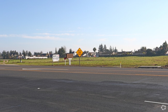
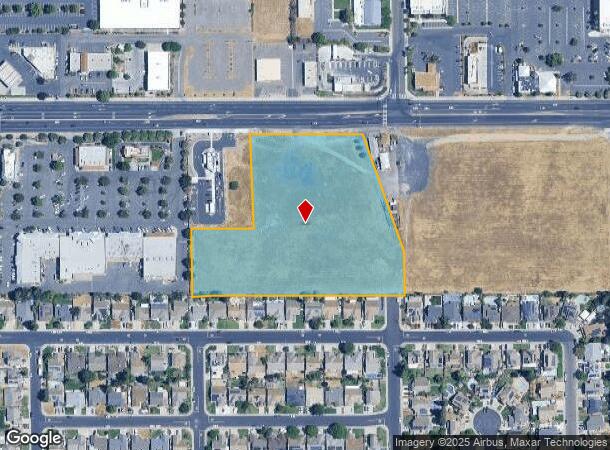
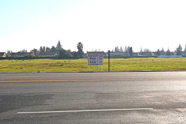
Property Record
2300 Patterson Rd, Riverbank, CA 95367

NEARBY LISTINGS FOR SALE OR LEASE
Property Detail
2300 Patterson Rd
Modesto, CA
Morrill
075-11-33
Stanislaus
Commercialacreage
California
X
10
06077C0830F
5.80 AC
2025
Modesto
2025
Stockton/Modesto
000303
DEMOGRAPHICS near 2300 Patterson Rd
1 Mile
3 Mile
5 Mile
2024 Total Population
12,420
35,403
134,554
2029 Population
12,377
35,412
135,251
Pop Growth 2024-2029
(0.35%)
+ 0.03%
+ 0.52%
Average Age
36
37
38
2024 Total Households
3,741
11,011
45,579
HH Growth 2024-2029
(0.35%)
+ 0.03%
+ 0.49%
Median Household Inc
$81,920
$89,963
$85,140
Avg Household Size
3.30
3.20
2.90
2024 Avg HH Vehicles
2.00
2.00
2.00
Median Home Value
$439,920
$430,767
$433,479
Median Year Built
1993
1992
1982
Nearby Places
Map Layers
Map Styles
 Street
 Aerial
- Restaurants
- Banks
- Shops
- Fitness
- Groceries
PUBLIC TRANSPORTATION
COMMUTER RAIL
Modesto (San Joaquins - Amtrak)
DRIVE
WALK
Distance
Modesto (San Joaquins - Amtrak)
12 min
6.9 mi
AIRPORT
Stockton Metro
DRIVE
WALK
Distance
Stockton Metro
37 min
26.4 mi
Freight Ports
Port of Stockton
DRIVE
WALK
Distance
Port of Stockton
46 min
34.9 mi
SALE & LEASE HISTORY
LISTING DATE
SALE/LEASE

Mar 26, 2021
For Sale
Dec 22, 2016
For Sale
Nearby Properties
Address
Land Use
TOTAL SIZE
Lot Size
Zoning
Address
Land Use
TOTAL SIZE
Lot Size
Zoning
15.68 AC
RIVPD
Address
Land Use
TOTAL SIZE
Lot Size
Zoning
186,665 SF
10.22 AC
Address
Land Use
TOTAL SIZE
Lot Size
Zoning
123,575 SF
10 AC
PC
Address
Land Use
TOTAL SIZE
Lot Size
Zoning
60,156 SF
16.20 AC
Address
Land Use
TOTAL SIZE
Lot Size
Zoning
72,338 SF
5.98 AC
RIVC1
Address
Land Use
TOTAL SIZE
Lot Size
Zoning
140,669 SF
10.96 AC
PC
Address
Land Use
TOTAL SIZE
Lot Size
Zoning
47,760 SF
128 AC
Address
Land Use
TOTAL SIZE
Lot Size
Zoning
77,578 SF
7.93 AC
Address
Land Use
TOTAL SIZE
Lot Size
Zoning
56,265 SF
4.94 AC
MODPD
Address
Land Use
TOTAL SIZE
Lot Size
Zoning
46,795 SF
8.79 AC
COUPD
Address
Land Use
TOTAL SIZE
Lot Size
Zoning
37.92 AC
Address
Land Use
TOTAL SIZE
Lot Size
Zoning
83,987 SF
4.59 AC
RIVR3
Address
Land Use
TOTAL SIZE
Lot Size
Zoning
88,274 SF
6.32 AC
PC
Address
Land Use
TOTAL SIZE
Lot Size
Zoning
27,182 SF
3.57 AC
COUA2
Address
Land Use
TOTAL SIZE
Lot Size
Zoning
28,560 SF
9.62 AC
Address
Land Use
TOTAL SIZE
Lot Size
Zoning
24,829 SF
4.60 AC
COUH1
Address
Land Use
TOTAL SIZE
Lot Size
Zoning
36,817 SF
4.51 AC
Address
Land Use
TOTAL SIZE
Lot Size
Zoning
85,218 SF
3.51 AC
Address
Land Use
TOTAL SIZE
Lot Size
Zoning
57,760 SF
4.89 AC
PC
Address
Land Use
TOTAL SIZE
Lot Size
Zoning
131.20 AC
Address
Land Use
TOTAL SIZE
Lot Size
Zoning
465,061 SF
26.66 AC
CERM1
Address
Land Use
TOTAL SIZE
Lot Size
Zoning
227,470 SF
13.84 AC
Address
Land Use
TOTAL SIZE
Lot Size
Zoning
2,201 SF
0.61 AC
Address
Land Use
TOTAL SIZE
Lot Size
Zoning
41,698 SF
5.17 AC
Address
Land Use
TOTAL SIZE
Lot Size
Zoning
369.73 AC
Address
Land Use
TOTAL SIZE
Lot Size
Zoning
1,304 SF
57.16 AC
A240
Address
Land Use
TOTAL SIZE
Lot Size
Zoning
201,657 SF
8.53 AC
Address
Land Use
TOTAL SIZE
Lot Size
Zoning
42,000 SF
2.84 AC
Address
Land Use
TOTAL SIZE
Lot Size
Zoning
20,623 SF
18.05 AC
Address
Land Use
TOTAL SIZE
Lot Size
Zoning
71,339 SF
4.26 AC
R3
The World's #1 Commercial Real Estate Marketplace
Connect with us
© 2026 CoStar Group
The information above has been obtained from sources believed reliable. While we do not doubt its accuracy we have not verified it and make no guarantee, warranty or representation about it. It is your responsibility to independently confirm its accuracy and completeness. Any projections, opinions, assumptions, or estimates used are for example only and do not represent the current or future performance of the property. The value of this transaction to you depends on tax and other factors which should be evaluated by your tax, financial, and legal advisors. You and your advisors should conduct a careful, independent investigation of the property to determine to your satisfaction the suitability of the property for your needs.