Property Record
2318 W Walnut St, Garland, TX 75042


NEARBY LISTINGS FOR SALE OR LEASE
Property Detail
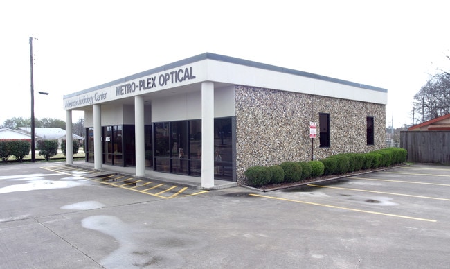
2318 W Walnut St
Dallas-Fort Worth-Arlington, TX
Westwood 2
26673500030010000
WESTWOOD 2 BLK C LOT 1 130 X 80 INT202400141979 DD07152024 CO-DC 6735000300100 2CG67350003
Medicalbuilding
Dallas
X
Texas
48113C0220L
1
2024
0.24 AC
2025
Garland
018900
Dallas/Ft Worth
1,656 SF
DEMOGRAPHICS near 2318 W Walnut St
1 Mile
3 Mile
5 Mile
2024 Total Population
14,559
132,268
354,667
2029 Population
14,432
130,251
350,891
Pop Growth 2024-2029
(0.87%)
(1.52%)
(1.06%)
Average Age
36
37
37
2024 Total Households
4,401
42,285
126,775
HH Growth 2024-2029
(1.14%)
(1.77%)
(1.19%)
Median Household Inc
$52,756
$58,945
$62,324
Avg Household Size
3.20
3.00
2.70
2024 Avg HH Vehicles
2.00
2.00
2.00
Median Home Value
$193,749
$211,580
$254,081
Median Year Built
1966
1973
1977
Nearby Places
Map Layers
Map Styles
 Street
 Aerial
- Restaurants
- Banks
- Shops
- Fitness
- Groceries
PUBLIC TRANSPORTATION
AIRPORT
Dallas Love Field
DRIVE
WALK
Distance
Dallas Love Field
30 min
19.6 mi
Dallas-Fort Worth International
DRIVE
WALK
Distance
Dallas-Fort Worth International
38 min
28.5 mi
SALE & LEASE HISTORY
LISTING DATE
SALE/LEASE

Apr 19, 2024
For Sale
Nearby Properties
Address
Land Use
TOTAL SIZE
Lot Size
Zoning
Address
Land Use
TOTAL SIZE
Lot Size
Zoning
433,745 SF
15.18 AC
Z02
Address
Land Use
TOTAL SIZE
Lot Size
Zoning
181,854 SF
14.51 AC
Z239
Address
Land Use
TOTAL SIZE
Lot Size
Zoning
244,025 SF
17.80 AC
Z02
Address
Land Use
TOTAL SIZE
Lot Size
Zoning
517,500 SF
29.97 AC
Z116
Address
Land Use
TOTAL SIZE
Lot Size
Zoning
107,686 SF
30.09 AC
Z386
Address
Land Use
TOTAL SIZE
Lot Size
Zoning
472,244 SF
25.25 AC
Z144
Address
Land Use
TOTAL SIZE
Lot Size
Zoning
531,950 SF
24.62 AC
Z239
Address
Land Use
TOTAL SIZE
Lot Size
Zoning
922,851 SF
52.28 AC
Z144
Address
Land Use
TOTAL SIZE
Lot Size
Zoning
333,298 SF
10.91 AC
Z149
Address
Land Use
TOTAL SIZE
Lot Size
Zoning
286,500 SF
14.98 AC
Z160
Address
Land Use
TOTAL SIZE
Lot Size
Zoning
468,220 SF
20.60 AC
Z144
Address
Land Use
TOTAL SIZE
Lot Size
Zoning
270,114 SF
8.50 AC
Z150
Address
Land Use
TOTAL SIZE
Lot Size
Zoning
187,440 SF
1.68 AC
Z25
Address
Land Use
TOTAL SIZE
Lot Size
Zoning
435,179 SF
20.20 AC
Z144
Address
Land Use
TOTAL SIZE
Lot Size
Zoning
77,102 SF
27.47 AC
Z144
Address
Land Use
TOTAL SIZE
Lot Size
Zoning
420,200 SF
34.75 AC
Z144
Address
Land Use
TOTAL SIZE
Lot Size
Zoning
382,000 SF
20.11 AC
Address
Land Use
TOTAL SIZE
Lot Size
Zoning
226,524 SF
10.31 AC
Z160
Address
Land Use
TOTAL SIZE
Lot Size
Zoning
227,624 SF
10.31 AC
Z160
Address
Land Use
TOTAL SIZE
Lot Size
Zoning
269,516 SF
13 AC
Z163
Address
Land Use
TOTAL SIZE
Lot Size
Zoning
392,736 SF
19.58 AC
Z144
Address
Land Use
TOTAL SIZE
Lot Size
Zoning
198,950 SF
10 AC
Z160
Address
Land Use
TOTAL SIZE
Lot Size
Zoning
327,600 SF
17.70 AC
Z144
Address
Land Use
TOTAL SIZE
Lot Size
Zoning
225,643 SF
10.42 AC
Z239
Address
Land Use
TOTAL SIZE
Lot Size
Zoning
241,420 SF
11.97 AC
Z163
Address
Land Use
TOTAL SIZE
Lot Size
Zoning
198,488 SF
10.17 AC
Z239
Address
Land Use
TOTAL SIZE
Lot Size
Zoning
114,738 SF
13.77 AC
Z207
Address
Land Use
TOTAL SIZE
Lot Size
Zoning
240,756 SF
12.50 AC
Z160
Address
Land Use
TOTAL SIZE
Lot Size
Zoning
870,902 SF
53.53 AC
Z144
Address
Land Use
TOTAL SIZE
Lot Size
Zoning
228,484 SF
34.50 AC
Z02
The World's #1 Commercial Real Estate Marketplace
Connect with us
© 2026 CoStar Group
The information above has been obtained from sources believed reliable. While we do not doubt its accuracy we have not verified it and make no guarantee, warranty or representation about it. It is your responsibility to independently confirm its accuracy and completeness. Any projections, opinions, assumptions, or estimates used are for example only and do not represent the current or future performance of the property. The value of this transaction to you depends on tax and other factors which should be evaluated by your tax, financial, and legal advisors. You and your advisors should conduct a careful, independent investigation of the property to determine to your satisfaction the suitability of the property for your needs.