Property Record
232 Centerville Tpke N, Chesapeake, VA 23320


Property Detail
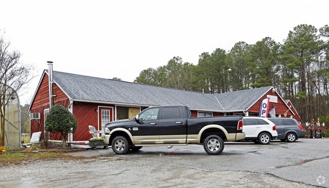
232 Centerville Tpke N
0490000000631
B SUB PROP OF MICHAEL C & IRMA S DAY 2.8337 AC
Storebuilding
Chesapeake City
R15S: RESI
Virginia
AE The base floodplain where base flood elevations are provided. AE Zones are now used on new format FIRMs instead of A1-A30 Zones.
2.83 AC
2024
Great Bridge
2025
Hampton Roads
020804
Virginia Beach-Chesapeake-Norfolk, VA-NC
2,454 SF
NEARBY LISTINGS FOR SALE OR LEASE
DEMOGRAPHICS near 232 Centerville Tpke N
1 mile
3 mile
5 mile
2025 Total Population
3,471
43,248
141,374
2030 Population
3,630
43,641
141,532
Pop Growth 2025-2030
+ 4.58%
+ 0.91%
+ 0.11%
Average Age
40
41
40
2025 Total Households
1,176
15,469
52,332
HH Growth 2025-2030
+ 4.68%
+ 0.96%
+ 0.18%
Median Household Inc
$152,811
$117,549
$103,962
Avg Household Size
2.80
2.70
2.60
2025 Avg HH Vehicles
2.00
2.00
2.00
Median Home Value
$663,678
$438,368
$398,396
Median Year Built
2010
1993
1990
Nearby Places
Map Layers
Map Styles
 Street
 Aerial
Layers
 Traffic
 Biking
Places
Listings with unknown addresses are not visible on the map
- Restaurants
- Banks
- Shops
- Fitness
- Groceries
PUBLIC TRANSPORTATION
AIRPORT
Norfolk International
Drive
Walk
Distance
Norfolk International
25 min
13.6 mi
Newport News/Williamsburg International
Drive
Walk
Distance
Newport News/Williamsburg International
60 min
39.4 mi
Freight Ports
Virginia Port Authority - Portsmouth
Drive
Walk
Distance
Virginia Port Authority - Portsmouth
30 min
17.2 mi
Nearby Properties
Address
Land Use
TOTAL SIZE
Lot Size
Zoning
Address
Land Use
TOTAL SIZE
Lot Size
Zoning
10.36 AC
A24
Address
Land Use
TOTAL SIZE
Lot Size
Zoning
71,711 SF
11.65 AC
B4
Address
Land Use
TOTAL SIZE
Lot Size
Zoning
140,369 SF
10.35 AC
PUD: PLANN
Address
Land Use
TOTAL SIZE
Lot Size
Zoning
16.03 AC
A24
Address
Land Use
TOTAL SIZE
Lot Size
Zoning
188,683 SF
13.14 AC
O-I: OFFIC
Address
Land Use
TOTAL SIZE
Lot Size
Zoning
422.43 AC
PUD: PLANN
Address
Land Use
TOTAL SIZE
Lot Size
Zoning
196,905 SF
46.84 AC
R15S: RESI
Address
Land Use
TOTAL SIZE
Lot Size
Zoning
1,188 SF
73.88 AC
A1: AGRICU
Address
Land Use
TOTAL SIZE
Lot Size
Zoning
190,194 SF
12.40 AC
RMF1: MULT
Address
Land Use
TOTAL SIZE
Lot Size
Zoning
27,696 SF
15.80 AC
B1: NEIGHB
Address
Land Use
TOTAL SIZE
Lot Size
Zoning
129,138 SF
8.86 AC
RMF1: MULT
Address
Land Use
TOTAL SIZE
Lot Size
Zoning
59,892 SF
6.71 AC
PUD: PLANN
Address
Land Use
TOTAL SIZE
Lot Size
Zoning
269.85 AC
MULTI: MUL
Address
Land Use
TOTAL SIZE
Lot Size
Zoning
22,680 SF
7.97 AC
PUD: PLANN
Address
Land Use
TOTAL SIZE
Lot Size
Zoning
35,962 SF
15.91 AC
B2: GENERA
Address
Land Use
TOTAL SIZE
Lot Size
Zoning
21,126 SF
36.51 AC
A1: AGRICU
Address
Land Use
TOTAL SIZE
Lot Size
Zoning
88,567 SF
15 AC
R15S: RESI
Address
Land Use
TOTAL SIZE
Lot Size
Zoning
66,978 SF
14.61 AC
RMF1: MULT
Address
Land Use
TOTAL SIZE
Lot Size
Zoning
95,106 SF
5.12 AC
R15S: RESI
Address
Land Use
TOTAL SIZE
Lot Size
Zoning
2,168 SF
7.93 AC
O-I: OFFIC
Address
Land Use
TOTAL SIZE
Lot Size
Zoning
40,337 SF
23.62 AC
AC: ASSEMB
Address
Land Use
TOTAL SIZE
Lot Size
Zoning
9,216 SF
3.30 AC
B2: GENERA
Address
Land Use
TOTAL SIZE
Lot Size
Zoning
31,479 SF
4.95 AC
O-I: OFFIC
Address
Land Use
TOTAL SIZE
Lot Size
Zoning
82,215 SF
1.47 AC
B4: SHOPPI
Address
Land Use
TOTAL SIZE
Lot Size
Zoning
46,571 SF
2.92 AC
O-I: OFFIC
Address
Land Use
TOTAL SIZE
Lot Size
Zoning
43,704 SF
2.96 AC
B4: SHOPPI
Address
Land Use
TOTAL SIZE
Lot Size
Zoning
87,212 SF
10.87 AC
B1: NEIGHB
Address
Land Use
TOTAL SIZE
Lot Size
Zoning
4,650 SF
7.46 AC
B2: GENERA
Address
Land Use
TOTAL SIZE
Lot Size
Zoning
57,899 SF
17.56 AC
O-I: OFFIC
Address
Land Use
TOTAL SIZE
Lot Size
Zoning
66,376 SF
14.73 AC
R5D
The World's #1 Commercial Real Estate Marketplace
Connect with us
© 2026 CoStar Group
The information above has been obtained from sources believed reliable. While we do not doubt its accuracy we have not verified it and make no guarantee, warranty or representation about it. It is your responsibility to independently confirm its accuracy and completeness. Any projections, opinions, assumptions, or estimates used are for example only and do not represent the current or future performance of the property. The value of this transaction to you depends on tax and other factors which should be evaluated by your tax, financial, and legal advisors. You and your advisors should conduct a careful, independent investigation of the property to determine to your satisfaction the suitability of the property for your needs.