Property Record
230 N Mojave Rd, Las Vegas, NV 89101

Save to a Folder
{{folder.Name}}
{{folder.ListingIds.length}} Properties
{{folder.ListingIds.length}} Property
Create a New Folder
Property Detail
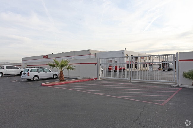
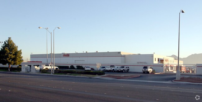
230 N Mojave Rd
139-36-710-022
LAS VEGAS SPECTRUM PLAT BOOK 43 PAGE 10 PT LOT 1 BLOCK 1
Foodprocessing
CLARK
M
Nevada
B and X Area of moderate flood hazard, usually the area between the limits of the 100-year and 500-year floods.
1
2026
20.31 AC
2026
Central Las Vegas
000403
Las Vegas
231,434 SF
Las Vegas-Henderson-North Las Vegas, NV
NEARBY LISTINGS FOR SALE OR LEASE
DEMOGRAPHICS near 230 N Mojave Rd
1 mile
3 mile
5 mile
2025 Total Population
28,826
245,490
544,119
2030 Population
30,333
256,741
568,957
Pop Growth 2025-2030
+ 5.23%
+ 4.58%
+ 4.56%
Average Age
37
37
38
2025 Total Households
10,702
83,950
193,553
HH Growth 2025-2030
+ 5.37%
+ 4.80%
+ 4.73%
Median Household Inc
$35,876
$46,481
$51,815
Avg Household Size
2.60
2.80
2.70
2025 Avg HH Vehicles
1.00
1.00
2.00
Median Home Value
$165,908
$291,087
$329,385
Median Year Built
1980
1980
1983
Nearby Places
Map Layers
Map Styles
 Street
 Aerial
Layers
 Traffic
 Biking
Places
Listings with unknown addresses are not visible on the map
- Restaurants
- Banks
- Shops
- Fitness
- Groceries
PUBLIC TRANSPORTATION
AIRPORT
Harry Reid International
Drive
Walk
Distance
Harry Reid International
17 min
8.6 mi
Boulder City Municipal
Drive
Walk
Distance
Boulder City Municipal
32 min
24.1 mi
Freight Ports
Port of Long Beach
Drive
Walk
Distance
Port of Long Beach
322 min
287.1 mi
Nearby Properties
Address
Land Use
TOTAL SIZE
Lot Size
Zoning
Address
Land Use
TOTAL SIZE
Lot Size
Zoning
315,865 SF
19.85 AC
Address
Land Use
TOTAL SIZE
Lot Size
Zoning
79,707 SF
2.76 AC
Address
Land Use
TOTAL SIZE
Lot Size
Zoning
39,972 SF
3.04 AC
CV
Address
Land Use
TOTAL SIZE
Lot Size
Zoning
162,501 SF
5.77 AC
C2
Address
Land Use
TOTAL SIZE
Lot Size
Zoning
18,125 SF
2.14 AC
Address
Land Use
TOTAL SIZE
Lot Size
Zoning
1,617,320 SF
7.21 AC
PD
Address
Land Use
TOTAL SIZE
Lot Size
Zoning
2.79 AC
CV
Address
Land Use
TOTAL SIZE
Lot Size
Zoning
281,120 SF
21.38 AC
Address
Land Use
TOTAL SIZE
Lot Size
Zoning
5.96 AC
C2
Address
Land Use
TOTAL SIZE
Lot Size
Zoning
1,283,663 SF
8.56 AC
PD
Address
Land Use
TOTAL SIZE
Lot Size
Zoning
44,418 SF
5.08 AC
PD
Address
Land Use
TOTAL SIZE
Lot Size
Zoning
345,133 SF
27.01 AC
H1
Address
Land Use
TOTAL SIZE
Lot Size
Zoning
123,990 SF
2.18 AC
C2
Address
Land Use
TOTAL SIZE
Lot Size
Zoning
38.80 AC
CV
Address
Land Use
TOTAL SIZE
Lot Size
Zoning
23,901 SF
5.25 AC
PD
Address
Land Use
TOTAL SIZE
Lot Size
Zoning
324 SF
8.74 AC
R1
Address
Land Use
TOTAL SIZE
Lot Size
Zoning
1,608 SF
30.32 AC
RAPSP
Address
Land Use
TOTAL SIZE
Lot Size
Zoning
53,435 SF
2.98 AC
C2
Address
Land Use
TOTAL SIZE
Lot Size
Zoning
16,004 SF
4.19 AC
Address
Land Use
TOTAL SIZE
Lot Size
Zoning
6,396 SF
15.06 AC
Address
Land Use
TOTAL SIZE
Lot Size
Zoning
191,879 SF
12 AC
RACHE
Address
Land Use
TOTAL SIZE
Lot Size
Zoning
198,388 SF
1.88 AC
C2
Address
Land Use
TOTAL SIZE
Lot Size
Zoning
520,114 SF
2.03 AC
Address
Land Use
TOTAL SIZE
Lot Size
Zoning
55,639 SF
6.13 AC
CV
Address
Land Use
TOTAL SIZE
Lot Size
Zoning
103,573 SF
2.75 AC
Address
Land Use
TOTAL SIZE
Lot Size
Zoning
2.84 AC
Address
Land Use
TOTAL SIZE
Lot Size
Zoning
61,010 SF
1.88 AC
M
Address
Land Use
TOTAL SIZE
Lot Size
Zoning
274,676 SF
1.01 AC
The World's #1 Commercial Real Estate Marketplace
Connect with us
© 2026 CoStar Group
The information above has been obtained from sources believed reliable. While we do not doubt its accuracy we have not verified it and make no guarantee, warranty or representation about it. It is your responsibility to independently confirm its accuracy and completeness. Any projections, opinions, assumptions, or estimates used are for example only and do not represent the current or future performance of the property. The value of this transaction to you depends on tax and other factors which should be evaluated by your tax, financial, and legal advisors. You and your advisors should conduct a careful, independent investigation of the property to determine to your satisfaction the suitability of the property for your needs.