Property Record
232 Roger Brown Dr, Barnesville, GA 30204

Property Detail
232 Roger Brown Dr
Officebuilding
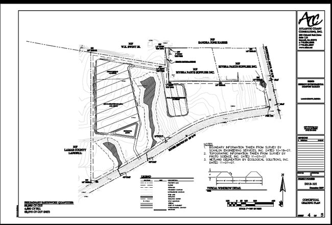
VACANT LAND - ROGER BROWN DR
003
LAMAR
B and X Area of moderate flood hazard, usually the area between the limits of the 100-year and 500-year floods.
Georgia
0
32.09 AC
2025
Lamar County
970100
Atlanta
560 SF
022-005-A
NEARBY LISTINGS FOR SALE OR LEASE
DEMOGRAPHICS near 232 Roger Brown Dr
1 mile
3 mile
5 mile
2025 Total Population
156
5,656
14,992
2030 Population
175
6,337
16,693
Pop Growth 2025-2030
+ 12.18%
+ 12.04%
+ 11.35%
Average Age
39
40
40
2025 Total Households
60
2,200
5,700
HH Growth 2025-2030
+ 13.33%
+ 12.09%
+ 11.82%
Median Household Inc
$68,749
$55,512
$65,067
Avg Household Size
2.50
2.50
2.50
2025 Avg HH Vehicles
2.00
2.00
2.00
Median Home Value
$254,166
$201,527
$235,986
Median Year Built
1979
1980
1985
Nearby Places
Map Layers
Map Styles
 Street
 Aerial
Layers
 Traffic
 Biking
Places
Listings with unknown addresses are not visible on the map
- Restaurants
- Banks
- Shops
- Fitness
- Groceries
SALE & LEASE HISTORY
LISTING DATE
SALE/LEASE

Sep 24, 2016
For Sale
Jan 13, 2017
For Sale
Jan 11, 2017
For Sale
Nearby Properties
Address
Land Use
TOTAL SIZE
Lot Size
Zoning
Address
Land Use
TOTAL SIZE
Lot Size
Zoning
6,975 SF
92.88 AC
003
Address
Land Use
TOTAL SIZE
Lot Size
Zoning
96,237 SF
34.40 AC
M-2
Address
Land Use
TOTAL SIZE
Lot Size
Zoning
467,708 SF
79.13 AC
AR
Address
Land Use
TOTAL SIZE
Lot Size
Zoning
7,808 SF
34.16 AC
M-2
Address
Land Use
TOTAL SIZE
Lot Size
Zoning
32,160 SF
8 AC
R-2
Address
Land Use
TOTAL SIZE
Lot Size
Zoning
20,256 SF
38.65 AC
024
Address
Land Use
TOTAL SIZE
Lot Size
Zoning
2,463 SF
139.06 AC
002
Address
Land Use
TOTAL SIZE
Lot Size
Zoning
13,916 SF
18.43 AC
I-1
Address
Land Use
TOTAL SIZE
Lot Size
Zoning
45,844 SF
6.26 AC
I-1
Address
Land Use
TOTAL SIZE
Lot Size
Zoning
23,040 SF
6.08 AC
R2
Address
Land Use
TOTAL SIZE
Lot Size
Zoning
7,200 SF
7.58 AC
M-2
Address
Land Use
TOTAL SIZE
Lot Size
Zoning
16,540 SF
8.30 AC
M-2
Address
Land Use
TOTAL SIZE
Lot Size
Zoning
1,957 SF
24.61 AC
M-2
Address
Land Use
TOTAL SIZE
Lot Size
Zoning
10,000 SF
3.50 AC
I-1
Address
Land Use
TOTAL SIZE
Lot Size
Zoning
4,544 SF
3.25 AC
C-2
Address
Land Use
TOTAL SIZE
Lot Size
Zoning
7,080 SF
1.60 AC
026
Address
Land Use
TOTAL SIZE
Lot Size
Zoning
7,300 SF
95.40 AC
004
Address
Land Use
TOTAL SIZE
Lot Size
Zoning
10,928 SF
4.59 AC
001
Address
Land Use
TOTAL SIZE
Lot Size
Zoning
1,200 SF
71.54 AC
002
Address
Land Use
TOTAL SIZE
Lot Size
Zoning
8,181 SF
1.52 AC
001
Address
Land Use
TOTAL SIZE
Lot Size
Zoning
31,680 SF
5 AC
M-2
Address
Land Use
TOTAL SIZE
Lot Size
Zoning
58.94 AC
001
Address
Land Use
TOTAL SIZE
Lot Size
Zoning
267.91 AC
004
Address
Land Use
TOTAL SIZE
Lot Size
Zoning
6,084 SF
2 AC
Address
Land Use
TOTAL SIZE
Lot Size
Zoning
9,146 SF
0.97 AC
C-2
Address
Land Use
TOTAL SIZE
Lot Size
Zoning
11,762 SF
3.75 AC
001
Address
Land Use
TOTAL SIZE
Lot Size
Zoning
14,494 SF
61.22 AC
004
Address
Land Use
TOTAL SIZE
Lot Size
Zoning
5,280 SF
2.38 AC
C-2
Address
Land Use
TOTAL SIZE
Lot Size
Zoning
7,327 SF
1.16 AC
C2
The World's #1 Commercial Real Estate Marketplace
Connect with us
© 2026 CoStar Group
The information above has been obtained from sources believed reliable. While we do not doubt its accuracy we have not verified it and make no guarantee, warranty or representation about it. It is your responsibility to independently confirm its accuracy and completeness. Any projections, opinions, assumptions, or estimates used are for example only and do not represent the current or future performance of the property. The value of this transaction to you depends on tax and other factors which should be evaluated by your tax, financial, and legal advisors. You and your advisors should conduct a careful, independent investigation of the property to determine to your satisfaction the suitability of the property for your needs.