Property Record
232 W 3Rd St, Dover, OH 44622


Property Detail
232 W 3Rd St
1504114000
WHOLE 328 329 330 331 .687A
Financialbuilding
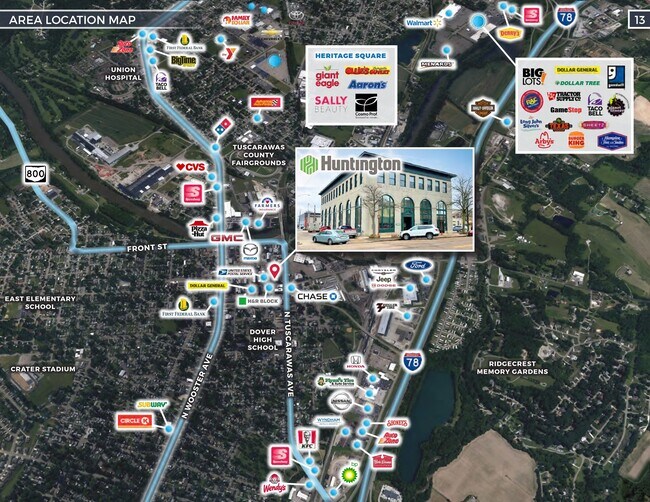
TUSCARAWAS
B and X Area of moderate flood hazard, usually the area between the limits of the 100-year and 500-year floods.
Ohio
2024
0.69 AC
2024
Ohio North Area
020700
Other Market Areas
8,253 SF
New Philadelphia-Dover, OH
NEARBY LISTINGS FOR SALE OR LEASE
-
-
No Photo
-
-
-
View all Dover listings for sale on LoopNet.com
DEMOGRAPHICS near 232 W 3Rd St
1 mile
3 mile
5 mile
2025 Total Population
7,140
27,708
38,805
2030 Population
7,078
27,766
38,774
Pop Growth 2025-2030
(0.87%)
+ 0.21%
(0.08%)
Average Age
40
42
42
2025 Total Households
2,781
11,441
16,144
HH Growth 2025-2030
(0.90%)
+ 0.16%
(0.12%)
Median Household Inc
$56,228
$60,354
$61,628
Avg Household Size
2.40
2.30
2.30
2025 Avg HH Vehicles
2.00
2.00
2.00
Median Home Value
$165,672
$185,662
$194,030
Median Year Built
1950
1959
1966
Nearby Places
Map Layers
Map Styles
 Street
 Aerial
Transit
 Traffic
 Biking
Places
Listings with unknown addresses are not visible on the map
- Restaurants
- Banks
- Shops
- Fitness
- Groceries
PUBLIC TRANSPORTATION
AIRPORT
Akron-Canton Regional
Drive
Walk
Distance
Akron-Canton Regional
40 min
32.6 mi
SALE & LEASE HISTORY
LISTING DATE
SALE/LEASE

Apr 25, 2022
For Sale
Nearby Properties
Address
Land Use
TOTAL SIZE
Lot Size
Zoning
Address
Land Use
TOTAL SIZE
Lot Size
Zoning
38,869 SF
2.98 AC
Address
Land Use
TOTAL SIZE
Lot Size
Zoning
4,021,013 SF
12 AC
Address
Land Use
TOTAL SIZE
Lot Size
Zoning
22,049 SF
2.70 AC
Address
Land Use
TOTAL SIZE
Lot Size
Zoning
68,337 SF
6.31 AC
Address
Land Use
TOTAL SIZE
Lot Size
Zoning
115,750 SF
18.54 AC
Address
Land Use
TOTAL SIZE
Lot Size
Zoning
42,760 SF
7.11 AC
Address
Land Use
TOTAL SIZE
Lot Size
Zoning
14,078 SF
2.30 AC
Address
Land Use
TOTAL SIZE
Lot Size
Zoning
1 SF
21.63 AC
Address
Land Use
TOTAL SIZE
Lot Size
Zoning
33,685 SF
13.89 AC
Address
Land Use
TOTAL SIZE
Lot Size
Zoning
36,692 SF
3.57 AC
Address
Land Use
TOTAL SIZE
Lot Size
Zoning
14,906 SF
5.42 AC
Address
Land Use
TOTAL SIZE
Lot Size
Zoning
45,276 SF
1.51 AC
Address
Land Use
TOTAL SIZE
Lot Size
Zoning
14,454 SF
3.52 AC
Address
Land Use
TOTAL SIZE
Lot Size
Zoning
36,354 SF
3.36 AC
Address
Land Use
TOTAL SIZE
Lot Size
Zoning
11,806 SF
0.53 AC
Address
Land Use
TOTAL SIZE
Lot Size
Zoning
23,528 SF
1.25 AC
Address
Land Use
TOTAL SIZE
Lot Size
Zoning
23,632 SF
2.66 AC
Address
Land Use
TOTAL SIZE
Lot Size
Zoning
28,902 SF
1.61 AC
Address
Land Use
TOTAL SIZE
Lot Size
Zoning
50,661 SF
28.95 AC
Address
Land Use
TOTAL SIZE
Lot Size
Zoning
35,434 SF
1.76 AC
Address
Land Use
TOTAL SIZE
Lot Size
Zoning
4,477 SF
0.63 AC
Address
Land Use
TOTAL SIZE
Lot Size
Zoning
28,406 SF
3.24 AC
Address
Land Use
TOTAL SIZE
Lot Size
Zoning
35,828 SF
4.16 AC
Address
Land Use
TOTAL SIZE
Lot Size
Zoning
11,786 SF
5.12 AC
Address
Land Use
TOTAL SIZE
Lot Size
Zoning
20,000 SF
1.08 AC
Address
Land Use
TOTAL SIZE
Lot Size
Zoning
22,118 SF
1.91 AC
Address
Land Use
TOTAL SIZE
Lot Size
Zoning
1 SF
37.59 AC
Address
Land Use
TOTAL SIZE
Lot Size
Zoning
18,952 SF
0.50 AC
Address
Land Use
TOTAL SIZE
Lot Size
Zoning
46,094 SF
0.97 AC
Address
Land Use
TOTAL SIZE
Lot Size
Zoning
12,708 SF
0.36 AC
The World's #1 Commercial Real Estate Marketplace
Connect with us
© 2026 CoStar Group
The information above has been obtained from sources believed reliable. While we do not doubt its accuracy we have not verified it and make no guarantee, warranty or representation about it. It is your responsibility to independently confirm its accuracy and completeness. Any projections, opinions, assumptions, or estimates used are for example only and do not represent the current or future performance of the property. The value of this transaction to you depends on tax and other factors which should be evaluated by your tax, financial, and legal advisors. You and your advisors should conduct a careful, independent investigation of the property to determine to your satisfaction the suitability of the property for your needs.