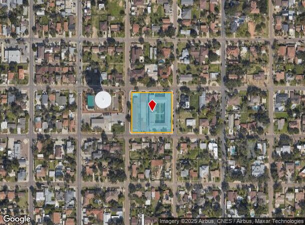
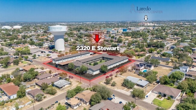
Property Record
2320 E Stewart St, Laredo, TX 78043

NEARBY LISTINGS FOR SALE OR LEASE
Property Detail
2320 E Stewart St
Laredo, TX
Eastern -- Blocks 1351 - 1400
177269
ALL OF BLK 1361 ED
Multifamilydwelling
Webb
X
Texas
48479C1215C
1
2024
1.77 AC
2025
Texas South Area
001104
Other Market Areas
48,936 SF
DEMOGRAPHICS near 2320 E Stewart St
1 Mile
3 Mile
5 Mile
2024 Total Population
20,033
112,733
187,092
2029 Population
20,156
113,129
188,618
Pop Growth 2024-2029
+ 0.61%
+ 0.35%
+ 0.82%
Average Age
36
36
35
2024 Total Households
6,552
35,336
56,621
HH Growth 2024-2029
+ 0.70%
+ 0.42%
+ 0.84%
Median Household Inc
$36,209
$39,636
$50,627
Avg Household Size
3.00
3.10
3.20
2024 Avg HH Vehicles
2.00
2.00
2.00
Median Home Value
$152,398
$127,959
$151,799
Median Year Built
1983
1982
1991
Nearby Places
Map Layers
Map Styles
 Street
 Aerial
- Restaurants
- Banks
- Shops
- Fitness
- Groceries
PUBLIC TRANSPORTATION
AIRPORT
Laredo International
DRIVE
WALK
Distance
Laredo International
8 min
4.1 mi
Freight Ports
Port of Corpus Christi
DRIVE
WALK
Distance
Port of Corpus Christi
160 min
140.4 mi
SALE & LEASE HISTORY
LISTING DATE
SALE/LEASE

Feb 28, 2020
For Sale
Nearby Properties
Address
Land Use
TOTAL SIZE
Lot Size
Zoning
Address
Land Use
TOTAL SIZE
Lot Size
Zoning
668,900 SF
38.32 AC
B4
Address
Land Use
TOTAL SIZE
Lot Size
Zoning
497,463 SF
1.77 AC
R1
Address
Land Use
TOTAL SIZE
Lot Size
Zoning
178,000 SF
23.50 AC
B4
Address
Land Use
TOTAL SIZE
Lot Size
Zoning
310,346 SF
87.65 AC
R1A
Address
Land Use
TOTAL SIZE
Lot Size
Zoning
489,093 SF
32.23 AC
B4
Address
Land Use
TOTAL SIZE
Lot Size
Zoning
152.08 AC
M1
Address
Land Use
TOTAL SIZE
Lot Size
Zoning
224,926 SF
21.49 AC
R3
Address
Land Use
TOTAL SIZE
Lot Size
Zoning
689,547 SF
2.70 AC
B3
Address
Land Use
TOTAL SIZE
Lot Size
Zoning
258,114 SF
30.54 AC
B1
Address
Land Use
TOTAL SIZE
Lot Size
Zoning
231,146 SF
1.77 AC
R1
Address
Land Use
TOTAL SIZE
Lot Size
Zoning
144,491 SF
3.54 AC
CBD
Address
Land Use
TOTAL SIZE
Lot Size
Zoning
380,420 SF
9.18 AC
B3
Address
Land Use
TOTAL SIZE
Lot Size
Zoning
227,503 SF
19.84 AC
B4
Address
Land Use
TOTAL SIZE
Lot Size
Zoning
96,991 SF
1.59 AC
CBD
Address
Land Use
TOTAL SIZE
Lot Size
Zoning
192,176 SF
34.94 AC
Address
Land Use
TOTAL SIZE
Lot Size
Zoning
127,364 SF
1.60 AC
CBD
Address
Land Use
TOTAL SIZE
Lot Size
Zoning
157,376 SF
25.86 AC
B3
Address
Land Use
TOTAL SIZE
Lot Size
Zoning
144,522 SF
3.86 AC
B3
Address
Land Use
TOTAL SIZE
Lot Size
Zoning
183,795 SF
10.36 AC
R2
Address
Land Use
TOTAL SIZE
Lot Size
Zoning
50,765 SF
39.73 AC
Address
Land Use
TOTAL SIZE
Lot Size
Zoning
25,104 SF
1.42 AC
CBD
Address
Land Use
TOTAL SIZE
Lot Size
Zoning
101,734 SF
1.63 AC
B3
Address
Land Use
TOTAL SIZE
Lot Size
Zoning
66,567 SF
3.81 AC
M1
Address
Land Use
TOTAL SIZE
Lot Size
Zoning
10,712 SF
745.84 AC
AG
Address
Land Use
TOTAL SIZE
Lot Size
Zoning
113,687 SF
5.58 AC
R3
Address
Land Use
TOTAL SIZE
Lot Size
Zoning
93,414 SF
8.57 AC
R1
Address
Land Use
TOTAL SIZE
Lot Size
Zoning
96,665 SF
12.03 AC
R1A
Address
Land Use
TOTAL SIZE
Lot Size
Zoning
102,815 SF
2.23 AC
Address
Land Use
TOTAL SIZE
Lot Size
Zoning
70,980 SF
1.44 AC
CBD
Address
Land Use
TOTAL SIZE
Lot Size
Zoning
138,920 SF
13.06 AC
The World's #1 Commercial Real Estate Marketplace
Connect with us
© 2026 CoStar Group
The information above has been obtained from sources believed reliable. While we do not doubt its accuracy we have not verified it and make no guarantee, warranty or representation about it. It is your responsibility to independently confirm its accuracy and completeness. Any projections, opinions, assumptions, or estimates used are for example only and do not represent the current or future performance of the property. The value of this transaction to you depends on tax and other factors which should be evaluated by your tax, financial, and legal advisors. You and your advisors should conduct a careful, independent investigation of the property to determine to your satisfaction the suitability of the property for your needs.