Property Record
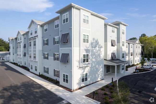
2320 E University Ave, Gainesville, FL 32641


Property Detail
2320 E University Ave
11235-005-000
NEW GAINESVILLE PB A-66 PART OF LOT 51 DESC AS: COM SW COR LOT 51 N 00 DEG 32 MIN 51 SEC E 48.20 FT POB N 00 DEG 32 MIN 51 SEC E 510 FT S 89 DEG 46 MIN 28 SEC E 200 FT N 00 DEG 32 MIN 51 SEC E 100 FT S 89 DEG 46 MIN 28 SEC E 57.51 FT S 00 DEG 19 MIN
Multifamilydwelling
ALACHUA
MU1
Florida
B and X Area of moderate flood hazard, usually the area between the limits of the 100-year and 500-year floods.
51
2025
3.53 AC
2025
Gainesville
000600
Other Market Areas
67,900 SF
Gainesville, FL
NEARBY LISTINGS FOR SALE OR LEASE
DEMOGRAPHICS near 2320 E University Ave
1 mile
3 mile
5 mile
2025 Total Population
6,940
54,844
106,693
2030 Population
7,361
56,314
110,340
Pop Growth 2025-2030
+ 6.07%
+ 2.68%
+ 3.42%
Average Age
36
33
33
2025 Total Households
2,579
19,537
41,728
HH Growth 2025-2030
+ 6.59%
+ 3.11%
+ 3.91%
Median Household Inc
$33,999
$39,092
$45,167
Avg Household Size
2.60
2.20
2.10
2025 Avg HH Vehicles
1.00
1.00
2.00
Median Home Value
$127,787
$186,279
$238,280
Median Year Built
1976
1974
1980
Nearby Places
Map Layers
Map Styles
 Street
 Aerial
Layers
 Traffic
 Biking
Places
Listings with unknown addresses are not visible on the map
- Restaurants
- Banks
- Shops
- Fitness
- Groceries
PUBLIC TRANSPORTATION
AIRPORT
Gainesville Regional
Drive
Walk
Distance
Gainesville Regional
12 min
4.3 mi
Freight Ports
Jacksonville Port
Drive
Walk
Distance
Jacksonville Port
97 min
74.1 mi
Nearby Properties
Address
Land Use
TOTAL SIZE
Lot Size
Zoning
Address
Land Use
TOTAL SIZE
Lot Size
Zoning
430,590 SF
16.95 AC
ED
Address
Land Use
TOTAL SIZE
Lot Size
Zoning
959,910 SF
2.50 AC
PD
Address
Land Use
TOTAL SIZE
Lot Size
Zoning
334,819 SF
1.79 AC
U9
Address
Land Use
TOTAL SIZE
Lot Size
Zoning
357,020 SF
20 AC
ED
Address
Land Use
TOTAL SIZE
Lot Size
Zoning
25.64 AC
PS
Address
Land Use
TOTAL SIZE
Lot Size
Zoning
594,946 SF
4.47 AC
DT
Address
Land Use
TOTAL SIZE
Lot Size
Zoning
271,079 SF
0.94 AC
PD
Address
Land Use
TOTAL SIZE
Lot Size
Zoning
279,647 SF
1.66 AC
PD
Address
Land Use
TOTAL SIZE
Lot Size
Zoning
117,563 SF
1.61 AC
U8
Address
Land Use
TOTAL SIZE
Lot Size
Zoning
362,539 SF
2.11 AC
U8
Address
Land Use
TOTAL SIZE
Lot Size
Zoning
299,737 SF
1.14 AC
DT
Address
Land Use
TOTAL SIZE
Lot Size
Zoning
94,156 SF
3.65 AC
U9
Address
Land Use
TOTAL SIZE
Lot Size
Zoning
385,841 SF
21.74 AC
U6
Address
Land Use
TOTAL SIZE
Lot Size
Zoning
280,840 SF
20 AC
ED
Address
Land Use
TOTAL SIZE
Lot Size
Zoning
404,722 SF
2.82 AC
U6
Address
Land Use
TOTAL SIZE
Lot Size
Zoning
444,350 SF
4.38 AC
DT
Address
Land Use
TOTAL SIZE
Lot Size
Zoning
1,331,605 SF
32.61 AC
ED
Address
Land Use
TOTAL SIZE
Lot Size
Zoning
943,515 SF
42.98 AC
INST
Address
Land Use
TOTAL SIZE
Lot Size
Zoning
346,154 SF
22.02 AC
U6
Address
Land Use
TOTAL SIZE
Lot Size
Zoning
378,985 SF
7.21 AC
PD
Address
Land Use
TOTAL SIZE
Lot Size
Zoning
308,599 SF
639 AC
A
Address
Land Use
TOTAL SIZE
Lot Size
Zoning
199,720 SF
1.10 AC
U9
Address
Land Use
TOTAL SIZE
Lot Size
Zoning
330,580 SF
6.54 AC
PD
Address
Land Use
TOTAL SIZE
Lot Size
Zoning
87,350 SF
13.16 AC
ED
Address
Land Use
TOTAL SIZE
Lot Size
Zoning
371,130 SF
20 AC
ED
Address
Land Use
TOTAL SIZE
Lot Size
Zoning
161,840 SF
2.25 AC
U6
Address
Land Use
TOTAL SIZE
Lot Size
Zoning
341,625 SF
1,093.63 AC
AF
Address
Land Use
TOTAL SIZE
Lot Size
Zoning
110,940 SF
30.65 AC
RH2
Address
Land Use
TOTAL SIZE
Lot Size
Zoning
81,674 SF
4.21 AC
U6
Address
Land Use
TOTAL SIZE
Lot Size
Zoning
125,495 SF
19.11 AC
ED
The World's #1 Commercial Real Estate Marketplace
Connect with us
© 2026 CoStar Group
The information above has been obtained from sources believed reliable. While we do not doubt its accuracy we have not verified it and make no guarantee, warranty or representation about it. It is your responsibility to independently confirm its accuracy and completeness. Any projections, opinions, assumptions, or estimates used are for example only and do not represent the current or future performance of the property. The value of this transaction to you depends on tax and other factors which should be evaluated by your tax, financial, and legal advisors. You and your advisors should conduct a careful, independent investigation of the property to determine to your satisfaction the suitability of the property for your needs.