Property Record
2320 Lapham Dr, Modesto, CA 95354


Property Detail
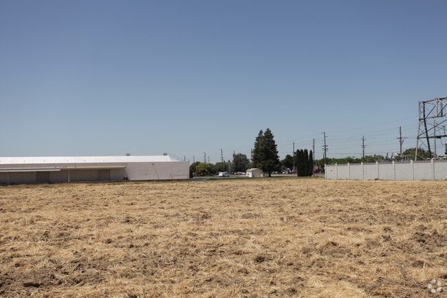
2320 Lapham Dr
Warehouse
STANISLAUS
COUM
California
B and X Area of moderate flood hazard, usually the area between the limits of the 100-year and 500-year floods.
8.72 AC
2025
Modesto
2025
Stockton/Modesto
001900
Modesto, CA
257,760 SF
036-01-80
NEARBY LISTINGS FOR SALE OR LEASE
DEMOGRAPHICS near 2320 Lapham Dr
1 mile
3 mile
5 mile
2025 Total Population
12,121
129,369
269,278
2030 Population
12,159
129,972
270,688
Pop Growth 2025-2030
+ 0.31%
+ 0.47%
+ 0.52%
Average Age
37
38
37
2025 Total Households
3,968
42,943
85,925
HH Growth 2025-2030
+ 0.25%
+ 0.48%
+ 0.53%
Median Household Inc
$74,860
$76,849
$78,896
Avg Household Size
3.00
2.90
3.00
2025 Avg HH Vehicles
2.00
2.00
2.00
Median Home Value
$372,477
$431,119
$438,561
Median Year Built
1971
1975
1976
Nearby Places
Map Layers
Map Styles
 Street
 Aerial
Layers
 Traffic
 Biking
Places
Listings with unknown addresses are not visible on the map
- Restaurants
- Banks
- Shops
- Fitness
- Groceries
PUBLIC TRANSPORTATION
AIRPORT
Stockton Metro
Drive
Walk
Distance
Stockton Metro
38 min
27.4 mi
Freight Ports
Port of Stockton
Drive
Walk
Distance
Port of Stockton
46 min
35.9 mi
Nearby Properties
Address
Land Use
TOTAL SIZE
Lot Size
Zoning
Address
Land Use
TOTAL SIZE
Lot Size
Zoning
517,008 SF
71.35 AC
Address
Land Use
TOTAL SIZE
Lot Size
Zoning
817,526 SF
17.31 AC
Address
Land Use
TOTAL SIZE
Lot Size
Zoning
766,000 SF
22.69 AC
MODPD
Address
Land Use
TOTAL SIZE
Lot Size
Zoning
373,574 SF
23 AC
Address
Land Use
TOTAL SIZE
Lot Size
Zoning
448,549 SF
58.48 AC
Address
Land Use
TOTAL SIZE
Lot Size
Zoning
726,299 SF
38.86 AC
M2
Address
Land Use
TOTAL SIZE
Lot Size
Zoning
774,633 SF
39.18 AC
MODM2
Address
Land Use
TOTAL SIZE
Lot Size
Zoning
153,937 SF
7.87 AC
Address
Land Use
TOTAL SIZE
Lot Size
Zoning
151,288 SF
6.50 AC
Address
Land Use
TOTAL SIZE
Lot Size
Zoning
138,618 SF
3.99 AC
Address
Land Use
TOTAL SIZE
Lot Size
Zoning
77,382 SF
2.60 AC
Address
Land Use
TOTAL SIZE
Lot Size
Zoning
1,225,202 SF
67.24 AC
MI
Address
Land Use
TOTAL SIZE
Lot Size
Zoning
154,264 SF
7.63 AC
Address
Land Use
TOTAL SIZE
Lot Size
Zoning
266,975 SF
1.90 AC
Address
Land Use
TOTAL SIZE
Lot Size
Zoning
482,100 SF
21 AC
Address
Land Use
TOTAL SIZE
Lot Size
Zoning
192,858 SF
10.44 AC
Address
Land Use
TOTAL SIZE
Lot Size
Zoning
775,280 SF
30.42 AC
COUM
Address
Land Use
TOTAL SIZE
Lot Size
Zoning
231,178 SF
10.04 AC
R3
Address
Land Use
TOTAL SIZE
Lot Size
Zoning
65,294 SF
4.20 AC
Address
Land Use
TOTAL SIZE
Lot Size
Zoning
327,227 SF
13.52 AC
MODM1
Address
Land Use
TOTAL SIZE
Lot Size
Zoning
120,383 SF
5.52 AC
MODCM
Address
Land Use
TOTAL SIZE
Lot Size
Zoning
476,580 SF
44.60 AC
Address
Land Use
TOTAL SIZE
Lot Size
Zoning
79,458 SF
5.32 AC
Address
Land Use
TOTAL SIZE
Lot Size
Zoning
164,740 SF
9.35 AC
Address
Land Use
TOTAL SIZE
Lot Size
Zoning
118,800 SF
0.64 AC
Address
Land Use
TOTAL SIZE
Lot Size
Zoning
233,787 SF
14.65 AC
Address
Land Use
TOTAL SIZE
Lot Size
Zoning
98,140 SF
6.04 AC
Address
Land Use
TOTAL SIZE
Lot Size
Zoning
206,271 SF
6.94 AC
Address
Land Use
TOTAL SIZE
Lot Size
Zoning
256,014 SF
19.38 AC
Address
Land Use
TOTAL SIZE
Lot Size
Zoning
2.16 AC
The World's #1 Commercial Real Estate Marketplace
Connect with us
© 2026 CoStar Group
The information above has been obtained from sources believed reliable. While we do not doubt its accuracy we have not verified it and make no guarantee, warranty or representation about it. It is your responsibility to independently confirm its accuracy and completeness. Any projections, opinions, assumptions, or estimates used are for example only and do not represent the current or future performance of the property. The value of this transaction to you depends on tax and other factors which should be evaluated by your tax, financial, and legal advisors. You and your advisors should conduct a careful, independent investigation of the property to determine to your satisfaction the suitability of the property for your needs.