Property Record
2320 Lincoln Hwy E, Lancaster, PA 17602

NEARBY LISTINGS FOR SALE OR LEASE
-
-
View all Lancaster listings for sale on LoopNet.com
Property Detail
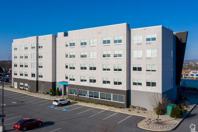
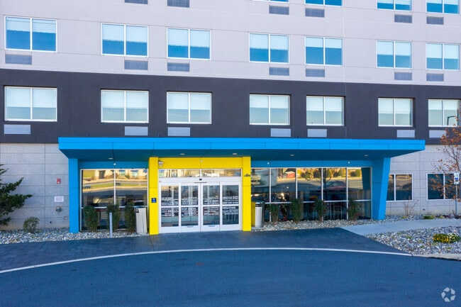
2320 Lincoln Hwy E
310-49418-1-0001
Lincoln Highway East Condominium
Commercialcondominium
Lancaster
X
Pennsylvania
42071C0389F
2.33 AC
2024
Lancaster
2025
Philadelphia
013204
Lancaster, PA
51,824 SF
DEMOGRAPHICS near 2320 Lincoln Hwy E
1 Mile
3 Mile
5 Mile
2024 Total Population
1,447
21,719
83,291
2029 Population
1,436
21,752
83,640
Pop Growth 2024-2029
(0.76%)
+ 0.15%
+ 0.42%
Average Age
41
40
40
2024 Total Households
507
8,011
30,610
HH Growth 2024-2029
(0.79%)
+ 0.17%
+ 0.32%
Median Household Inc
$75,605
$85,681
$74,158
Avg Household Size
2.70
2.70
2.60
2024 Avg HH Vehicles
2.00
2.00
2.00
Median Home Value
$299,999
$303,967
$261,585
Median Year Built
1981
1984
1970
Nearby Places
Map Layers
Map Styles
 Street
 Aerial
- Restaurants
- Banks
- Shops
- Fitness
- Groceries
PUBLIC TRANSPORTATION
COMMUTER RAIL
Lancaster (Keystone Service - Amtrak, Pennsylvanian - Amtrak)
DRIVE
WALK
Distance
Lancaster (Keystone Service - Amtrak, Pennsylvanian - Amtrak)
13 min
7.6 mi
Freight Ports
Port of Wilmington, RI
DRIVE
WALK
Distance
Port of Wilmington, RI
85 min
48.7 mi
Nearby Properties
Address
Land Use
TOTAL SIZE
Lot Size
Zoning
Address
Land Use
TOTAL SIZE
Lot Size
Zoning
403,771 SF
106.93 AC
Address
Land Use
TOTAL SIZE
Lot Size
Zoning
333,041 SF
159.39 AC
RV
Address
Land Use
TOTAL SIZE
Lot Size
Zoning
610,108 SF
39.96 AC
C-2
Address
Land Use
TOTAL SIZE
Lot Size
Zoning
322,380 SF
33.29 AC
R-3
Address
Land Use
TOTAL SIZE
Lot Size
Zoning
289,398 SF
35.20 AC
C-2
Address
Land Use
TOTAL SIZE
Lot Size
Zoning
21.41 AC
Address
Land Use
TOTAL SIZE
Lot Size
Zoning
323,300 SF
21.60 AC
C-2
Address
Land Use
TOTAL SIZE
Lot Size
Zoning
302,460 SF
51.80 AC
R4
Address
Land Use
TOTAL SIZE
Lot Size
Zoning
221,609 SF
62.37 AC
HC
Address
Land Use
TOTAL SIZE
Lot Size
Zoning
125,153 SF
24.10 AC
Address
Land Use
TOTAL SIZE
Lot Size
Zoning
198,492 SF
24.74 AC
R-2
Address
Land Use
TOTAL SIZE
Lot Size
Zoning
251,051 SF
31.10 AC
R-3
Address
Land Use
TOTAL SIZE
Lot Size
Zoning
19.29 AC
Address
Land Use
TOTAL SIZE
Lot Size
Zoning
258,104 SF
31.40 AC
I
Address
Land Use
TOTAL SIZE
Lot Size
Zoning
83,728 SF
2.70 AC
C-2
Address
Land Use
TOTAL SIZE
Lot Size
Zoning
172,408 SF
13.70 AC
R-3
Address
Land Use
TOTAL SIZE
Lot Size
Zoning
70,314 SF
3.20 AC
C-2
Address
Land Use
TOTAL SIZE
Lot Size
Zoning
65,964 SF
12.80 AC
A
Address
Land Use
TOTAL SIZE
Lot Size
Zoning
156,140 SF
23.50 AC
RV
Address
Land Use
TOTAL SIZE
Lot Size
Zoning
251,531 SF
42.54 AC
Address
Land Use
TOTAL SIZE
Lot Size
Zoning
71,600 SF
15.20 AC
C-2
Address
Land Use
TOTAL SIZE
Lot Size
Zoning
142,393 SF
22 AC
I
Address
Land Use
TOTAL SIZE
Lot Size
Zoning
36,494 SF
7 AC
R-2
Address
Land Use
TOTAL SIZE
Lot Size
Zoning
82,420 SF
3.17 AC
C-2
Address
Land Use
TOTAL SIZE
Lot Size
Zoning
82,718 SF
7.85 AC
I
Address
Land Use
TOTAL SIZE
Lot Size
Zoning
116,308 SF
12.30 AC
R-3
Address
Land Use
TOTAL SIZE
Lot Size
Zoning
200,027 SF
27.80 AC
C-2
Address
Land Use
TOTAL SIZE
Lot Size
Zoning
298,472 SF
160.06 AC
R
Address
Land Use
TOTAL SIZE
Lot Size
Zoning
123,614 SF
8.99 AC
C-2
The World's #1 Commercial Real Estate Marketplace
Connect with us
© 2026 CoStar Group
The information above has been obtained from sources believed reliable. While we do not doubt its accuracy we have not verified it and make no guarantee, warranty or representation about it. It is your responsibility to independently confirm its accuracy and completeness. Any projections, opinions, assumptions, or estimates used are for example only and do not represent the current or future performance of the property. The value of this transaction to you depends on tax and other factors which should be evaluated by your tax, financial, and legal advisors. You and your advisors should conduct a careful, independent investigation of the property to determine to your satisfaction the suitability of the property for your needs.