Property Record
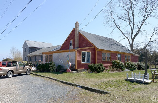
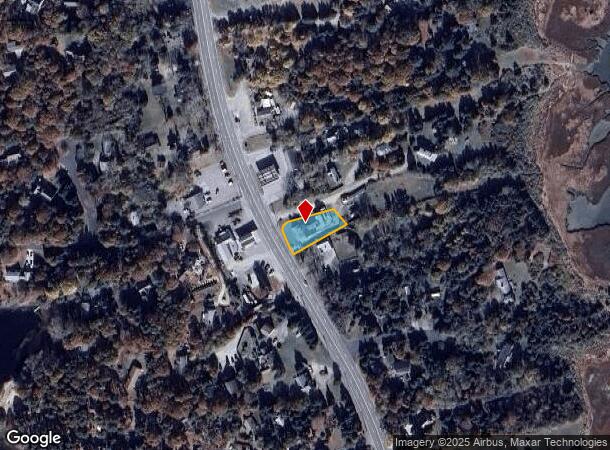
2320 State Hwy, Eastham, MA 02642

NEARBY LISTINGS FOR SALE OR LEASE
-
-
View all Eastham listings for sale on LoopNet.com
Property Detail
2320 State Hwy
Commercialofficeresidentialmixeduse
Barnstable
X
Massachusetts
25001C0428J
93
2025
0.28 AC
2025
Other Market Areas
010304
Barnstable Town, MA
4,693 SF
EAST-000015-000000-000093
DEMOGRAPHICS near 2320 State Hwy
1 mile
3 mile
5 mile
2024 Total Population
959
6,858
11,142
2029 Population
971
6,909
11,155
Pop Growth 2024-2029
+ 1.25%
+ 0.74%
+ 0.12%
Average Age
55
55
54
2024 Total Households
465
3,323
5,375
HH Growth 2024-2029
+ 0.86%
+ 0.42%
(0.24%)
Median Household Inc
$87,735
$84,514
$88,766
Avg Household Size
2.00
2.00
2.00
2024 Avg HH Vehicles
2.00
2.00
2.00
Median Home Value
$689,462
$667,735
$665,225
Median Year Built
1975
1976
1976
Nearby Places
Map Layers
Map Styles
 Street
 Aerial
Transit
 Traffic
 Biking
Places
Listings with unknown addresses are not visible on the map
- Restaurants
- Banks
- Shops
- Fitness
- Groceries
Nearby Properties
Address
Land Use
TOTAL SIZE
Lot Size
Zoning
Address
Land Use
TOTAL SIZE
Lot Size
Zoning
69.90 AC
CCNS
Address
Land Use
TOTAL SIZE
Lot Size
Zoning
105 AC
CCNS
Address
Land Use
TOTAL SIZE
Lot Size
Zoning
2,872 SF
13.74 AC
R
Address
Land Use
TOTAL SIZE
Lot Size
Zoning
99,086 SF
10.69 AC
GB
Address
Land Use
TOTAL SIZE
Lot Size
Zoning
50 AC
CCNS
Address
Land Use
TOTAL SIZE
Lot Size
Zoning
52,020 SF
71.85 AC
CCNS
Address
Land Use
TOTAL SIZE
Lot Size
Zoning
425 SF
29.52 AC
RESIDE
Address
Land Use
TOTAL SIZE
Lot Size
Zoning
125 AC
CCNS
Address
Land Use
TOTAL SIZE
Lot Size
Zoning
7,680 SF
10.50 AC
R
Address
Land Use
TOTAL SIZE
Lot Size
Zoning
5,817 SF
5.75 AC
R
Address
Land Use
TOTAL SIZE
Lot Size
Zoning
123.73 AC
CCNS
Address
Land Use
TOTAL SIZE
Lot Size
Zoning
6,524 SF
2.24 AC
R
Address
Land Use
TOTAL SIZE
Lot Size
Zoning
4,495 SF
1.06 AC
R
Address
Land Use
TOTAL SIZE
Lot Size
Zoning
9,084 SF
1.40 AC
R
Address
Land Use
TOTAL SIZE
Lot Size
Zoning
3,633 SF
1.19 AC
R
Address
Land Use
TOTAL SIZE
Lot Size
Zoning
94,530 SF
8.51 AC
RETAIL
Address
Land Use
TOTAL SIZE
Lot Size
Zoning
33,188 SF
9.97 AC
VILLAG
Address
Land Use
TOTAL SIZE
Lot Size
Zoning
52,487 SF
11.40 AC
RESIDE
Address
Land Use
TOTAL SIZE
Lot Size
Zoning
4,327 SF
1.31 AC
R
Address
Land Use
TOTAL SIZE
Lot Size
Zoning
5,159 SF
1.86 AC
R
Address
Land Use
TOTAL SIZE
Lot Size
Zoning
5,944 SF
1.17 AC
RESIDE
Address
Land Use
TOTAL SIZE
Lot Size
Zoning
32.70 AC
CCNS
Address
Land Use
TOTAL SIZE
Lot Size
Zoning
3,457 SF
1.33 AC
R
Address
Land Use
TOTAL SIZE
Lot Size
Zoning
468 SF
44.10 AC
RESIDE
Address
Land Use
TOTAL SIZE
Lot Size
Zoning
6,436 SF
1.15 AC
R
Address
Land Use
TOTAL SIZE
Lot Size
Zoning
5,221 SF
2.57 AC
RESIDE
Address
Land Use
TOTAL SIZE
Lot Size
Zoning
41.97 AC
CCNS
Address
Land Use
TOTAL SIZE
Lot Size
Zoning
8,277 SF
1.20 AC
R
Address
Land Use
TOTAL SIZE
Lot Size
Zoning
3,706 SF
1.73 AC
R
Address
Land Use
TOTAL SIZE
Lot Size
Zoning
4,544 SF
0.76 AC
R
The World's #1 Commercial Real Estate Marketplace
Connect with us
© 2026 CoStar Group
The information above has been obtained from sources believed reliable. While we do not doubt its accuracy we have not verified it and make no guarantee, warranty or representation about it. It is your responsibility to independently confirm its accuracy and completeness. Any projections, opinions, assumptions, or estimates used are for example only and do not represent the current or future performance of the property. The value of this transaction to you depends on tax and other factors which should be evaluated by your tax, financial, and legal advisors. You and your advisors should conduct a careful, independent investigation of the property to determine to your satisfaction the suitability of the property for your needs.