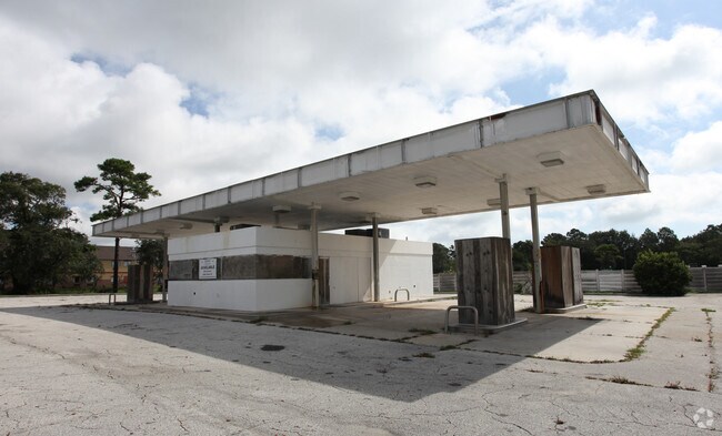
Property Record
2321 Mayport Rd, Atlantic Beach, FL 32233
NEARBY LISTINGS FOR SALE OR LEASE
Property Detail
2321 Mayport Rd
Jacksonville, FL
Section Land
169398-0410
Duval
Storebuilding
Florida
X
1.85 AC
12031C0406J
Beaches
10,208 SF
Jacksonville (Florida)
DEMOGRAPHICS near 2321 Mayport Rd
1 Mile
3 Mile
5 Mile
2024 Total Population
12,162
42,546
100,212
2029 Population
12,891
44,826
104,595
Pop Growth 2024-2029
+ 5.99%
+ 5.36%
+ 4.37%
Average Age
44
41
40
2024 Total Households
5,345
17,181
40,477
HH Growth 2024-2029
+ 6.30%
+ 5.52%
+ 4.60%
Median Household Inc
$72,979
$85,873
$89,479
Avg Household Size
2.20
2.30
2.40
2024 Avg HH Vehicles
2.00
2.00
2.00
Median Home Value
$417,312
$428,781
$364,513
Median Year Built
1987
1985
1989
Nearby Places
Map Layers
Map Styles
 Street
 Aerial
- Restaurants
- Banks
- Shops
- Fitness
- Groceries
PUBLIC TRANSPORTATION
AIRPORT
Jacksonville International
DRIVE
WALK
Distance
Jacksonville International
38 min
24.5 mi
Freight Ports
Jacksonville Port
DRIVE
WALK
Distance
Jacksonville Port
32 min
18.9 mi
Nearby Properties
Address
Land Use
TOTAL SIZE
Lot Size
Zoning
Address
Land Use
TOTAL SIZE
Lot Size
Zoning
1 SF
1,309.30 AC
PBF-1
Address
Land Use
TOTAL SIZE
Lot Size
Zoning
240,363 SF
24.71 AC
PUD
Address
Land Use
TOTAL SIZE
Lot Size
Zoning
178,884 SF
12.54 AC
PUD
Address
Land Use
TOTAL SIZE
Lot Size
Zoning
194,953 SF
22.43 AC
PUD
Address
Land Use
TOTAL SIZE
Lot Size
Zoning
696,126 SF
70.05 AC
APUD
Address
Land Use
TOTAL SIZE
Lot Size
Zoning
34,612 SF
446.76 AC
PBF-1
Address
Land Use
TOTAL SIZE
Lot Size
Zoning
65,384 SF
2.33 AC
ACG
Address
Land Use
TOTAL SIZE
Lot Size
Zoning
265,386 SF
29.35 AC
RMD-C
Address
Land Use
TOTAL SIZE
Lot Size
Zoning
206,990 SF
15.76 AC
RMD-D
Address
Land Use
TOTAL SIZE
Lot Size
Zoning
244,454 SF
14.76 AC
NR-5
Address
Land Use
TOTAL SIZE
Lot Size
Zoning
185,402 SF
14.03 AC
RMD-C
Address
Land Use
TOTAL SIZE
Lot Size
Zoning
157,942 SF
15.55 AC
PUD
Address
Land Use
TOTAL SIZE
Lot Size
Zoning
171,440 SF
11.15 AC
PUD
Address
Land Use
TOTAL SIZE
Lot Size
Zoning
219,659 SF
21.37 AC
NR-1
Address
Land Use
TOTAL SIZE
Lot Size
Zoning
120,233 SF
14.08 AC
ACG
Address
Land Use
TOTAL SIZE
Lot Size
Zoning
167,476 SF
12.89 AC
RMD-C
Address
Land Use
TOTAL SIZE
Lot Size
Zoning
248,601 SF
43.01 AC
PBF-1
Address
Land Use
TOTAL SIZE
Lot Size
Zoning
151,117 SF
10.04 AC
RMD-C
Address
Land Use
TOTAL SIZE
Lot Size
Zoning
95,879 SF
14.46 AC
PUD
Address
Land Use
TOTAL SIZE
Lot Size
Zoning
110,902 SF
8.15 AC
RMD-C
Address
Land Use
TOTAL SIZE
Lot Size
Zoning
100,039 SF
6.30 AC
ARG-M
Address
Land Use
TOTAL SIZE
Lot Size
Zoning
55,659 SF
6.91 AC
PUD
Address
Land Use
TOTAL SIZE
Lot Size
Zoning
80,746 SF
11.68 AC
NC-3
Address
Land Use
TOTAL SIZE
Lot Size
Zoning
123,803 SF
11.87 AC
PUD
Address
Land Use
TOTAL SIZE
Lot Size
Zoning
98,393 SF
6.50 AC
RMD-C
Address
Land Use
TOTAL SIZE
Lot Size
Zoning
119,618 SF
4.65 AC
ACG
Address
Land Use
TOTAL SIZE
Lot Size
Zoning
57,024 SF
1.49 AC
CCG-1
Address
Land Use
TOTAL SIZE
Lot Size
Zoning
62,151 SF
7.99 AC
NC-3
Address
Land Use
TOTAL SIZE
Lot Size
Zoning
6,863 SF
44.04 AC
PUD
Address
Land Use
TOTAL SIZE
Lot Size
Zoning
124,923 SF
14.99 AC
NR-1
The World's #1 Commercial Real Estate Marketplace
Connect with us
© 2025 CoStar Group
The information above has been obtained from sources believed reliable. While we do not doubt its accuracy we have not verified it and make no guarantee, warranty or representation about it. It is your responsibility to independently confirm its accuracy and completeness. Any projections, opinions, assumptions, or estimates used are for example only and do not represent the current or future performance of the property. The value of this transaction to you depends on tax and other factors which should be evaluated by your tax, financial, and legal advisors. You and your advisors should conduct a careful, independent investigation of the property to determine to your satisfaction the suitability of the property for your needs.