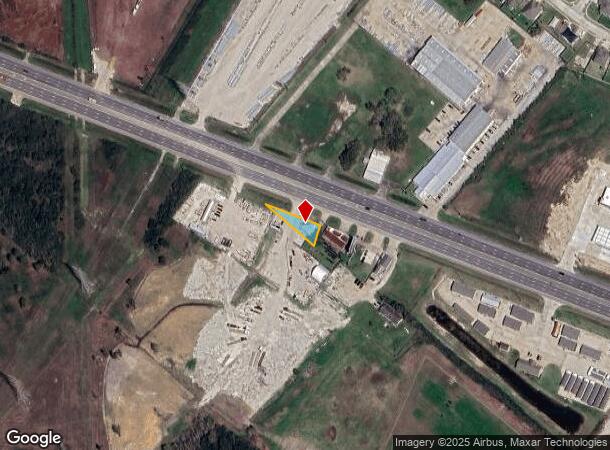
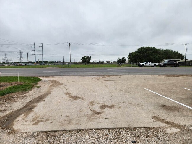
Property Record
23210 W Highway 6, Alvin, TX 77511

NEARBY LISTINGS FOR SALE OR LEASE
Property Detail
23210 W Highway 6
0230-0015-130
H T & B R R
Commercialnec
A0230 H T & B R R TRACT 8C4C ACRES .0923
X
Brazoria
48039C0135K
Texas
2024
0.09 AC
2025
South Hwy 35
661501
Houston
1,471 SF
Houston-The Woodlands-Sugar Land, TX
DEMOGRAPHICS near 23210 W Highway 6
1 Mile
3 Mile
5 Mile
2024 Total Population
1,656
10,303
45,584
2029 Population
1,860
11,542
51,143
Pop Growth 2024-2029
+ 12.32%
+ 12.03%
+ 12.20%
Average Age
40
39
37
2024 Total Households
558
3,416
15,676
HH Growth 2024-2029
+ 12.37%
+ 12.15%
+ 12.31%
Median Household Inc
$75,441
$73,407
$69,748
Avg Household Size
2.80
2.90
2.80
2024 Avg HH Vehicles
2.00
2.00
2.00
Median Home Value
$312,176
$247,920
$220,943
Median Year Built
1990
1990
1992
Nearby Places
Map Layers
Map Styles
 Street
 Aerial
- Restaurants
- Banks
- Shops
- Fitness
- Groceries
PUBLIC TRANSPORTATION
AIRPORT
William P Hobby
DRIVE
WALK
Distance
William P Hobby
35 min
15.9 mi
Freight Ports
Port of Houston
DRIVE
WALK
Distance
Port of Houston
43 min
30.4 mi
SALE & LEASE HISTORY
LISTING DATE
SALE/LEASE

Sep 11, 2024
For Lease
Oct 13, 2022
For Lease
Jun 22, 2021
For Lease
Nearby Properties
Address
Land Use
TOTAL SIZE
Lot Size
Zoning
Address
Land Use
TOTAL SIZE
Lot Size
Zoning
39.21 AC
0113
Address
Land Use
TOTAL SIZE
Lot Size
Zoning
172,015 SF
18.36 AC
Address
Land Use
TOTAL SIZE
Lot Size
Zoning
17.17 AC
Address
Land Use
TOTAL SIZE
Lot Size
Zoning
41,510 SF
20.52 AC
Address
Land Use
TOTAL SIZE
Lot Size
Zoning
48,750 SF
2.82 AC
Address
Land Use
TOTAL SIZE
Lot Size
Zoning
50,400 SF
8.40 AC
0013
Address
Land Use
TOTAL SIZE
Lot Size
Zoning
162,100 SF
24.51 AC
0056
Address
Land Use
TOTAL SIZE
Lot Size
Zoning
34,368 SF
4.32 AC
Address
Land Use
TOTAL SIZE
Lot Size
Zoning
3,504 SF
187.33 AC
0027
Address
Land Use
TOTAL SIZE
Lot Size
Zoning
9,020 SF
3.12 AC
Address
Land Use
TOTAL SIZE
Lot Size
Zoning
25,200 SF
5.08 AC
Address
Land Use
TOTAL SIZE
Lot Size
Zoning
50,958 SF
10.33 AC
Address
Land Use
TOTAL SIZE
Lot Size
Zoning
21,152 SF
34.11 AC
0007
Address
Land Use
TOTAL SIZE
Lot Size
Zoning
7,460 SF
1.75 AC
0002
Address
Land Use
TOTAL SIZE
Lot Size
Zoning
24.77 AC
0025
Address
Land Use
TOTAL SIZE
Lot Size
Zoning
12.04 AC
0088
Address
Land Use
TOTAL SIZE
Lot Size
Zoning
3,633 SF
69.42 AC
0060
Address
Land Use
TOTAL SIZE
Lot Size
Zoning
18,250 SF
9.07 AC
0034
Address
Land Use
TOTAL SIZE
Lot Size
Zoning
46,700 SF
6.41 AC
0022
Address
Land Use
TOTAL SIZE
Lot Size
Zoning
9,100 SF
2.87 AC
0076
Address
Land Use
TOTAL SIZE
Lot Size
Zoning
9,250 SF
1.55 AC
0004
Address
Land Use
TOTAL SIZE
Lot Size
Zoning
3,186 SF
2 AC
Address
Land Use
TOTAL SIZE
Lot Size
Zoning
52,000 SF
3.86 AC
Address
Land Use
TOTAL SIZE
Lot Size
Zoning
2,920 SF
4.48 AC
0003
Address
Land Use
TOTAL SIZE
Lot Size
Zoning
2,400 SF
15.29 AC
0026
Address
Land Use
TOTAL SIZE
Lot Size
Zoning
28,122 SF
1.12 AC
0045
Address
Land Use
TOTAL SIZE
Lot Size
Zoning
14,640 SF
4.48 AC
0054
Address
Land Use
TOTAL SIZE
Lot Size
Zoning
4.20 AC
Address
Land Use
TOTAL SIZE
Lot Size
Zoning
14,160 SF
20.50 AC
Address
Land Use
TOTAL SIZE
Lot Size
Zoning
9,110 SF
3.22 AC
0064
The World's #1 Commercial Real Estate Marketplace
Connect with us
© 2025 CoStar Group
The information above has been obtained from sources believed reliable. While we do not doubt its accuracy we have not verified it and make no guarantee, warranty or representation about it. It is your responsibility to independently confirm its accuracy and completeness. Any projections, opinions, assumptions, or estimates used are for example only and do not represent the current or future performance of the property. The value of this transaction to you depends on tax and other factors which should be evaluated by your tax, financial, and legal advisors. You and your advisors should conduct a careful, independent investigation of the property to determine to your satisfaction the suitability of the property for your needs.