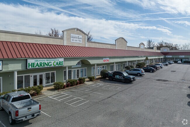
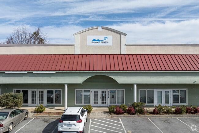
Property Record
23233 Interstate 30 S, Bryant, AR 72022

Property Detail
23233 Interstate 30 S
840-12634-000
PT NWSW2002-26538
Commercialnec
SALINE
AE The base floodplain where base flood elevations are provided. AE Zones are now used on new format FIRMs instead of A1-A30 Zones.
Arkansas
2025
2.68 AC
2025
Saline County
010411
Little Rock/N Little Rock
19,600 SF
Little Rock-North Little Rock-Conway, AR
NEARBY LISTINGS FOR SALE OR LEASE
DEMOGRAPHICS near 23233 Interstate 30 S
1 mile
3 mile
5 mile
2025 Total Population
5,891
30,405
64,776
2030 Population
6,164
31,935
67,755
Pop Growth 2025-2030
+ 4.63%
+ 5.03%
+ 4.60%
Average Age
40
39
39
2025 Total Households
2,301
11,920
25,278
HH Growth 2025-2030
+ 4.78%
+ 4.99%
+ 4.57%
Median Household Inc
$96,369
$81,684
$78,735
Avg Household Size
2.50
2.50
2.50
2025 Avg HH Vehicles
2.00
2.00
2.00
Median Home Value
$255,636
$255,421
$244,276
Median Year Built
1994
1999
1999
Nearby Places
Map Layers
Map Styles
 Street
 Aerial
Transit
 Traffic
 Biking
Places
Listings with unknown addresses are not visible on the map
- Restaurants
- Banks
- Shops
- Fitness
- Groceries
PUBLIC TRANSPORTATION
AIRPORT
Bill and Hillary Clinton Ntl/Adams Field
Drive
Walk
Distance
Bill and Hillary Clinton Ntl/Adams Field
22 min
18.6 mi
Freight Ports
Port of Shreveport
Drive
Walk
Distance
Port of Shreveport
234 min
217.4 mi
SALE & LEASE HISTORY
LISTING DATE
SALE/LEASE

Sep 30, 2016
For Lease
Sep 22, 2023
For Lease
Nearby Properties
Address
Land Use
TOTAL SIZE
Lot Size
Zoning
Address
Land Use
TOTAL SIZE
Lot Size
Zoning
80,480 SF
33.40 AC
Address
Land Use
TOTAL SIZE
Lot Size
Zoning
91,459 SF
6.03 AC
Address
Land Use
TOTAL SIZE
Lot Size
Zoning
28,150 SF
17.11 AC
Address
Land Use
TOTAL SIZE
Lot Size
Zoning
304,000 SF
20.93 AC
Address
Land Use
TOTAL SIZE
Lot Size
Zoning
262,431 SF
23.01 AC
Address
Land Use
TOTAL SIZE
Lot Size
Zoning
175,840 SF
21.93 AC
Address
Land Use
TOTAL SIZE
Lot Size
Zoning
121,010 SF
13.33 AC
Address
Land Use
TOTAL SIZE
Lot Size
Zoning
174,460 SF
19.30 AC
Address
Land Use
TOTAL SIZE
Lot Size
Zoning
22,000 SF
20.76 AC
Address
Land Use
TOTAL SIZE
Lot Size
Zoning
138,752 SF
12.60 AC
Address
Land Use
TOTAL SIZE
Lot Size
Zoning
106,096 SF
9.46 AC
Address
Land Use
TOTAL SIZE
Lot Size
Zoning
36,979 SF
7.85 AC
Address
Land Use
TOTAL SIZE
Lot Size
Zoning
139,990 SF
14.40 AC
Address
Land Use
TOTAL SIZE
Lot Size
Zoning
75,795 SF
9.39 AC
Address
Land Use
TOTAL SIZE
Lot Size
Zoning
128,225 SF
8.41 AC
Address
Land Use
TOTAL SIZE
Lot Size
Zoning
72,506 SF
4.44 AC
Address
Land Use
TOTAL SIZE
Lot Size
Zoning
19,208 SF
12 AC
Address
Land Use
TOTAL SIZE
Lot Size
Zoning
10,050 SF
94.63 AC
Address
Land Use
TOTAL SIZE
Lot Size
Zoning
36,356 SF
5.45 AC
Address
Land Use
TOTAL SIZE
Lot Size
Zoning
43,055 SF
3.94 AC
Address
Land Use
TOTAL SIZE
Lot Size
Zoning
61,535 SF
10.99 AC
Address
Land Use
TOTAL SIZE
Lot Size
Zoning
54,681 SF
1.88 AC
Address
Land Use
TOTAL SIZE
Lot Size
Zoning
44,776 SF
7 AC
Address
Land Use
TOTAL SIZE
Lot Size
Zoning
27,288 SF
4.02 AC
Address
Land Use
TOTAL SIZE
Lot Size
Zoning
44,100 SF
3.52 AC
Address
Land Use
TOTAL SIZE
Lot Size
Zoning
44,132 SF
8.31 AC
Address
Land Use
TOTAL SIZE
Lot Size
Zoning
6,715 SF
2.95 AC
Address
Land Use
TOTAL SIZE
Lot Size
Zoning
18,720 SF
9.49 AC
Address
Land Use
TOTAL SIZE
Lot Size
Zoning
9,304 SF
7.48 AC
Address
Land Use
TOTAL SIZE
Lot Size
Zoning
48,067 SF
17.18 AC
The World's #1 Commercial Real Estate Marketplace
Connect with us
© 2026 CoStar Group
The information above has been obtained from sources believed reliable. While we do not doubt its accuracy we have not verified it and make no guarantee, warranty or representation about it. It is your responsibility to independently confirm its accuracy and completeness. Any projections, opinions, assumptions, or estimates used are for example only and do not represent the current or future performance of the property. The value of this transaction to you depends on tax and other factors which should be evaluated by your tax, financial, and legal advisors. You and your advisors should conduct a careful, independent investigation of the property to determine to your satisfaction the suitability of the property for your needs.