Property Record
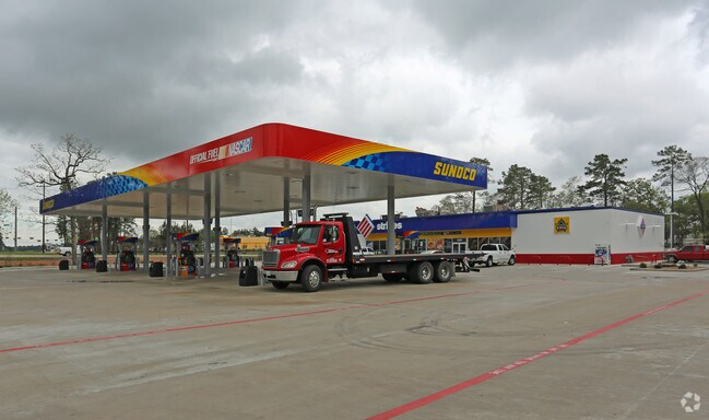
2325 N Fm 3083 Rd E, Conroe, TX 77303


Property Detail
2325 N Fm 3083 Rd E
8000-00-00808
S800000 - PINEWOOD PLAZA, LOT TR 5-B (A0664), LOT 10-A, 11, 12-A, 13-A (AKA STRIPES AT LOOP 336 & FM 3083 #2013132669), ACRES 3.123
Commercialnec
MONTGOMERY
1
Texas
B and X Area of moderate flood hazard, usually the area between the limits of the 100-year and 500-year floods.
10-a
2024
3.12 AC
2025
Montgomery County
693901
Houston
6,608 SF
Houston-Pasadena-The Woodlands, TX
NEARBY LISTINGS FOR SALE OR LEASE
DEMOGRAPHICS near 2325 N Fm 3083 Rd E
1 mile
3 mile
5 mile
2025 Total Population
4,809
40,333
97,927
2030 Population
5,672
47,303
115,439
Pop Growth 2025-2030
+ 17.95%
+ 17.28%
+ 17.88%
Average Age
35
36
37
2025 Total Households
1,430
12,962
34,431
HH Growth 2025-2030
+ 18.60%
+ 18.65%
+ 18.74%
Median Household Inc
$79,464
$66,678
$70,242
Avg Household Size
3.00
2.80
2.70
2025 Avg HH Vehicles
2.00
2.00
2.00
Median Home Value
$243,007
$228,581
$281,776
Median Year Built
2010
2001
2004
Nearby Places
Map Layers
Map Styles
 Street
 Aerial
Transit
 Traffic
 Biking
Places
Listings with unknown addresses are not visible on the map
- Restaurants
- Banks
- Shops
- Fitness
- Groceries
PUBLIC TRANSPORTATION
AIRPORT
George Bush Intcntl/Houston
Drive
Walk
Distance
George Bush Intcntl/Houston
45 min
36.1 mi
Freight Ports
Port of Houston
Drive
Walk
Distance
Port of Houston
68 min
51.8 mi
Nearby Properties
Address
Land Use
TOTAL SIZE
Lot Size
Zoning
Address
Land Use
TOTAL SIZE
Lot Size
Zoning
322,082 SF
36.56 AC
1
Address
Land Use
TOTAL SIZE
Lot Size
Zoning
776,164 SF
71.74 AC
Address
Land Use
TOTAL SIZE
Lot Size
Zoning
165,071 SF
16.01 AC
Address
Land Use
TOTAL SIZE
Lot Size
Zoning
398,842 SF
23.75 AC
1
Address
Land Use
TOTAL SIZE
Lot Size
Zoning
619,770 SF
81.76 AC
Address
Land Use
TOTAL SIZE
Lot Size
Zoning
361,388 SF
16.32 AC
Address
Land Use
TOTAL SIZE
Lot Size
Zoning
191,700 SF
19.41 AC
1
Address
Land Use
TOTAL SIZE
Lot Size
Zoning
366,709 SF
27.72 AC
Address
Land Use
TOTAL SIZE
Lot Size
Zoning
206,008 SF
107.61 AC
Address
Land Use
TOTAL SIZE
Lot Size
Zoning
191,006 SF
9.19 AC
Address
Land Use
TOTAL SIZE
Lot Size
Zoning
142,800 SF
7.82 AC
Address
Land Use
TOTAL SIZE
Lot Size
Zoning
141,100 SF
25.34 AC
Address
Land Use
TOTAL SIZE
Lot Size
Zoning
62,296 SF
20.62 AC
Address
Land Use
TOTAL SIZE
Lot Size
Zoning
171,124 SF
9.03 AC
1
Address
Land Use
TOTAL SIZE
Lot Size
Zoning
75,048 SF
10.59 AC
Address
Land Use
TOTAL SIZE
Lot Size
Zoning
214,039 SF
20 AC
Address
Land Use
TOTAL SIZE
Lot Size
Zoning
123,674 SF
21.67 AC
Address
Land Use
TOTAL SIZE
Lot Size
Zoning
376,980 SF
24.37 AC
1
Address
Land Use
TOTAL SIZE
Lot Size
Zoning
242,944 SF
179.58 AC
Address
Land Use
TOTAL SIZE
Lot Size
Zoning
235,219 SF
40.03 AC
Address
Land Use
TOTAL SIZE
Lot Size
Zoning
332,274 SF
40 AC
Address
Land Use
TOTAL SIZE
Lot Size
Zoning
205,088 SF
79.14 AC
Address
Land Use
TOTAL SIZE
Lot Size
Zoning
93,668 SF
45.56 AC
Address
Land Use
TOTAL SIZE
Lot Size
Zoning
214,039 SF
20 AC
Address
Land Use
TOTAL SIZE
Lot Size
Zoning
236,986 SF
19.54 AC
Address
Land Use
TOTAL SIZE
Lot Size
Zoning
210,383 SF
15.84 AC
Address
Land Use
TOTAL SIZE
Lot Size
Zoning
186,100 SF
29.68 AC
1
Address
Land Use
TOTAL SIZE
Lot Size
Zoning
192,624 SF
25.16 AC
Address
Land Use
TOTAL SIZE
Lot Size
Zoning
188,128 SF
30.49 AC
1
Address
Land Use
TOTAL SIZE
Lot Size
Zoning
82,078 SF
61.15 AC
1
The World's #1 Commercial Real Estate Marketplace
Connect with us
© 2026 CoStar Group
The information above has been obtained from sources believed reliable. While we do not doubt its accuracy we have not verified it and make no guarantee, warranty or representation about it. It is your responsibility to independently confirm its accuracy and completeness. Any projections, opinions, assumptions, or estimates used are for example only and do not represent the current or future performance of the property. The value of this transaction to you depends on tax and other factors which should be evaluated by your tax, financial, and legal advisors. You and your advisors should conduct a careful, independent investigation of the property to determine to your satisfaction the suitability of the property for your needs.