Property Record
23280 Main St, Hampton, MN 55031
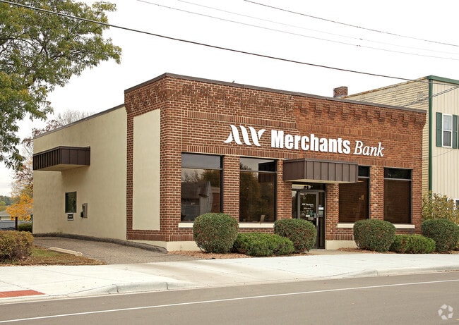
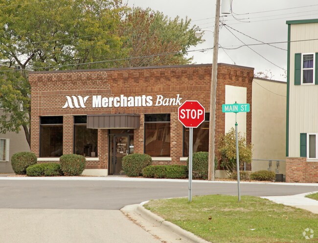
Property Detail
23280 Main St
Minneapolis-St. Paul-Bloomington, MN-WI
HAMPTON DAKOTA CO MINN 18 2 NORTH 10 FT OF LOT 18 BLK 2 LESS N 2 1/2 FT TO ANNA WEILER
18-32000-02-191
Dakota
Commercialnec
Minnesota
B and X Area of moderate flood hazard, usually the area between the limits of the 100-year and 500-year floods.
18
2024
0.12 AC
2024
Apple Vly/Lakeville
061402
Minneapolis/St Paul
3,900 SF
NEARBY LISTINGS FOR SALE OR LEASE
-
-
View all Hampton listings for sale on LoopNet.com
DEMOGRAPHICS near 23280 Main St
1 mile
3 mile
5 mile
2025 Total Population
759
1,533
3,602
2030 Population
768
1,556
3,653
Pop Growth 2025-2030
+ 1.19%
+ 1.50%
+ 1.42%
Average Age
37
40
41
2025 Total Households
281
584
1,341
HH Growth 2025-2030
+ 1.07%
+ 1.54%
+ 1.42%
Median Household Inc
$107,143
$107,942
$109,587
Avg Household Size
2.70
2.60
2.70
2025 Avg HH Vehicles
2.00
3.00
3.00
Median Home Value
$328,889
$387,323
$426,078
Median Year Built
1991
1984
1981
Nearby Places
Map Layers
Map Styles
 Street
 Aerial
Transit
 Traffic
 Biking
Places
Listings with unknown addresses are not visible on the map
- Restaurants
- Banks
- Shops
- Fitness
- Groceries
PUBLIC TRANSPORTATION
AIRPORT
Minneapolis-St Paul International/Wold-Chamberlain
Drive
Walk
Distance
Minneapolis-St Paul International/Wold-Chamberlain
36 min
26.8 mi
Freight Ports
Port Milwaukee
Drive
Walk
Distance
Port Milwaukee
366 min
329.6 mi
Nearby Properties
Address
Land Use
TOTAL SIZE
Lot Size
Zoning
Address
Land Use
TOTAL SIZE
Lot Size
Zoning
9.53 AC
Address
Land Use
TOTAL SIZE
Lot Size
Zoning
1,120 SF
159.26 AC
Address
Land Use
TOTAL SIZE
Lot Size
Zoning
2,332 SF
147.97 AC
Address
Land Use
TOTAL SIZE
Lot Size
Zoning
2,366 SF
156.82 AC
Address
Land Use
TOTAL SIZE
Lot Size
Zoning
2,952 SF
148.45 AC
Address
Land Use
TOTAL SIZE
Lot Size
Zoning
7,200 SF
39.16 AC
Address
Land Use
TOTAL SIZE
Lot Size
Zoning
2,824 SF
117.98 AC
Address
Land Use
TOTAL SIZE
Lot Size
Zoning
154.56 AC
Address
Land Use
TOTAL SIZE
Lot Size
Zoning
2,528 SF
74.78 AC
Address
Land Use
TOTAL SIZE
Lot Size
Zoning
144.54 AC
Address
Land Use
TOTAL SIZE
Lot Size
Zoning
150.69 AC
Address
Land Use
TOTAL SIZE
Lot Size
Zoning
148.06 AC
Address
Land Use
TOTAL SIZE
Lot Size
Zoning
147.88 AC
Address
Land Use
TOTAL SIZE
Lot Size
Zoning
145.87 AC
Address
Land Use
TOTAL SIZE
Lot Size
Zoning
131.70 AC
Address
Land Use
TOTAL SIZE
Lot Size
Zoning
2,252 SF
80.02 AC
Address
Land Use
TOTAL SIZE
Lot Size
Zoning
128.61 AC
Address
Land Use
TOTAL SIZE
Lot Size
Zoning
3,156 SF
78.01 AC
Address
Land Use
TOTAL SIZE
Lot Size
Zoning
7,938 SF
0.61 AC
Address
Land Use
TOTAL SIZE
Lot Size
Zoning
2,179 SF
78.88 AC
Address
Land Use
TOTAL SIZE
Lot Size
Zoning
1,509 SF
91.48 AC
Address
Land Use
TOTAL SIZE
Lot Size
Zoning
22,076 SF
30.39 AC
Address
Land Use
TOTAL SIZE
Lot Size
Zoning
111.52 AC
Address
Land Use
TOTAL SIZE
Lot Size
Zoning
3,314 SF
66.77 AC
Address
Land Use
TOTAL SIZE
Lot Size
Zoning
2,912 SF
48.81 AC
Address
Land Use
TOTAL SIZE
Lot Size
Zoning
3,856 SF
28.67 AC
Address
Land Use
TOTAL SIZE
Lot Size
Zoning
13,106 SF
11.79 AC
Address
Land Use
TOTAL SIZE
Lot Size
Zoning
6,646 SF
10 AC
Address
Land Use
TOTAL SIZE
Lot Size
Zoning
98.56 AC
Address
Land Use
TOTAL SIZE
Lot Size
Zoning
4,216 SF
12.68 AC
The World's #1 Commercial Real Estate Marketplace
Connect with us
© 2026 CoStar Group
The information above has been obtained from sources believed reliable. While we do not doubt its accuracy we have not verified it and make no guarantee, warranty or representation about it. It is your responsibility to independently confirm its accuracy and completeness. Any projections, opinions, assumptions, or estimates used are for example only and do not represent the current or future performance of the property. The value of this transaction to you depends on tax and other factors which should be evaluated by your tax, financial, and legal advisors. You and your advisors should conduct a careful, independent investigation of the property to determine to your satisfaction the suitability of the property for your needs.