Property Record
2024 Tennessee Rd, Ozark, MO 65721


NEARBY LISTINGS FOR SALE OR LEASE
-
-
View all Ozark listings for sale on LoopNet.com
Property Detail
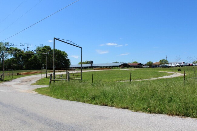
2024 Tennessee Rd
18-0.2-09-000-000-002.000
Ozark Out
Agriculturalland
NE W OF HWY, NE NW (EX TR SOLD)
X
Christian
29043C0230D
Missouri
2024
119.55 AC
2025
West Christian County
020303
Springfield
4,411 SF
Springfield, MO
DEMOGRAPHICS near 2024 Tennessee Rd
1 Mile
3 Mile
5 Mile
2024 Total Population
329
7,228
25,421
2029 Population
371
8,157
28,657
Pop Growth 2024-2029
+ 12.77%
+ 12.85%
+ 12.73%
Average Age
41
39
39
2024 Total Households
120
2,671
9,338
HH Growth 2024-2029
+ 12.50%
+ 12.95%
+ 12.82%
Median Household Inc
$61,304
$62,619
$67,568
Avg Household Size
2.70
2.70
2.70
2024 Avg HH Vehicles
2.00
2.00
2.00
Median Home Value
$285,999
$225,000
$221,229
Median Year Built
1997
1995
1995
Nearby Places
Map Layers
Map Styles
 Street
 Aerial
- Restaurants
- Banks
- Shops
- Fitness
- Groceries
PUBLIC TRANSPORTATION
AIRPORT
Springfield-Branson Ntl
DRIVE
WALK
Distance
Springfield-Branson Ntl
53 min
34.7 mi
Freight Ports
Tulsa Port of Inola
DRIVE
WALK
Distance
Tulsa Port of Inola
217 min
189.1 mi
SALE & LEASE HISTORY
LISTING DATE
SALE/LEASE

Apr 27, 2022
For Sale
Nearby Properties
Address
Land Use
TOTAL SIZE
Lot Size
Zoning
Address
Land Use
TOTAL SIZE
Lot Size
Zoning
2,942 SF
17.41 AC
Address
Land Use
TOTAL SIZE
Lot Size
Zoning
131,905 SF
17.94 AC
Address
Land Use
TOTAL SIZE
Lot Size
Zoning
77,079 SF
28.40 AC
Address
Land Use
TOTAL SIZE
Lot Size
Zoning
7,950 SF
8.05 AC
Address
Land Use
TOTAL SIZE
Lot Size
Zoning
3,464 SF
13.34 AC
Address
Land Use
TOTAL SIZE
Lot Size
Zoning
28,000 SF
3.62 AC
Address
Land Use
TOTAL SIZE
Lot Size
Zoning
32,000 SF
3.11 AC
Address
Land Use
TOTAL SIZE
Lot Size
Zoning
3,664 SF
2.81 AC
Address
Land Use
TOTAL SIZE
Lot Size
Zoning
3,654 SF
2.11 AC
Address
Land Use
TOTAL SIZE
Lot Size
Zoning
6,310 SF
1.42 AC
Address
Land Use
TOTAL SIZE
Lot Size
Zoning
27,391 SF
6.90 AC
Address
Land Use
TOTAL SIZE
Lot Size
Zoning
14,880 SF
1.65 AC
Address
Land Use
TOTAL SIZE
Lot Size
Zoning
10,000 SF
16.92 AC
Address
Land Use
TOTAL SIZE
Lot Size
Zoning
1,114 SF
1.10 AC
Address
Land Use
TOTAL SIZE
Lot Size
Zoning
12,120 SF
0.96 AC
Address
Land Use
TOTAL SIZE
Lot Size
Zoning
15,000 SF
1.73 AC
Address
Land Use
TOTAL SIZE
Lot Size
Zoning
18,921 SF
4.12 AC
Address
Land Use
TOTAL SIZE
Lot Size
Zoning
5,932 SF
1.10 AC
Address
Land Use
TOTAL SIZE
Lot Size
Zoning
3,800 SF
0.89 AC
Address
Land Use
TOTAL SIZE
Lot Size
Zoning
2,264 SF
1.47 AC
Address
Land Use
TOTAL SIZE
Lot Size
Zoning
300 SF
0.93 AC
Address
Land Use
TOTAL SIZE
Lot Size
Zoning
4,664 SF
0.92 AC
Address
Land Use
TOTAL SIZE
Lot Size
Zoning
9,000 SF
1.09 AC
Address
Land Use
TOTAL SIZE
Lot Size
Zoning
4,400 SF
1.19 AC
Address
Land Use
TOTAL SIZE
Lot Size
Zoning
7,424 SF
1 AC
Address
Land Use
TOTAL SIZE
Lot Size
Zoning
3,090 SF
1.01 AC
Address
Land Use
TOTAL SIZE
Lot Size
Zoning
18,944 SF
7 AC
Address
Land Use
TOTAL SIZE
Lot Size
Zoning
3,489 SF
0.91 AC
Address
Land Use
TOTAL SIZE
Lot Size
Zoning
1,200 SF
9.10 AC
Address
Land Use
TOTAL SIZE
Lot Size
Zoning
10,200 SF
1.58 AC
The World's #1 Commercial Real Estate Marketplace
Connect with us
© 2026 CoStar Group
The information above has been obtained from sources believed reliable. While we do not doubt its accuracy we have not verified it and make no guarantee, warranty or representation about it. It is your responsibility to independently confirm its accuracy and completeness. Any projections, opinions, assumptions, or estimates used are for example only and do not represent the current or future performance of the property. The value of this transaction to you depends on tax and other factors which should be evaluated by your tax, financial, and legal advisors. You and your advisors should conduct a careful, independent investigation of the property to determine to your satisfaction the suitability of the property for your needs.