Property Record
233 S Loomis St, Southwick, MA 01077

Save to a Folder
{{folder.Name}}
{{folder.ListingIds.length}} Properties
{{folder.ListingIds.length}} Property
Create a New Folder
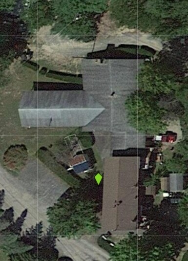
Property Detail
233 S Loomis St
SWIC-000056-000000-000007
Hampden
Campgroundrvpark
Massachusetts
AC
7
B and X Area of moderate flood hazard, usually the area between the limits of the 100-year and 500-year floods.
245.82 AC
2025
Hampden County
2025
Hartford
813102
Springfield, MA
6,778 SF
NEARBY LISTINGS FOR SALE OR LEASE
DEMOGRAPHICS near 233 S Loomis St
1 mile
3 mile
5 mile
2025 Total Population
338
4,162
24,423
2030 Population
341
4,180
24,480
Pop Growth 2025-2030
+ 0.89%
+ 0.43%
+ 0.23%
Average Age
45
45
43
2025 Total Households
130
1,632
9,169
HH Growth 2025-2030
+ 0.77%
+ 0.43%
+ 0.14%
Median Household Inc
$110,714
$106,158
$102,513
Avg Household Size
2.60
2.50
2.40
2025 Avg HH Vehicles
3.00
2.00
2.00
Median Home Value
$440,909
$409,319
$368,861
Median Year Built
1988
1981
1971
Nearby Places
Map Layers
Map Styles
 Street
 Aerial
Layers
 Traffic
 Biking
Places
Listings with unknown addresses are not visible on the map
- Restaurants
- Banks
- Shops
- Fitness
- Groceries
PUBLIC TRANSPORTATION
AIRPORT
Bradley International
Drive
Walk
Distance
Bradley International
41 min
16.9 mi
Freight Ports
Albany, NY Port
Drive
Walk
Distance
Albany, NY Port
112 min
82.9 mi
Nearby Properties
Address
Land Use
TOTAL SIZE
Lot Size
Zoning
Address
Land Use
TOTAL SIZE
Lot Size
Zoning
27,730 SF
17 AC
BR
Address
Land Use
TOTAL SIZE
Lot Size
Zoning
41,451 SF
6 AC
RA
Address
Land Use
TOTAL SIZE
Lot Size
Zoning
31,216 SF
9.20 AC
I
Address
Land Use
TOTAL SIZE
Lot Size
Zoning
11,304 SF
0.52 AC
BR
Address
Land Use
TOTAL SIZE
Lot Size
Zoning
5,336 SF
1 AC
RA
Address
Land Use
TOTAL SIZE
Lot Size
Zoning
3,058 SF
244 AC
R-40
Address
Land Use
TOTAL SIZE
Lot Size
Zoning
35,478 SF
3.10 AC
BR
Address
Land Use
TOTAL SIZE
Lot Size
Zoning
770.10 AC
RA
Address
Land Use
TOTAL SIZE
Lot Size
Zoning
2,000 SF
7.09 AC
RA
Address
Land Use
TOTAL SIZE
Lot Size
Zoning
62.37 AC
R-40
Address
Land Use
TOTAL SIZE
Lot Size
Zoning
16,478 SF
11.50 AC
RA
Address
Land Use
TOTAL SIZE
Lot Size
Zoning
18,373 SF
2.40 AC
BR
Address
Land Use
TOTAL SIZE
Lot Size
Zoning
8,320 SF
0.92 AC
BR
Address
Land Use
TOTAL SIZE
Lot Size
Zoning
10,537 SF
6.40 AC
BR
Address
Land Use
TOTAL SIZE
Lot Size
Zoning
3,986 SF
0.50 AC
RA
Address
Land Use
TOTAL SIZE
Lot Size
Zoning
7,350 SF
4.31 AC
RG
Address
Land Use
TOTAL SIZE
Lot Size
Zoning
3,120 SF
1.77 AC
I
Address
Land Use
TOTAL SIZE
Lot Size
Zoning
3,240 SF
1.35 AC
RA
Address
Land Use
TOTAL SIZE
Lot Size
Zoning
1,570 SF
1.50 AC
RA
Address
Land Use
TOTAL SIZE
Lot Size
Zoning
22,038 SF
13 AC
I
Address
Land Use
TOTAL SIZE
Lot Size
Zoning
322.10 AC
RA
Address
Land Use
TOTAL SIZE
Lot Size
Zoning
7,104 SF
0.59 AC
R-40
Address
Land Use
TOTAL SIZE
Lot Size
Zoning
3,264 SF
8.18 AC
B
Address
Land Use
TOTAL SIZE
Lot Size
Zoning
7,500 SF
4.10 AC
I
Address
Land Use
TOTAL SIZE
Lot Size
Zoning
9,530 SF
3 AC
BR
Address
Land Use
TOTAL SIZE
Lot Size
Zoning
768 SF
209.86 AC
R2A
Address
Land Use
TOTAL SIZE
Lot Size
Zoning
3,450 SF
0.46 AC
RA
Address
Land Use
TOTAL SIZE
Lot Size
Zoning
1,200 SF
121.37 AC
RA
Address
Land Use
TOTAL SIZE
Lot Size
Zoning
12,800 SF
43.83 AC
R-40
The World's #1 Commercial Real Estate Marketplace
Connect with us
© 2026 CoStar Group
The information above has been obtained from sources believed reliable. While we do not doubt its accuracy we have not verified it and make no guarantee, warranty or representation about it. It is your responsibility to independently confirm its accuracy and completeness. Any projections, opinions, assumptions, or estimates used are for example only and do not represent the current or future performance of the property. The value of this transaction to you depends on tax and other factors which should be evaluated by your tax, financial, and legal advisors. You and your advisors should conduct a careful, independent investigation of the property to determine to your satisfaction the suitability of the property for your needs.