Property Record
233 State Rt 94, Vernon, NJ 07462
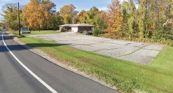

Property Detail
233 State Rt 94
22-00184-0000-00019
SUSSEX
Storemultistory
New Jersey
C3
4
B and X Area of moderate flood hazard, usually the area between the limits of the 100-year and 500-year floods.
1.65 AC
2024
Sussex County
2025
Northern New Jersey
371600
Newark, NJ
1,288 SF
NEARBY LISTINGS FOR SALE OR LEASE
-
-
View all Vernon listings for sale on LoopNet.com
DEMOGRAPHICS near 233 State Rt 94
1 mile
3 mile
5 mile
2025 Total Population
1,494
15,293
29,704
2030 Population
1,538
15,787
30,638
Pop Growth 2025-2030
+ 2.95%
+ 3.23%
+ 3.14%
Average Age
43
43
43
2025 Total Households
751
6,137
11,758
HH Growth 2025-2030
+ 3.06%
+ 3.31%
+ 3.19%
Median Household Inc
$80,435
$109,348
$112,538
Avg Household Size
2.00
2.50
2.50
2025 Avg HH Vehicles
2.00
2.00
2.00
Median Home Value
$242,857
$330,389
$339,691
Median Year Built
1983
1975
1977
Nearby Places
Map Layers
Map Styles
 Street
 Aerial
Layers
 Traffic
 Biking
Places
Listings with unknown addresses are not visible on the map
- Restaurants
- Banks
- Shops
- Fitness
- Groceries
PUBLIC TRANSPORTATION
AIRPORT
New York Stewart International
Drive
Walk
Distance
New York Stewart International
58 min
36.7 mi
Freight Ports
Port Newark Container Terminal
Drive
Walk
Distance
Port Newark Container Terminal
72 min
51.3 mi
SALE & LEASE HISTORY
LISTING DATE
SALE/LEASE

May 28, 2024
For Sale
Nearby Properties
Address
Land Use
TOTAL SIZE
Lot Size
Zoning
Address
Land Use
TOTAL SIZE
Lot Size
Zoning
28,375 SF
24.67 AC
TC
Address
Land Use
TOTAL SIZE
Lot Size
Zoning
115,384 SF
49.34 AC
R2
Address
Land Use
TOTAL SIZE
Lot Size
Zoning
98,112 SF
59 AC
R2
Address
Land Use
TOTAL SIZE
Lot Size
Zoning
Address
Land Use
TOTAL SIZE
Lot Size
Zoning
Address
Land Use
TOTAL SIZE
Lot Size
Zoning
3,164 SF
1.44 AC
TC
Address
Land Use
TOTAL SIZE
Lot Size
Zoning
17,936 SF
15.21 AC
Address
Land Use
TOTAL SIZE
Lot Size
Zoning
2,056 SF
1,112.15 AC
P
Address
Land Use
TOTAL SIZE
Lot Size
Zoning
Address
Land Use
TOTAL SIZE
Lot Size
Zoning
31,520 SF
18.40 AC
TC
Address
Land Use
TOTAL SIZE
Lot Size
Zoning
381.50 AC
Address
Land Use
TOTAL SIZE
Lot Size
Zoning
31,960 SF
20 AC
Address
Land Use
TOTAL SIZE
Lot Size
Zoning
72.15 AC
CR
Address
Land Use
TOTAL SIZE
Lot Size
Zoning
25,236 SF
14.69 AC
Address
Land Use
TOTAL SIZE
Lot Size
Zoning
16,728 SF
70.63 AC
Address
Land Use
TOTAL SIZE
Lot Size
Zoning
34,276 SF
7.64 AC
R2
Address
Land Use
TOTAL SIZE
Lot Size
Zoning
4.11 AC
LI
Address
Land Use
TOTAL SIZE
Lot Size
Zoning
14,048 SF
158.54 AC
CR
Address
Land Use
TOTAL SIZE
Lot Size
Zoning
2,239 SF
56.62 AC
MR
Address
Land Use
TOTAL SIZE
Lot Size
Zoning
12,630 SF
15 AC
Address
Land Use
TOTAL SIZE
Lot Size
Zoning
39,238 SF
14.34 AC
AET
Address
Land Use
TOTAL SIZE
Lot Size
Zoning
215.50 AC
R2
Address
Land Use
TOTAL SIZE
Lot Size
Zoning
Address
Land Use
TOTAL SIZE
Lot Size
Zoning
30,016 SF
6.11 AC
LI
Address
Land Use
TOTAL SIZE
Lot Size
Zoning
26,960 SF
4.51 AC
LI
Address
Land Use
TOTAL SIZE
Lot Size
Zoning
8,008 SF
6.11 AC
Address
Land Use
TOTAL SIZE
Lot Size
Zoning
1,120 SF
193.34 AC
PLC
Address
Land Use
TOTAL SIZE
Lot Size
Zoning
2,778 SF
12.14 AC
CR
Address
Land Use
TOTAL SIZE
Lot Size
Zoning
13,500 SF
9.59 AC
TC
Address
Land Use
TOTAL SIZE
Lot Size
Zoning
16,266 SF
3.42 AC
TC
The World's #1 Commercial Real Estate Marketplace
Connect with us
© 2026 CoStar Group
The information above has been obtained from sources believed reliable. While we do not doubt its accuracy we have not verified it and make no guarantee, warranty or representation about it. It is your responsibility to independently confirm its accuracy and completeness. Any projections, opinions, assumptions, or estimates used are for example only and do not represent the current or future performance of the property. The value of this transaction to you depends on tax and other factors which should be evaluated by your tax, financial, and legal advisors. You and your advisors should conduct a careful, independent investigation of the property to determine to your satisfaction the suitability of the property for your needs.