Property Record
233 Sw 3Rd St, Ocala, FL 34471

NEARBY LISTINGS FOR SALE OR LEASE
-
-
-
-
-
-
-
-
-
-
-
-
-
-
-
No Photo
-
View all Ocala listings for lease on LoopNet.com
Property Detail
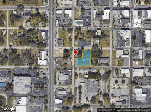
233 Sw 3Rd St
Ocala, FL
Old Survey Ocala
2853-028-003
SEC 18 TWP 15 RGE 22 PLAT BOOK E PAGE 001 OLD SURVEY OCALA BLK 28 LOTS 1.3 EX S 10 FT FOR ST & LOT 4
Officebuilding
Marion
X
Florida
12083C0517E
1
2021
0.84 AC
2025
Downtown Ocala
001900
Ocala
7,091 SF
DEMOGRAPHICS near 233 Sw 3Rd St
1 Mile
3 Mile
5 Mile
2024 Total Population
5,340
46,257
99,504
2029 Population
6,128
52,205
112,076
Pop Growth 2024-2029
+ 14.76%
+ 12.86%
+ 12.63%
Average Age
38
39
41
2024 Total Households
2,273
18,359
40,382
HH Growth 2024-2029
+ 14.61%
+ 12.96%
+ 12.65%
Median Household Inc
$39,999
$43,917
$54,113
Avg Household Size
2.30
2.30
2.30
2024 Avg HH Vehicles
1.00
2.00
2.00
Median Home Value
$153,167
$181,428
$200,562
Median Year Built
1963
1977
1983
Nearby Places
Map Layers
Map Styles
 Street
 Aerial
- Restaurants
- Banks
- Shops
- Fitness
- Groceries
SALE & LEASE HISTORY
LISTING DATE
SALE/LEASE

Nov 14, 2024
For Lease
May 23, 2019
For Lease
Feb 22, 2024
For Sale
Nearby Properties
Address
Land Use
TOTAL SIZE
Lot Size
Zoning
Address
Land Use
TOTAL SIZE
Lot Size
Zoning
207,950 SF
14.08 AC
INST
Address
Land Use
TOTAL SIZE
Lot Size
Zoning
704,765 SF
71.04 AC
GU
Address
Land Use
TOTAL SIZE
Lot Size
Zoning
331,687 SF
11.66 AC
INST
Address
Land Use
TOTAL SIZE
Lot Size
Zoning
446,764 SF
138.06 AC
GU
Address
Land Use
TOTAL SIZE
Lot Size
Zoning
189,025 SF
35.42 AC
PD08
Address
Land Use
TOTAL SIZE
Lot Size
Zoning
195,992 SF
5.72 AC
FBC
Address
Land Use
TOTAL SIZE
Lot Size
Zoning
422,264 SF
40.87 AC
SC
Address
Land Use
TOTAL SIZE
Lot Size
Zoning
458,983 SF
35.14 AC
M1
Address
Land Use
TOTAL SIZE
Lot Size
Zoning
135,945 SF
22.30 AC
PD
Address
Land Use
TOTAL SIZE
Lot Size
Zoning
178,015 SF
18.28 AC
PD07
Address
Land Use
TOTAL SIZE
Lot Size
Zoning
222,210 SF
22.14 AC
SC
Address
Land Use
TOTAL SIZE
Lot Size
Zoning
92,049 SF
15.75 AC
R3
Address
Land Use
TOTAL SIZE
Lot Size
Zoning
65,570 SF
18.96 AC
PD
Address
Land Use
TOTAL SIZE
Lot Size
Zoning
60,816 SF
13.67 AC
PD
Address
Land Use
TOTAL SIZE
Lot Size
Zoning
266,503 SF
25.48 AC
SC
Address
Land Use
TOTAL SIZE
Lot Size
Zoning
604,920 SF
42.92 AC
M1
Address
Land Use
TOTAL SIZE
Lot Size
Zoning
88,462 SF
31.76 AC
INST
Address
Land Use
TOTAL SIZE
Lot Size
Zoning
89,719 SF
15.16 AC
PD12
Address
Land Use
TOTAL SIZE
Lot Size
Zoning
76,062 SF
23.73 AC
B4
Address
Land Use
TOTAL SIZE
Lot Size
Zoning
482,618 SF
34.54 AC
M2
Address
Land Use
TOTAL SIZE
Lot Size
Zoning
30,274 SF
3.94 AC
FBC
Address
Land Use
TOTAL SIZE
Lot Size
Zoning
360,450 SF
20 AC
M1
Address
Land Use
TOTAL SIZE
Lot Size
Zoning
56,484 SF
12.50 AC
PD14
Address
Land Use
TOTAL SIZE
Lot Size
Zoning
234,097 SF
22.89 AC
SC
Address
Land Use
TOTAL SIZE
Lot Size
Zoning
65,882 SF
13.34 AC
R3
Address
Land Use
TOTAL SIZE
Lot Size
Zoning
111,395 SF
13 AC
B2
Address
Land Use
TOTAL SIZE
Lot Size
Zoning
180,334 SF
24.29 AC
INST
Address
Land Use
TOTAL SIZE
Lot Size
Zoning
101,892 SF
16.81 AC
INST
Address
Land Use
TOTAL SIZE
Lot Size
Zoning
95,552 SF
11.31 AC
SC
Address
Land Use
TOTAL SIZE
Lot Size
Zoning
69,607 SF
6.74 AC
INST
The World's #1 Commercial Real Estate Marketplace
Connect with us
© 2026 CoStar Group
The information above has been obtained from sources believed reliable. While we do not doubt its accuracy we have not verified it and make no guarantee, warranty or representation about it. It is your responsibility to independently confirm its accuracy and completeness. Any projections, opinions, assumptions, or estimates used are for example only and do not represent the current or future performance of the property. The value of this transaction to you depends on tax and other factors which should be evaluated by your tax, financial, and legal advisors. You and your advisors should conduct a careful, independent investigation of the property to determine to your satisfaction the suitability of the property for your needs.