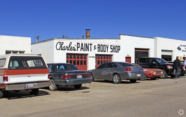
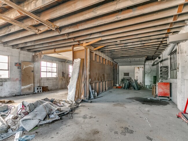
Property Record
231 W Mcarthur Dr, Oklahoma City, OK 73110
NEARBY LISTINGS FOR SALE OR LEASE
Property Detail
231 W Mcarthur Dr
Oklahoma City, OK
Mccorkle Park Add
150502600
MCCORKLE PARK ADD 000 000 E35FT LOTS 25 & 26 & W15FT LOT 27
Autorepair
Oklahoma
X
Oklahoma
40109C0310H
25-27
2023
0.17 AC
2024
East Oklahoma County
107604
Oklahoma City
2,151 SF
DEMOGRAPHICS near 231 W Mcarthur Dr
1 Mile
3 Mile
5 Mile
2024 Total Population
7,688
70,193
122,106
2029 Population
7,841
72,463
125,921
Pop Growth 2024-2029
+ 1.99%
+ 3.23%
+ 3.12%
Average Age
36
37
37
2024 Total Households
3,403
28,097
48,396
HH Growth 2024-2029
+ 2.09%
+ 3.03%
+ 3.03%
Median Household Inc
$41,041
$51,083
$51,643
Avg Household Size
2.10
2.40
2.40
2024 Avg HH Vehicles
2.00
2.00
2.00
Median Home Value
$72,837
$120,565
$130,125
Median Year Built
1952
1969
1973
Nearby Places
- Restaurants
- Banks
- Shops
- Fitness
- Groceries
PUBLIC TRANSPORTATION
COMMUTER RAIL
Oklahoma City (Heartland Flyer - Amtrak)
DRIVE
WALK
Distance
Oklahoma City (Heartland Flyer - Amtrak)
11 min
7.7 mi
AIRPORT
Will Rogers World
DRIVE
WALK
Distance
Will Rogers World
29 min
17.2 mi
Freight Ports
Tulsa Port Of Catoosa
DRIVE
WALK
Distance
Tulsa Port Of Catoosa
137 min
125.9 mi
SALE & LEASE HISTORY
LISTING DATE
SALE/LEASE

Jan 20, 2020
For Sale
Nearby Properties
Address
Land Use
TOTAL SIZE
Lot Size
Zoning
Address
Land Use
TOTAL SIZE
Lot Size
Zoning
320,100 SF
10.41 AC
I-2
Address
Land Use
TOTAL SIZE
Lot Size
Zoning
318,692 SF
15.25 AC
Address
Land Use
TOTAL SIZE
Lot Size
Zoning
67,732 SF
6.99 AC
PUD
Address
Land Use
TOTAL SIZE
Lot Size
Zoning
200,784 SF
9.28 AC
I-2
Address
Land Use
TOTAL SIZE
Lot Size
Zoning
20,670 SF
3.56 AC
Address
Land Use
TOTAL SIZE
Lot Size
Zoning
313,650 SF
44.50 AC
I-2
Address
Land Use
TOTAL SIZE
Lot Size
Zoning
78,452 SF
5.19 AC
I-2
Address
Land Use
TOTAL SIZE
Lot Size
Zoning
142,772 SF
11.07 AC
Address
Land Use
TOTAL SIZE
Lot Size
Zoning
242,484 SF
13.18 AC
Address
Land Use
TOTAL SIZE
Lot Size
Zoning
95,330 SF
25.68 AC
Address
Land Use
TOTAL SIZE
Lot Size
Zoning
141,387 SF
41 AC
PUD
Address
Land Use
TOTAL SIZE
Lot Size
Zoning
233,016 SF
10.81 AC
Address
Land Use
TOTAL SIZE
Lot Size
Zoning
431,366 SF
17.57 AC
Address
Land Use
TOTAL SIZE
Lot Size
Zoning
10,050 SF
0.79 AC
Address
Land Use
TOTAL SIZE
Lot Size
Zoning
84,940 SF
9.58 AC
Address
Land Use
TOTAL SIZE
Lot Size
Zoning
90,798 SF
11.07 AC
Address
Land Use
TOTAL SIZE
Lot Size
Zoning
203,263 SF
45.46 AC
Address
Land Use
TOTAL SIZE
Lot Size
Zoning
14,992 SF
1.34 AC
Address
Land Use
TOTAL SIZE
Lot Size
Zoning
124,997 SF
9.80 AC
Address
Land Use
TOTAL SIZE
Lot Size
Zoning
126,556 SF
6.74 AC
R-4
Address
Land Use
TOTAL SIZE
Lot Size
Zoning
145,328 SF
14.95 AC
R-4
Address
Land Use
TOTAL SIZE
Lot Size
Zoning
209,552 SF
11.67 AC
R-4
Address
Land Use
TOTAL SIZE
Lot Size
Zoning
35,245 SF
2.60 AC
Address
Land Use
TOTAL SIZE
Lot Size
Zoning
171,622 SF
9.74 AC
Address
Land Use
TOTAL SIZE
Lot Size
Zoning
8,811 SF
1.73 AC
Address
Land Use
TOTAL SIZE
Lot Size
Zoning
144,000 SF
17.72 AC
PUD
Address
Land Use
TOTAL SIZE
Lot Size
Zoning
164,256 SF
8.38 AC
R-4
Address
Land Use
TOTAL SIZE
Lot Size
Zoning
51,352 SF
21.12 AC
Address
Land Use
TOTAL SIZE
Lot Size
Zoning
94,261 SF
13.12 AC
Address
Land Use
TOTAL SIZE
Lot Size
Zoning
180,937 SF
9.92 AC
The World's #1 Commercial Real Estate Marketplace
Connect with us
© 2025 CoStar Group
The information above has been obtained from sources believed reliable. While we do not doubt its accuracy we have not verified it and make no guarantee, warranty or representation about it. It is your responsibility to independently confirm its accuracy and completeness. Any projections, opinions, assumptions, or estimates used are for example only and do not represent the current or future performance of the property. The value of this transaction to you depends on tax and other factors which should be evaluated by your tax, financial, and legal advisors. You and your advisors should conduct a careful, independent investigation of the property to determine to your satisfaction the suitability of the property for your needs.