Property Record
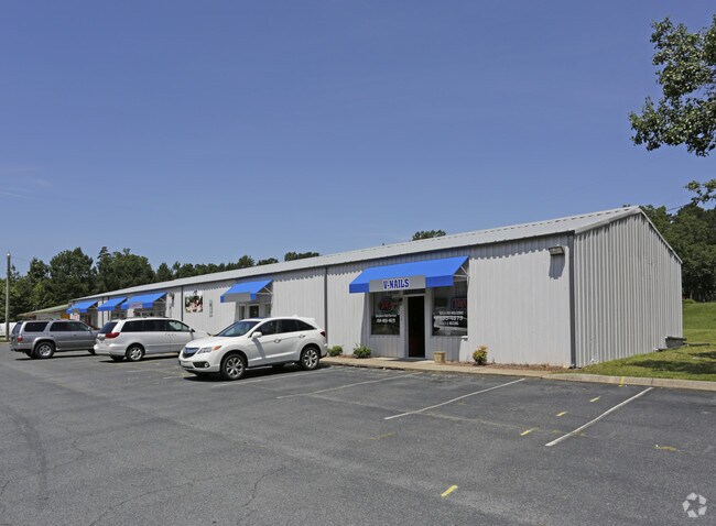
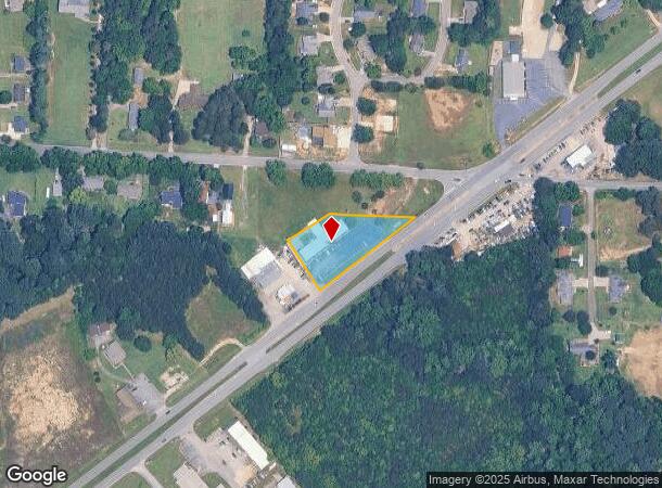
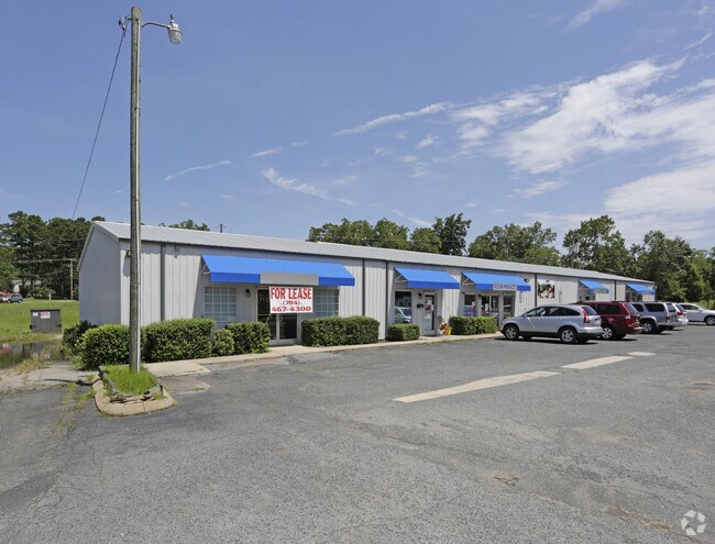
2330 S Us 29 Hwy, China Grove, NC 28023
NEARBY LISTINGS FOR SALE OR LEASE
Property Detail
2330 S Us 29 Hwy
133-132
PT CAFE LOT & PT L 7&9 .98AC
Storebuilding
Rowan
X
North Carolina
3710562500K
0.95 AC
2025
Rowan County
2025
Charlotte
051600
Charlotte-Concord-Gastonia, NC-SC
5,616 SF
DEMOGRAPHICS near 2330 S Us 29 Hwy
1 Mile
3 Mile
5 Mile
2024 Total Population
3,331
25,443
62,867
2029 Population
3,514
27,022
68,489
Pop Growth 2024-2029
+ 5.49%
+ 6.21%
+ 8.94%
Average Age
39
39
39
2024 Total Households
1,347
9,941
24,505
HH Growth 2024-2029
+ 5.49%
+ 6.11%
+ 8.36%
Median Household Inc
$66,387
$54,042
$55,234
Avg Household Size
2.50
2.50
2.50
2024 Avg HH Vehicles
2.00
2.00
2.00
Median Home Value
$225,796
$166,855
$174,218
Median Year Built
1979
1977
1977
Nearby Places
Map Layers
Map Styles
 Street
 Aerial
- Restaurants
- Banks
- Shops
- Fitness
- Groceries
PUBLIC TRANSPORTATION
COMMUTER RAIL
Kannapolis Station (Piedmont - North Carolina by Train (NC Train))
DRIVE
WALK
Distance
Kannapolis Station (Piedmont - North Carolina by Train (NC Train))
8 min
4.2 mi
AIRPORT
Concord-Padgett Regional
DRIVE
WALK
Distance
Concord-Padgett Regional
26 min
16.5 mi
Charlotte/Douglas International
DRIVE
WALK
Distance
Charlotte/Douglas International
52 min
36.8 mi
Freight Ports
Port of Wilmington
DRIVE
WALK
Distance
Port of Wilmington
267 min
205.8 mi
SALE & LEASE HISTORY
LISTING DATE
SALE/LEASE

Jul 13, 2017
For Lease
Nearby Properties
Address
Land Use
TOTAL SIZE
Lot Size
Zoning
Address
Land Use
TOTAL SIZE
Lot Size
Zoning
728,000 SF
51.80 AC
Address
Land Use
TOTAL SIZE
Lot Size
Zoning
55,888 SF
39.43 AC
Address
Land Use
TOTAL SIZE
Lot Size
Zoning
269,700 SF
76.24 AC
Address
Land Use
TOTAL SIZE
Lot Size
Zoning
35,850 SF
34 AC
Address
Land Use
TOTAL SIZE
Lot Size
Zoning
83,701 SF
2.99 AC
R4
Address
Land Use
TOTAL SIZE
Lot Size
Zoning
21,906 SF
7.50 AC
OI:OFFICE
Address
Land Use
TOTAL SIZE
Lot Size
Zoning
37,300 SF
20.95 AC
RM2:MULTI
Address
Land Use
TOTAL SIZE
Lot Size
Zoning
44,149 SF
11.26 AC
Address
Land Use
TOTAL SIZE
Lot Size
Zoning
146,346 SF
16.39 AC
Address
Land Use
TOTAL SIZE
Lot Size
Zoning
34,288 SF
5.61 AC
O-I
Address
Land Use
TOTAL SIZE
Lot Size
Zoning
14,258 SF
137.98 AC
RM1:MULTI
Address
Land Use
TOTAL SIZE
Lot Size
Zoning
58,300 SF
14.53 AC
R8:SINGLE
Address
Land Use
TOTAL SIZE
Lot Size
Zoning
19,951 SF
9.12 AC
OI:OFFICE
Address
Land Use
TOTAL SIZE
Lot Size
Zoning
43,091 SF
21.39 AC
Address
Land Use
TOTAL SIZE
Lot Size
Zoning
139,812 SF
17.35 AC
Address
Land Use
TOTAL SIZE
Lot Size
Zoning
99.27 AC
Address
Land Use
TOTAL SIZE
Lot Size
Zoning
8,941 SF
2.36 AC
Address
Land Use
TOTAL SIZE
Lot Size
Zoning
1,640 SF
21.46 AC
Address
Land Use
TOTAL SIZE
Lot Size
Zoning
13,770 SF
1.28 AC
GC
Address
Land Use
TOTAL SIZE
Lot Size
Zoning
30,284 SF
12.51 AC
Address
Land Use
TOTAL SIZE
Lot Size
Zoning
45,450 SF
5.01 AC
C2:HIGHWAY
Address
Land Use
TOTAL SIZE
Lot Size
Zoning
3,200 SF
259.49 AC
Address
Land Use
TOTAL SIZE
Lot Size
Zoning
27,467 SF
52.01 AC
R1:SINGLE
Address
Land Use
TOTAL SIZE
Lot Size
Zoning
17,259 SF
0.90 AC
Address
Land Use
TOTAL SIZE
Lot Size
Zoning
23,926 SF
4.70 AC
Address
Land Use
TOTAL SIZE
Lot Size
Zoning
2,552 SF
80.44 AC
Address
Land Use
TOTAL SIZE
Lot Size
Zoning
17,045 SF
6.60 AC
Address
Land Use
TOTAL SIZE
Lot Size
Zoning
40,162 SF
7.28 AC
HB:HIGHWAY
Address
Land Use
TOTAL SIZE
Lot Size
Zoning
29,715 SF
4.06 AC
R4:SINGLE
Address
Land Use
TOTAL SIZE
Lot Size
Zoning
12,977 SF
2.98 AC
The World's #1 Commercial Real Estate Marketplace
Connect with us
© 2025 CoStar Group
The information above has been obtained from sources believed reliable. While we do not doubt its accuracy we have not verified it and make no guarantee, warranty or representation about it. It is your responsibility to independently confirm its accuracy and completeness. Any projections, opinions, assumptions, or estimates used are for example only and do not represent the current or future performance of the property. The value of this transaction to you depends on tax and other factors which should be evaluated by your tax, financial, and legal advisors. You and your advisors should conduct a careful, independent investigation of the property to determine to your satisfaction the suitability of the property for your needs.