Property Record
2333 Eastern Blvd, Middle River, MD 21220


Property Detail
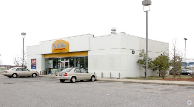
2333 Eastern Blvd
15-1700004718
1.00 AC SS EASTERN B
Storebuilding
Baltimore
MH-IM
Maryland
B and X Area of moderate flood hazard, usually the area between the limits of the 100-year and 500-year floods.
1 AC
2024
Baltimore County East
2025
Baltimore
451600
Baltimore-Columbia-Towson, MD
2,856 SF
NEARBY LISTINGS FOR SALE OR LEASE
DEMOGRAPHICS near 2333 Eastern Blvd
1 mile
3 mile
5 mile
2025 Total Population
12,290
85,510
159,051
2030 Population
12,323
86,025
159,824
Pop Growth 2025-2030
+ 0.27%
+ 0.60%
+ 0.49%
Average Age
37
39
40
2025 Total Households
4,448
33,887
61,790
HH Growth 2025-2030
+ 0.38%
+ 0.68%
+ 0.51%
Median Household Inc
$66,883
$70,396
$81,151
Avg Household Size
2.70
2.50
2.50
2025 Avg HH Vehicles
2.00
2.00
2.00
Median Home Value
$244,285
$281,739
$305,164
Median Year Built
1973
1976
1975
Nearby Places
Map Layers
Map Styles
 Street
 Aerial
Transit
 Traffic
 Biking
Places
Listings with unknown addresses are not visible on the map
- Restaurants
- Banks
- Shops
- Fitness
- Groceries
PUBLIC TRANSPORTATION
COMMUTER RAIL
Martin Airport Marc Nb (PENN - WASHINGTON - Maryland Transit Administration)
Drive
Walk
Distance
Martin Airport Marc Nb (PENN - WASHINGTON - Maryland Transit Administration)
2 min
17 min
0.9 mi
AIRPORT
Baltimore/Washington International Thurgood Marshall
Drive
Walk
Distance
Baltimore/Washington International Thurgood Marshall
38 min
23.3 mi
Freight Ports
Port of Baltimore
Drive
Walk
Distance
Port of Baltimore
24 min
13.8 mi
The World's #1 Commercial Real Estate Marketplace
Connect with us
© 2026 CoStar Group
The information above has been obtained from sources believed reliable. While we do not doubt its accuracy we have not verified it and make no guarantee, warranty or representation about it. It is your responsibility to independently confirm its accuracy and completeness. Any projections, opinions, assumptions, or estimates used are for example only and do not represent the current or future performance of the property. The value of this transaction to you depends on tax and other factors which should be evaluated by your tax, financial, and legal advisors. You and your advisors should conduct a careful, independent investigation of the property to determine to your satisfaction the suitability of the property for your needs.