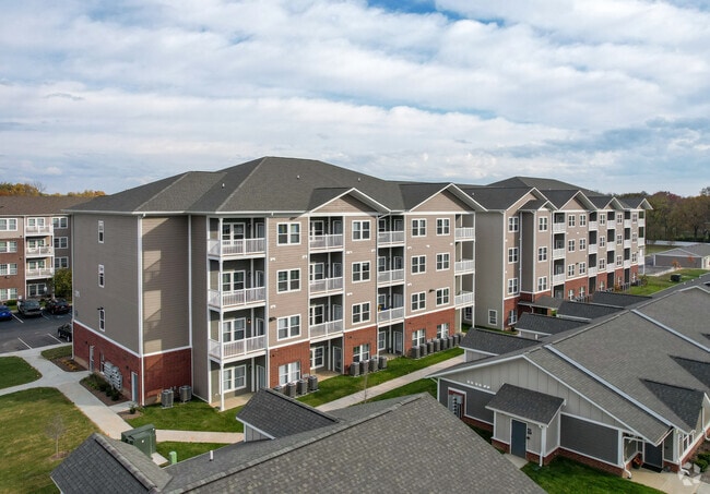
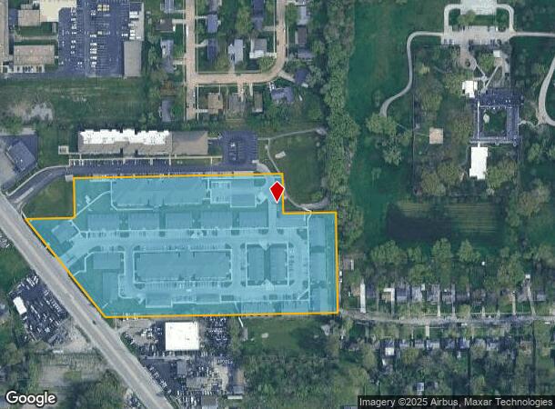
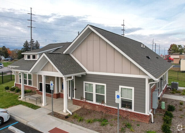
Property Record
2333 Lafayette Rd, Indianapolis, IN 46222
NEARBY LISTINGS FOR SALE OR LEASE
Property Detail
2333 Lafayette Rd
49-06-28-117-004.000-901
PT SW1/4 S28 T16 R3 BEG 991.64 S OF NE COR P.O.B. S329.68 W832.47 NW418.26 E162.94 N133.23 E690.2 S133.33 E175.7 TO BEG
Apartment
Marion
X
Indiana
18097C0137G
9.40 AC
2023
Marian Cold Springs
2024
Indianapolis
340600
Indianapolis-Carmel-Anderson, IN
18,154 SF
DEMOGRAPHICS near 2333 Lafayette Rd
1 Mile
3 Mile
5 Mile
2024 Total Population
10,215
100,277
286,120
2029 Population
10,211
101,054
286,303
Pop Growth 2024-2029
(0.04%)
+ 0.77%
+ 0.06%
Average Age
36
35
35
2024 Total Households
3,659
40,837
119,587
HH Growth 2024-2029
(0.08%)
+ 0.95%
+ 0.14%
Median Household Inc
$52,595
$49,329
$53,672
Avg Household Size
2.50
2.30
2.30
2024 Avg HH Vehicles
2.00
2.00
2.00
Median Home Value
$99,133
$134,769
$174,704
Median Year Built
1956
1959
1964
Nearby Places
Map Layers
Map Styles
 Street
 Aerial
- Restaurants
- Banks
- Shops
- Fitness
- Groceries
PUBLIC TRANSPORTATION
COMMUTER RAIL
Indianapolis (Cardinal - Amtrak)
DRIVE
WALK
Distance
Indianapolis (Cardinal - Amtrak)
10 min
4.7 mi
AIRPORT
Indianapolis International
DRIVE
WALK
Distance
Indianapolis International
27 min
13.9 mi
Freight Ports
Port of Toledo
DRIVE
WALK
Distance
Port of Toledo
273 min
225.8 mi
Nearby Properties
Address
Land Use
TOTAL SIZE
Lot Size
Zoning
Address
Land Use
TOTAL SIZE
Lot Size
Zoning
19,176 SF
28.36 AC
ZO01
Address
Land Use
TOTAL SIZE
Lot Size
Zoning
170,000 SF
4.05 AC
ZO01
Address
Land Use
TOTAL SIZE
Lot Size
Zoning
2,674 SF
3.05 AC
ZO01
Address
Land Use
TOTAL SIZE
Lot Size
Zoning
80,249 SF
71.96 AC
ZO01
Address
Land Use
TOTAL SIZE
Lot Size
Zoning
176,017 SF
3.92 AC
ZO01
Address
Land Use
TOTAL SIZE
Lot Size
Zoning
271,411 SF
3 AC
ZO01
Address
Land Use
TOTAL SIZE
Lot Size
Zoning
1,260 SF
3.92 AC
ZO01
Address
Land Use
TOTAL SIZE
Lot Size
Zoning
3,013 SF
10.80 AC
ZO01
Address
Land Use
TOTAL SIZE
Lot Size
Zoning
700 SF
1.50 AC
ZO01
Address
Land Use
TOTAL SIZE
Lot Size
Zoning
11,150 SF
3.24 AC
ZO01
Address
Land Use
TOTAL SIZE
Lot Size
Zoning
415,877 SF
55.83 AC
ZO01
Address
Land Use
TOTAL SIZE
Lot Size
Zoning
20,072 SF
2.74 AC
Address
Land Use
TOTAL SIZE
Lot Size
Zoning
296,086 SF
6.19 AC
ZO01
Address
Land Use
TOTAL SIZE
Lot Size
Zoning
25,170 SF
0.65 AC
ZO01
Address
Land Use
TOTAL SIZE
Lot Size
Zoning
1,889,477 SF
89.82 AC
ZO01
Address
Land Use
TOTAL SIZE
Lot Size
Zoning
1,417 SF
2.26 AC
ZO01
Address
Land Use
TOTAL SIZE
Lot Size
Zoning
132 SF
3.26 AC
ZO01
Address
Land Use
TOTAL SIZE
Lot Size
Zoning
94,784 SF
4.31 AC
Address
Land Use
TOTAL SIZE
Lot Size
Zoning
60,400 SF
4.41 AC
ZO01
Address
Land Use
TOTAL SIZE
Lot Size
Zoning
69,380 SF
4.45 AC
ZO01
Address
Land Use
TOTAL SIZE
Lot Size
Zoning
4,808 SF
5.76 AC
ZO01
Address
Land Use
TOTAL SIZE
Lot Size
Zoning
4,663 SF
7.98 AC
ZO01
Address
Land Use
TOTAL SIZE
Lot Size
Zoning
600,000 SF
41.64 AC
ZO01
Address
Land Use
TOTAL SIZE
Lot Size
Zoning
2,505 SF
13.80 AC
ZO01
Address
Land Use
TOTAL SIZE
Lot Size
Zoning
20,417 SF
0.99 AC
ZO01
Address
Land Use
TOTAL SIZE
Lot Size
Zoning
3,546 SF
25.09 AC
ZO01
Address
Land Use
TOTAL SIZE
Lot Size
Zoning
85,414 SF
10.10 AC
Address
Land Use
TOTAL SIZE
Lot Size
Zoning
2,288 SF
6 AC
ZO01
Address
Land Use
TOTAL SIZE
Lot Size
Zoning
438,643 SF
43.63 AC
ZO01
The World's #1 Commercial Real Estate Marketplace
Connect with us
© 2026 CoStar Group
The information above has been obtained from sources believed reliable. While we do not doubt its accuracy we have not verified it and make no guarantee, warranty or representation about it. It is your responsibility to independently confirm its accuracy and completeness. Any projections, opinions, assumptions, or estimates used are for example only and do not represent the current or future performance of the property. The value of this transaction to you depends on tax and other factors which should be evaluated by your tax, financial, and legal advisors. You and your advisors should conduct a careful, independent investigation of the property to determine to your satisfaction the suitability of the property for your needs.