Property Record
2333 N James Madison Hwy, Locust Dale, VA 22948
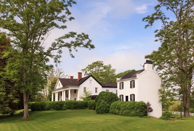
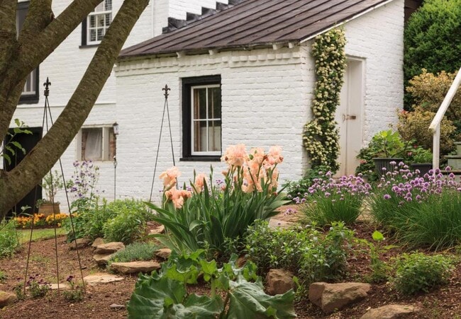
This Property Is For Sale
NEARBY LISTINGS FOR SALE OR LEASE
-
-
View all Locust Dale listings for sale on LoopNet.com
Property Detail
2333 N James Madison Hwy
52-1D
IN 170000727 77.067 AC 52-1D RT 15
Agriculturalland
Madison
2025
Virginia
2025
77.07 AC
930101
Virginia Regional
6,772 SF
Other Market Areas
DEMOGRAPHICS near 2333 N James Madison Hwy
1 Mile
3 Mile
5 Mile
2024 Total Population
164
1,324
4,265
2029 Population
171
1,377
4,448
Pop Growth 2024-2029
+ 4.27%
+ 4.00%
+ 4.29%
Average Age
43
43
43
2024 Total Households
50
448
1,390
HH Growth 2024-2029
+ 4.00%
+ 4.02%
+ 3.96%
Median Household Inc
$106,944
$101,056
$98,963
Avg Household Size
2.70
2.70
2.70
2024 Avg HH Vehicles
3.00
3.00
3.00
Median Home Value
$389,999
$369,736
$346,093
Median Year Built
1983
1983
1984
Nearby Places
Map Layers
Map Styles
 Street
 Aerial
- Restaurants
- Banks
- Shops
- Fitness
- Groceries
PUBLIC TRANSPORTATION
AIRPORT
Charlottesville-Albemarle
DRIVE
WALK
Distance
Charlottesville-Albemarle
53 min
33.2 mi
Freight Ports
Virginia Port Authority - Richmond
DRIVE
WALK
Distance
Virginia Port Authority - Richmond
117 min
90.4 mi
Nearby Properties
Address
Land Use
TOTAL SIZE
Lot Size
Zoning
Address
Land Use
TOTAL SIZE
Lot Size
Zoning
1,360 SF
484.96 AC
A1FP
Address
Land Use
TOTAL SIZE
Lot Size
Zoning
13,154 SF
78 AC
A1
Address
Land Use
TOTAL SIZE
Lot Size
Zoning
3,752 SF
385.27 AC
A1FP
Address
Land Use
TOTAL SIZE
Lot Size
Zoning
6,772 SF
77.07 AC
A1FP
Address
Land Use
TOTAL SIZE
Lot Size
Zoning
3,752 SF
385.27 AC
A1FP
Address
Land Use
TOTAL SIZE
Lot Size
Zoning
5,540 SF
165.54 AC
A1FP
Address
Land Use
TOTAL SIZE
Lot Size
Zoning
263.57 AC
A1FP
Address
Land Use
TOTAL SIZE
Lot Size
Zoning
2,763.33 AC
A1
Address
Land Use
TOTAL SIZE
Lot Size
Zoning
2,424 SF
55 AC
A1
Address
Land Use
TOTAL SIZE
Lot Size
Zoning
2,080 SF
335.70 AC
A1FP
Address
Land Use
TOTAL SIZE
Lot Size
Zoning
6,003 SF
120.06 AC
A1FP
Address
Land Use
TOTAL SIZE
Lot Size
Zoning
4,720 SF
234.77 AC
A1
Address
Land Use
TOTAL SIZE
Lot Size
Zoning
241.10 AC
A1
Address
Land Use
TOTAL SIZE
Lot Size
Zoning
3,659 SF
151.17 AC
A1FP
Address
Land Use
TOTAL SIZE
Lot Size
Zoning
4,974 SF
39.11 AC
A1
Address
Land Use
TOTAL SIZE
Lot Size
Zoning
3,636 SF
31.69 AC
A1
Address
Land Use
TOTAL SIZE
Lot Size
Zoning
2,444 SF
213.53 AC
A1FP
Address
Land Use
TOTAL SIZE
Lot Size
Zoning
6,772 SF
77.07 AC
A1FP
Address
Land Use
TOTAL SIZE
Lot Size
Zoning
3,102 SF
109.08 AC
A1FP
Address
Land Use
TOTAL SIZE
Lot Size
Zoning
2,208 SF
227 AC
A1
Address
Land Use
TOTAL SIZE
Lot Size
Zoning
3,678 SF
213.16 AC
A1FP
Address
Land Use
TOTAL SIZE
Lot Size
Zoning
2,544 SF
149.40 AC
A1
Address
Land Use
TOTAL SIZE
Lot Size
Zoning
3,248 SF
196 AC
A1FP
Address
Land Use
TOTAL SIZE
Lot Size
Zoning
2,608 SF
123.55 AC
A1
Address
Land Use
TOTAL SIZE
Lot Size
Zoning
127.76 AC
A1
Address
Land Use
TOTAL SIZE
Lot Size
Zoning
1,206 SF
125.11 AC
A1
Address
Land Use
TOTAL SIZE
Lot Size
Zoning
2,112 SF
50.10 AC
A1
Address
Land Use
TOTAL SIZE
Lot Size
Zoning
1,920 SF
28.91 AC
A1
Address
Land Use
TOTAL SIZE
Lot Size
Zoning
2,399 SF
32.11 AC
A1
Address
Land Use
TOTAL SIZE
Lot Size
Zoning
2,940 SF
39.26 AC
A1FP
The World's #1 Commercial Real Estate Marketplace
Connect with us
© 2026 CoStar Group
The information above has been obtained from sources believed reliable. While we do not doubt its accuracy we have not verified it and make no guarantee, warranty or representation about it. It is your responsibility to independently confirm its accuracy and completeness. Any projections, opinions, assumptions, or estimates used are for example only and do not represent the current or future performance of the property. The value of this transaction to you depends on tax and other factors which should be evaluated by your tax, financial, and legal advisors. You and your advisors should conduct a careful, independent investigation of the property to determine to your satisfaction the suitability of the property for your needs.