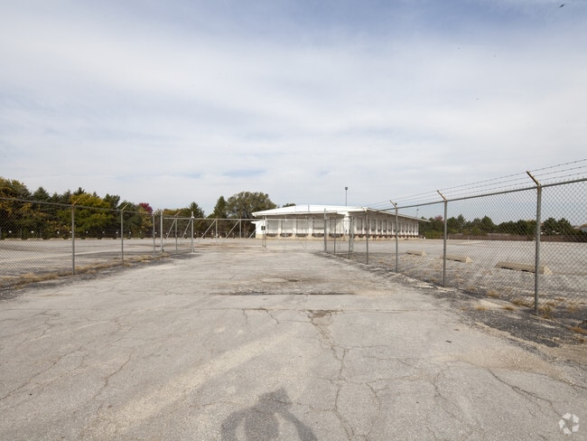
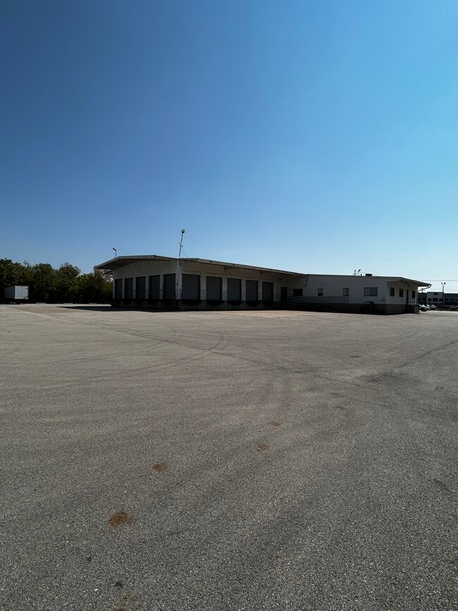
Property Record
23348 W Eames St, Channahon, IL 60410

Property Detail
23348 W Eames St
05-06-34-400-011
PARCEL 1: THT PRT OF THE E1/2 OF THE SE1/4 OF SEC 34, T35N-R9E, DAF: COMM AT THE INTERSECTION OF THE N'LY ROW LN OF US HWY, R
Industrialgeneral
Will
B and X Area of moderate flood hazard, usually the area between the limits of the 100-year and 500-year floods.
Illinois
2024
4.33 AC
2024
Joliet Area
883211
Chicago
12,580 SF
Chicago-Naperville-Elgin, IL-IN
NEARBY LISTINGS FOR SALE OR LEASE
DEMOGRAPHICS near 23348 W Eames St
1 mile
3 mile
5 mile
2025 Total Population
1,795
9,616
52,955
2030 Population
1,845
9,917
54,067
Pop Growth 2025-2030
+ 2.79%
+ 3.13%
+ 2.10%
Average Age
45
41
41
2025 Total Households
712
3,379
19,550
HH Growth 2025-2030
+ 2.81%
+ 3.17%
+ 2.05%
Median Household Inc
$82,776
$115,737
$101,223
Avg Household Size
2.50
2.80
2.60
2025 Avg HH Vehicles
2.00
2.00
2.00
Median Home Value
$251,892
$286,827
$294,572
Median Year Built
1969
1992
1990
Nearby Places
Map Layers
Map Styles
 Street
 Aerial
Layers
 Traffic
 Biking
Places
Listings with unknown addresses are not visible on the map
- Restaurants
- Banks
- Shops
- Fitness
- Groceries
PUBLIC TRANSPORTATION
COMMUTER RAIL
Joliet Station (Heritage Corridor Line - Northeast Illinois Regional Commuter Railroad (Metra), Rock Island District Line - Northeast Illinois Regional Commuter Railroad (Metra))
Drive
Walk
Distance
Joliet Station (Heritage Corridor Line - Northeast Illinois Regional Commuter Railroad (Metra), Rock Island District Line - Northeast Illinois Regional Commuter Railroad (Metra))
12 min
7.2 mi
Freight Ports
Port Milwaukee
Drive
Walk
Distance
Port Milwaukee
147 min
121.8 mi
SALE & LEASE HISTORY
LISTING DATE
SALE/LEASE

Apr 21, 2025
For Lease
Nearby Properties
Address
Land Use
TOTAL SIZE
Lot Size
Zoning
Address
Land Use
TOTAL SIZE
Lot Size
Zoning
1,617,159 SF
74.66 AC
Address
Land Use
TOTAL SIZE
Lot Size
Zoning
79.79 AC
Address
Land Use
TOTAL SIZE
Lot Size
Zoning
75.30 AC
Address
Land Use
TOTAL SIZE
Lot Size
Zoning
273.07 AC
Address
Land Use
TOTAL SIZE
Lot Size
Zoning
52.75 AC
Address
Land Use
TOTAL SIZE
Lot Size
Zoning
50.58 AC
Address
Land Use
TOTAL SIZE
Lot Size
Zoning
60,212 SF
61.11 AC
Address
Land Use
TOTAL SIZE
Lot Size
Zoning
146.25 AC
Address
Land Use
TOTAL SIZE
Lot Size
Zoning
57.52 AC
Address
Land Use
TOTAL SIZE
Lot Size
Zoning
48.10 AC
Address
Land Use
TOTAL SIZE
Lot Size
Zoning
51.97 AC
Address
Land Use
TOTAL SIZE
Lot Size
Zoning
54.84 AC
Address
Land Use
TOTAL SIZE
Lot Size
Zoning
502,836 SF
24.99 AC
Address
Land Use
TOTAL SIZE
Lot Size
Zoning
31.43 AC
Address
Land Use
TOTAL SIZE
Lot Size
Zoning
35.65 AC
Address
Land Use
TOTAL SIZE
Lot Size
Zoning
445,236 SF
20.40 AC
Address
Land Use
TOTAL SIZE
Lot Size
Zoning
459,070 SF
22.35 AC
Address
Land Use
TOTAL SIZE
Lot Size
Zoning
20.37 AC
Address
Land Use
TOTAL SIZE
Lot Size
Zoning
408,850 SF
18.27 AC
Address
Land Use
TOTAL SIZE
Lot Size
Zoning
30.14 AC
Address
Land Use
TOTAL SIZE
Lot Size
Zoning
322,874 SF
13.71 AC
Address
Land Use
TOTAL SIZE
Lot Size
Zoning
22.74 AC
Address
Land Use
TOTAL SIZE
Lot Size
Zoning
15.31 AC
Address
Land Use
TOTAL SIZE
Lot Size
Zoning
309,840 SF
13.24 AC
Address
Land Use
TOTAL SIZE
Lot Size
Zoning
277,776 SF
14.17 AC
Address
Land Use
TOTAL SIZE
Lot Size
Zoning
44.81 AC
Address
Land Use
TOTAL SIZE
Lot Size
Zoning
17.58 AC
Address
Land Use
TOTAL SIZE
Lot Size
Zoning
250,560 SF
11.18 AC
Address
Land Use
TOTAL SIZE
Lot Size
Zoning
259,200 SF
17.87 AC
Address
Land Use
TOTAL SIZE
Lot Size
Zoning
240,468 SF
10.31 AC
The World's #1 Commercial Real Estate Marketplace
Connect with us
© 2026 CoStar Group
The information above has been obtained from sources believed reliable. While we do not doubt its accuracy we have not verified it and make no guarantee, warranty or representation about it. It is your responsibility to independently confirm its accuracy and completeness. Any projections, opinions, assumptions, or estimates used are for example only and do not represent the current or future performance of the property. The value of this transaction to you depends on tax and other factors which should be evaluated by your tax, financial, and legal advisors. You and your advisors should conduct a careful, independent investigation of the property to determine to your satisfaction the suitability of the property for your needs.