Property Record
2335 26Th St Ne, Rochester, MN 55906


NEARBY LISTINGS FOR SALE OR LEASE
Property Detail
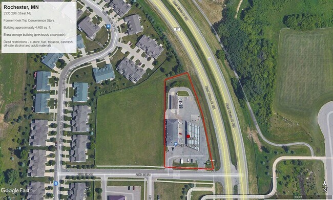
2335 26Th St Ne
Rochester, MN
Northern Heights East 11Th
73.30.21.053872
SECT-30 TWP-107 RANGE-013 NORTHERN HEIGHTS EAST 11TH LOT-003 BLOCK-001 1.59 AC LOT 3 BLK 1
Officebuilding
Olmsted
X
Minnesota
27109C0166F
3
2025
1.57 AC
2024
Rochester
001602
Other Market Areas
4,400 SF
DEMOGRAPHICS near 2335 26Th St Ne
1 Mile
3 Mile
5 Mile
2024 Total Population
6,265
47,677
102,911
2029 Population
6,376
49,175
105,543
Pop Growth 2024-2029
+ 1.77%
+ 3.14%
+ 2.56%
Average Age
43
40
40
2024 Total Households
2,336
20,504
43,619
HH Growth 2024-2029
+ 1.67%
+ 3.29%
+ 2.58%
Median Household Inc
$145,362
$71,417
$74,507
Avg Household Size
2.60
2.20
2.20
2024 Avg HH Vehicles
2.00
2.00
2.00
Median Home Value
$384,505
$260,472
$268,596
Median Year Built
1994
1977
1982
Nearby Places
Map Layers
Map Styles
 Street
 Aerial
- Restaurants
- Banks
- Shops
- Fitness
- Groceries
PUBLIC TRANSPORTATION
AIRPORT
Rochester International
DRIVE
WALK
Distance
Rochester International
20 min
12.5 mi
SALE & LEASE HISTORY
LISTING DATE
SALE/LEASE

Jan 23, 2024
For Lease
Aug 26, 2021
For Sale
Apr 28, 2022
For Lease
Nearby Properties
Address
Land Use
TOTAL SIZE
Lot Size
Zoning
Address
Land Use
TOTAL SIZE
Lot Size
Zoning
2,238,362 SF
2.06 AC
Address
Land Use
TOTAL SIZE
Lot Size
Zoning
791,669 SF
2.15 AC
Address
Land Use
TOTAL SIZE
Lot Size
Zoning
37,242 SF
1.06 AC
Address
Land Use
TOTAL SIZE
Lot Size
Zoning
454,243 SF
3.92 AC
Address
Land Use
TOTAL SIZE
Lot Size
Zoning
443,223 SF
4.44 AC
Address
Land Use
TOTAL SIZE
Lot Size
Zoning
448,296 SF
1.21 AC
Address
Land Use
TOTAL SIZE
Lot Size
Zoning
960 SF
38.12 AC
Address
Land Use
TOTAL SIZE
Lot Size
Zoning
45.84 AC
Address
Land Use
TOTAL SIZE
Lot Size
Zoning
1,836 SF
80.90 AC
Address
Land Use
TOTAL SIZE
Lot Size
Zoning
339,724 SF
0.56 AC
Address
Land Use
TOTAL SIZE
Lot Size
Zoning
0.88 AC
Address
Land Use
TOTAL SIZE
Lot Size
Zoning
13,946 SF
34.10 AC
Address
Land Use
TOTAL SIZE
Lot Size
Zoning
309,127 SF
0.67 AC
Address
Land Use
TOTAL SIZE
Lot Size
Zoning
175,078 SF
1.98 AC
Address
Land Use
TOTAL SIZE
Lot Size
Zoning
98,878 SF
0.89 AC
Address
Land Use
TOTAL SIZE
Lot Size
Zoning
76,338 SF
7.90 AC
Address
Land Use
TOTAL SIZE
Lot Size
Zoning
159,238 SF
0.65 AC
Address
Land Use
TOTAL SIZE
Lot Size
Zoning
423,328 SF
1.89 AC
Address
Land Use
TOTAL SIZE
Lot Size
Zoning
192,929 SF
1.12 AC
Address
Land Use
TOTAL SIZE
Lot Size
Zoning
Address
Land Use
TOTAL SIZE
Lot Size
Zoning
210,691 SF
34.19 AC
Address
Land Use
TOTAL SIZE
Lot Size
Zoning
61,632 SF
53.25 AC
Address
Land Use
TOTAL SIZE
Lot Size
Zoning
9.01 AC
Address
Land Use
TOTAL SIZE
Lot Size
Zoning
122,460 SF
0.33 AC
Address
Land Use
TOTAL SIZE
Lot Size
Zoning
136,031 SF
35.28 AC
Address
Land Use
TOTAL SIZE
Lot Size
Zoning
199,348 SF
2.89 AC
Address
Land Use
TOTAL SIZE
Lot Size
Zoning
176,131 SF
1.16 AC
Address
Land Use
TOTAL SIZE
Lot Size
Zoning
15,540 SF
0.35 AC
Address
Land Use
TOTAL SIZE
Lot Size
Zoning
182,517 SF
12.64 AC
Address
Land Use
TOTAL SIZE
Lot Size
Zoning
1,100 SF
0.78 AC
The World's #1 Commercial Real Estate Marketplace
Connect with us
© 2026 CoStar Group
The information above has been obtained from sources believed reliable. While we do not doubt its accuracy we have not verified it and make no guarantee, warranty or representation about it. It is your responsibility to independently confirm its accuracy and completeness. Any projections, opinions, assumptions, or estimates used are for example only and do not represent the current or future performance of the property. The value of this transaction to you depends on tax and other factors which should be evaluated by your tax, financial, and legal advisors. You and your advisors should conduct a careful, independent investigation of the property to determine to your satisfaction the suitability of the property for your needs.