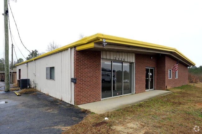
Property Record
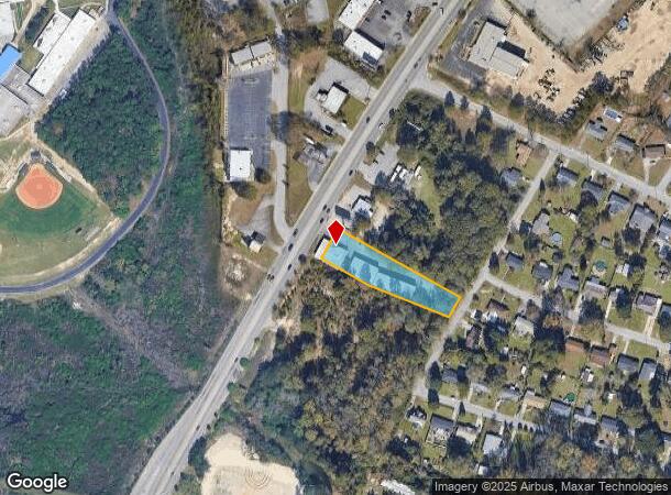
2335 Airport Blvd, West Columbia, SC 29170
NEARBY LISTINGS FOR SALE OR LEASE
Property Detail
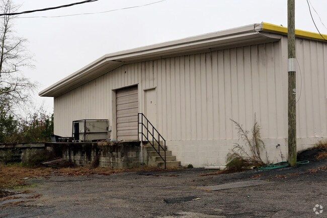
2335 Airport Blvd
005731-02-004
UNNUMB LOT .94 AC
Officebuilding
Lexington
X
South Carolina
45063C0278J
0.94 AC
2025
Cayce/West Columbia
2024
Columbia
020605
Columbia, SC
4,410 SF
DEMOGRAPHICS near 2335 Airport Blvd
1 Mile
3 Mile
5 Mile
2024 Total Population
2,125
25,188
88,946
2029 Population
2,325
27,480
96,356
Pop Growth 2024-2029
+ 9.41%
+ 9.10%
+ 8.33%
Average Age
42
41
39
2024 Total Households
954
11,016
37,723
HH Growth 2024-2029
+ 9.54%
+ 9.26%
+ 8.67%
Median Household Inc
$48,981
$54,748
$55,646
Avg Household Size
2.20
2.20
2.20
2024 Avg HH Vehicles
2.00
2.00
2.00
Median Home Value
$162,896
$148,393
$156,016
Median Year Built
1972
1972
1981
Nearby Places
Map Layers
Map Styles
 Street
 Aerial
- Restaurants
- Banks
- Shops
- Fitness
- Groceries
PUBLIC TRANSPORTATION
COMMUTER RAIL
DRIVE
WALK
Distance
11 min
7.1 mi
AIRPORT
Columbia Metro
DRIVE
WALK
Distance
Columbia Metro
11 min
3.5 mi
SALE & LEASE HISTORY
LISTING DATE
SALE/LEASE

Oct 26, 2018
For Lease
Nearby Properties
Address
Land Use
TOTAL SIZE
Lot Size
Zoning
Address
Land Use
TOTAL SIZE
Lot Size
Zoning
461,888 SF
61.50 AC
ID
Address
Land Use
TOTAL SIZE
Lot Size
Zoning
3,614 SF
1,444.32 AC
ID
Address
Land Use
TOTAL SIZE
Lot Size
Zoning
1,218 SF
8.99 AC
RG
Address
Land Use
TOTAL SIZE
Lot Size
Zoning
297,500 SF
20.26 AC
ID
Address
Land Use
TOTAL SIZE
Lot Size
Zoning
8,118 SF
10.98 AC
RG
Address
Land Use
TOTAL SIZE
Lot Size
Zoning
222,557 SF
26.90 AC
ID
Address
Land Use
TOTAL SIZE
Lot Size
Zoning
180,000 SF
27.57 AC
ID
Address
Land Use
TOTAL SIZE
Lot Size
Zoning
10,304 SF
11.89 AC
R1
Address
Land Use
TOTAL SIZE
Lot Size
Zoning
107,890 SF
21.99 AC
C2
Address
Land Use
TOTAL SIZE
Lot Size
Zoning
9,800 SF
13.52 AC
ID
Address
Land Use
TOTAL SIZE
Lot Size
Zoning
5,502 SF
16.15 AC
ID
Address
Land Use
TOTAL SIZE
Lot Size
Zoning
257,688 SF
23.03 AC
ID
Address
Land Use
TOTAL SIZE
Lot Size
Zoning
318,309 SF
33.51 AC
ID
Address
Land Use
TOTAL SIZE
Lot Size
Zoning
200,000 SF
10.58 AC
ID
Address
Land Use
TOTAL SIZE
Lot Size
Zoning
200,000 SF
9.66 AC
ID
Address
Land Use
TOTAL SIZE
Lot Size
Zoning
41,860 SF
5.67 AC
C3
Address
Land Use
TOTAL SIZE
Lot Size
Zoning
180,000 SF
12.48 AC
ID
Address
Land Use
TOTAL SIZE
Lot Size
Zoning
279,568 SF
11.38 AC
ID
Address
Land Use
TOTAL SIZE
Lot Size
Zoning
44,352 SF
7.55 AC
D1
Address
Land Use
TOTAL SIZE
Lot Size
Zoning
70,740 SF
13 AC
ID
Address
Land Use
TOTAL SIZE
Lot Size
Zoning
430.11 AC
ID
Address
Land Use
TOTAL SIZE
Lot Size
Zoning
254,399 SF
49.79 AC
ID
Address
Land Use
TOTAL SIZE
Lot Size
Zoning
54,000 SF
8.60 AC
ID
Address
Land Use
TOTAL SIZE
Lot Size
Zoning
147,166 SF
18.27 AC
ID
Address
Land Use
TOTAL SIZE
Lot Size
Zoning
202,029 SF
21.13 AC
ID
Address
Land Use
TOTAL SIZE
Lot Size
Zoning
215,770 SF
24.51 AC
Address
Land Use
TOTAL SIZE
Lot Size
Zoning
50,400 SF
11 AC
ID
Address
Land Use
TOTAL SIZE
Lot Size
Zoning
29,991 SF
1.85 AC
C3
Address
Land Use
TOTAL SIZE
Lot Size
Zoning
14,602 SF
2.41 AC
C2
Address
Land Use
TOTAL SIZE
Lot Size
Zoning
50,000 SF
6.89 AC
ID
The World's #1 Commercial Real Estate Marketplace
Connect with us
© 2025 CoStar Group
The information above has been obtained from sources believed reliable. While we do not doubt its accuracy we have not verified it and make no guarantee, warranty or representation about it. It is your responsibility to independently confirm its accuracy and completeness. Any projections, opinions, assumptions, or estimates used are for example only and do not represent the current or future performance of the property. The value of this transaction to you depends on tax and other factors which should be evaluated by your tax, financial, and legal advisors. You and your advisors should conduct a careful, independent investigation of the property to determine to your satisfaction the suitability of the property for your needs.