Property Record
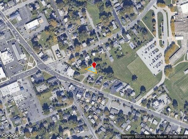
2335 Chichester Ave, Upper Chichester, PA 19061
NEARBY LISTINGS FOR SALE OR LEASE
Property Detail
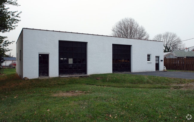
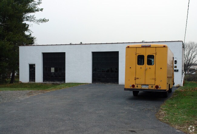
2335 Chichester Ave
09-00-00824-01
Anthony & Marie J Costa Surv
Lightindustrial
1 STY BLDG 121 X 90 X IRR
X
Delaware
10003C0079K
Pennsylvania
2024
0.09 AC
2025
Delaware County
406802
Philadelphia
2,400 SF
Philadelphia-Camden-Wilmington, PA-NJ-DE-MD
DEMOGRAPHICS near 2335 Chichester Ave
1 Mile
3 Mile
5 Mile
2024 Total Population
10,166
73,993
168,478
2029 Population
10,077
74,004
168,822
Pop Growth 2024-2029
(0.88%)
+ 0.01%
+ 0.20%
Average Age
41
40
41
2024 Total Households
4,033
29,269
65,383
HH Growth 2024-2029
(0.92%)
+ 0.04%
+ 0.21%
Median Household Inc
$78,636
$69,636
$74,553
Avg Household Size
2.50
2.50
2.50
2024 Avg HH Vehicles
2.00
2.00
2.00
Median Home Value
$218,145
$251,983
$284,340
Median Year Built
1958
1965
1964
Nearby Places
Map Layers
Map Styles
 Street
 Aerial
- Restaurants
- Banks
- Shops
- Fitness
- Groceries
PUBLIC TRANSPORTATION
COMMUTER RAIL
Marcus Hook (R2 - Southeastern Pennsylvania Transportation Authority Regional Rail (SEPTA Regional Rail))
DRIVE
WALK
Distance
Marcus Hook (R2 - Southeastern Pennsylvania Transportation Authority Regional Rail (SEPTA Regional Rail))
4 min
1.3 mi
Highland Avenue (R2 - Southeastern Pennsylvania Transportation Authority Regional Rail (SEPTA Regional Rail))
DRIVE
WALK
Distance
Highland Avenue (R2 - Southeastern Pennsylvania Transportation Authority Regional Rail (SEPTA Regional Rail))
6 min
2.8 mi
AIRPORT
Philadelphia International
DRIVE
WALK
Distance
Philadelphia International
20 min
11.9 mi
Freight Ports
Port of Wilmington, RI
DRIVE
WALK
Distance
Port of Wilmington, RI
17 min
11.6 mi
SALE & LEASE HISTORY
LISTING DATE
SALE/LEASE

Nov 06, 2023
For Lease
Nearby Properties
Address
Land Use
TOTAL SIZE
Lot Size
Zoning
Address
Land Use
TOTAL SIZE
Lot Size
Zoning
Address
Land Use
TOTAL SIZE
Lot Size
Zoning
26,424 SF
341 AC
Address
Land Use
TOTAL SIZE
Lot Size
Zoning
141,978 SF
2.11 AC
Address
Land Use
TOTAL SIZE
Lot Size
Zoning
36.50 AC
Address
Land Use
TOTAL SIZE
Lot Size
Zoning
492,750 SF
11.50 AC
Address
Land Use
TOTAL SIZE
Lot Size
Zoning
164,862 SF
10.70 AC
Address
Land Use
TOTAL SIZE
Lot Size
Zoning
5,200 SF
6.47 AC
Address
Land Use
TOTAL SIZE
Lot Size
Zoning
15,880 SF
27.07 AC
Address
Land Use
TOTAL SIZE
Lot Size
Zoning
23,179 SF
2 AC
Address
Land Use
TOTAL SIZE
Lot Size
Zoning
161,707 SF
56 AC
Address
Land Use
TOTAL SIZE
Lot Size
Zoning
95,760 SF
20 AC
Address
Land Use
TOTAL SIZE
Lot Size
Zoning
22,140 SF
16 AC
Address
Land Use
TOTAL SIZE
Lot Size
Zoning
254,414 SF
18.10 AC
Address
Land Use
TOTAL SIZE
Lot Size
Zoning
401,000 SF
10 AC
Address
Land Use
TOTAL SIZE
Lot Size
Zoning
148,451 SF
22.82 AC
Address
Land Use
TOTAL SIZE
Lot Size
Zoning
37,216 SF
7.68 AC
Address
Land Use
TOTAL SIZE
Lot Size
Zoning
10,716 SF
14.34 AC
Address
Land Use
TOTAL SIZE
Lot Size
Zoning
208,352 SF
21 AC
Address
Land Use
TOTAL SIZE
Lot Size
Zoning
5,626 SF
54.24 AC
Address
Land Use
TOTAL SIZE
Lot Size
Zoning
5,812 SF
72.63 AC
Address
Land Use
TOTAL SIZE
Lot Size
Zoning
146,900 SF
9.96 AC
Address
Land Use
TOTAL SIZE
Lot Size
Zoning
290,050 SF
21.84 AC
Address
Land Use
TOTAL SIZE
Lot Size
Zoning
128,467 SF
54.30 AC
Address
Land Use
TOTAL SIZE
Lot Size
Zoning
11,146 SF
21.82 AC
Address
Land Use
TOTAL SIZE
Lot Size
Zoning
122,819 SF
21.23 AC
S
Address
Land Use
TOTAL SIZE
Lot Size
Zoning
560 SF
298.31 AC
Address
Land Use
TOTAL SIZE
Lot Size
Zoning
44,200 SF
9.30 AC
Address
Land Use
TOTAL SIZE
Lot Size
Zoning
131,812 SF
20.70 AC
Address
Land Use
TOTAL SIZE
Lot Size
Zoning
166,216 SF
5.01 AC
NCAP
Address
Land Use
TOTAL SIZE
Lot Size
Zoning
141,066 SF
36.52 AC
S
The World's #1 Commercial Real Estate Marketplace
Connect with us
© 2025 CoStar Group
The information above has been obtained from sources believed reliable. While we do not doubt its accuracy we have not verified it and make no guarantee, warranty or representation about it. It is your responsibility to independently confirm its accuracy and completeness. Any projections, opinions, assumptions, or estimates used are for example only and do not represent the current or future performance of the property. The value of this transaction to you depends on tax and other factors which should be evaluated by your tax, financial, and legal advisors. You and your advisors should conduct a careful, independent investigation of the property to determine to your satisfaction the suitability of the property for your needs.