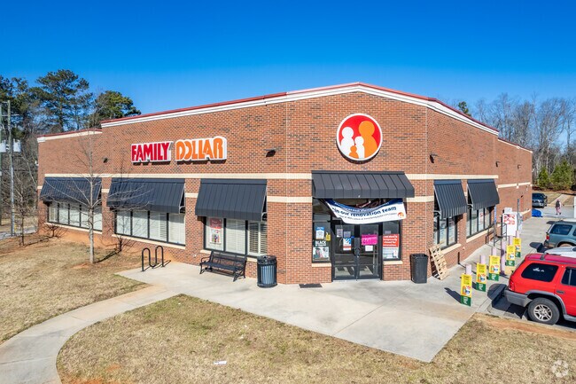
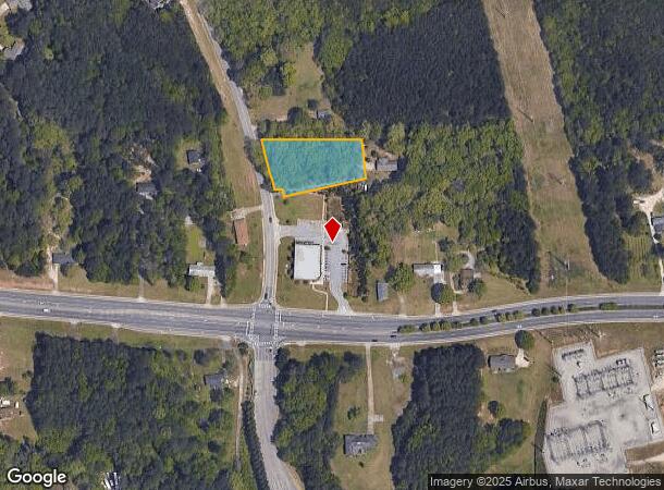
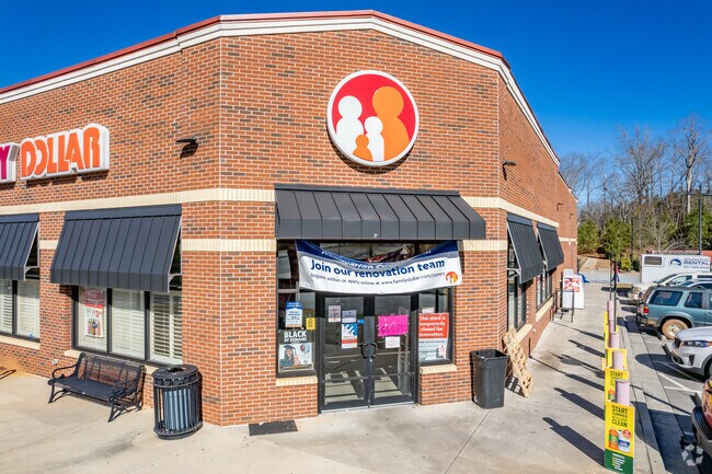
Property Record
2335 Highway 138 E, Jonesboro, GA 30236
NEARBY LISTINGS FOR SALE OR LEASE
Property Detail
2335 Highway 138 E
12-0045D-00B-001
Emma G Slaughter Estate
Commercialacreage
Clayton
X
Georgia
13063C0087F
0.86 AC
2025
Riverdale/Jonesboro
2025
Atlanta
040615
Atlanta-Sandy Springs-Roswell, GA
DEMOGRAPHICS near 2335 Highway 138 E
1 Mile
3 Mile
5 Mile
2024 Total Population
5,496
52,845
166,940
2029 Population
5,499
52,906
168,867
Pop Growth 2024-2029
+ 0.05%
+ 0.12%
+ 1.15%
Average Age
44
38
37
2024 Total Households
1,874
19,781
59,157
HH Growth 2024-2029
+ 0.21%
+ 0.08%
+ 1.24%
Median Household Inc
$84,991
$62,617
$56,733
Avg Household Size
2.80
2.60
2.70
2024 Avg HH Vehicles
2.00
2.00
2.00
Median Home Value
$239,177
$203,370
$180,992
Median Year Built
1986
1989
1989
Nearby Places
Map Layers
Map Styles
 Street
 Aerial
- Restaurants
- Banks
- Shops
- Fitness
- Groceries
PUBLIC TRANSPORTATION
AIRPORT
Hartsfield - Jackson Atlanta International
DRIVE
WALK
Distance
Hartsfield - Jackson Atlanta International
21 min
12.6 mi
Freight Ports
Georgia Ports - Savannah
DRIVE
WALK
Distance
Georgia Ports - Savannah
259 min
232.2 mi
Nearby Properties
Address
Land Use
TOTAL SIZE
Lot Size
Zoning
Address
Land Use
TOTAL SIZE
Lot Size
Zoning
368 SF
42.85 AC
RM
Address
Land Use
TOTAL SIZE
Lot Size
Zoning
35,082 SF
31.82 AC
C3
Address
Land Use
TOTAL SIZE
Lot Size
Zoning
217,289 SF
52.12 AC
OI
Address
Land Use
TOTAL SIZE
Lot Size
Zoning
194,682 SF
27.80 AC
OI
Address
Land Use
TOTAL SIZE
Lot Size
Zoning
25.16 AC
RM
Address
Land Use
TOTAL SIZE
Lot Size
Zoning
330 SF
33.30 AC
RM
Address
Land Use
TOTAL SIZE
Lot Size
Zoning
11.31 AC
RM
Address
Land Use
TOTAL SIZE
Lot Size
Zoning
250 SF
31.25 AC
RM
Address
Land Use
TOTAL SIZE
Lot Size
Zoning
1,140 SF
187.84 AC
MX
Address
Land Use
TOTAL SIZE
Lot Size
Zoning
200 SF
23.02 AC
RM
Address
Land Use
TOTAL SIZE
Lot Size
Zoning
284 SF
29 AC
RM
Address
Land Use
TOTAL SIZE
Lot Size
Zoning
707,780 SF
85.14 AC
MXI
Address
Land Use
TOTAL SIZE
Lot Size
Zoning
230 SF
27.09 AC
RM
Address
Land Use
TOTAL SIZE
Lot Size
Zoning
123,842 SF
31.53 AC
RS110
Address
Land Use
TOTAL SIZE
Lot Size
Zoning
351,207 SF
20 AC
HI
Address
Land Use
TOTAL SIZE
Lot Size
Zoning
216 SF
31.17 AC
RM
Address
Land Use
TOTAL SIZE
Lot Size
Zoning
500,415 SF
26.99 AC
HI
Address
Land Use
TOTAL SIZE
Lot Size
Zoning
20.65 AC
RM
Address
Land Use
TOTAL SIZE
Lot Size
Zoning
200 SF
22 AC
RM
Address
Land Use
TOTAL SIZE
Lot Size
Zoning
87,449 SF
14 AC
MC
Address
Land Use
TOTAL SIZE
Lot Size
Zoning
200 SF
20.23 AC
RM
Address
Land Use
TOTAL SIZE
Lot Size
Zoning
200 SF
25 AC
RM
Address
Land Use
TOTAL SIZE
Lot Size
Zoning
14,230 AC
C
Address
Land Use
TOTAL SIZE
Lot Size
Zoning
252 SF
23.62 AC
RM
Address
Land Use
TOTAL SIZE
Lot Size
Zoning
30.90 AC
RS110
Address
Land Use
TOTAL SIZE
Lot Size
Zoning
65,798 SF
7.41 AC
C
Address
Land Use
TOTAL SIZE
Lot Size
Zoning
182 SF
19.46 AC
RM
Address
Land Use
TOTAL SIZE
Lot Size
Zoning
120 SF
26.48 AC
RM
Address
Land Use
TOTAL SIZE
Lot Size
Zoning
250,048 SF
31.80 AC
HI
Address
Land Use
TOTAL SIZE
Lot Size
Zoning
155,204 SF
21.37 AC
I
The World's #1 Commercial Real Estate Marketplace
Connect with us
© 2025 CoStar Group
The information above has been obtained from sources believed reliable. While we do not doubt its accuracy we have not verified it and make no guarantee, warranty or representation about it. It is your responsibility to independently confirm its accuracy and completeness. Any projections, opinions, assumptions, or estimates used are for example only and do not represent the current or future performance of the property. The value of this transaction to you depends on tax and other factors which should be evaluated by your tax, financial, and legal advisors. You and your advisors should conduct a careful, independent investigation of the property to determine to your satisfaction the suitability of the property for your needs.