Property Record
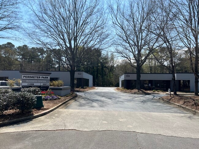
2337 Perimeter Park Dr, Atlanta, GA 30341


NEARBY LISTINGS FOR SALE OR LEASE
Property Detail
2337 Perimeter Park Dr
Atlanta-Sandy Springs-Roswell, GA
Prop Mrs Mary W Lires
18-334-01-129
2358 PERIMETER PARK DR
Commercialnec
DeKalb
X
Georgia
13089C0016K
129
2025
5.56 AC
2025
Chamblee
021301
Atlanta
50,223 SF
DEMOGRAPHICS near 2337 Perimeter Park Dr
1 Mile
3 Mile
5 Mile
2024 Total Population
12,470
92,397
269,706
2029 Population
12,450
92,647
272,020
Pop Growth 2024-2029
(0.16%)
+ 0.27%
+ 0.86%
Average Age
36
37
37
2024 Total Households
5,327
37,588
110,825
HH Growth 2024-2029
(0.24%)
+ 0.40%
+ 0.89%
Median Household Inc
$64,696
$78,002
$85,049
Avg Household Size
2.30
2.40
2.40
2024 Avg HH Vehicles
2.00
2.00
2.00
Median Home Value
$369,426
$422,629
$467,085
Median Year Built
1980
1982
1985
Nearby Places
Map Layers
Map Styles
 Street
 Aerial
- Restaurants
- Banks
- Shops
- Fitness
- Groceries
PUBLIC TRANSPORTATION
AIRPORT
Hartsfield - Jackson Atlanta International
DRIVE
WALK
Distance
Hartsfield - Jackson Atlanta International
40 min
26.6 mi
SALE & LEASE HISTORY
LISTING DATE
SALE/LEASE

Jun 17, 2019
For Lease
Nearby Properties
Address
Land Use
TOTAL SIZE
Lot Size
Zoning
Address
Land Use
TOTAL SIZE
Lot Size
Zoning
1,123,714 SF
47.33 AC
C1
Address
Land Use
TOTAL SIZE
Lot Size
Zoning
705,518 SF
39.09 AC
M
Address
Land Use
TOTAL SIZE
Lot Size
Zoning
12,600 SF
508.30 AC
M
Address
Land Use
TOTAL SIZE
Lot Size
Zoning
409,493 SF
10.01 AC
OI
Address
Land Use
TOTAL SIZE
Lot Size
Zoning
376,010 SF
3.76 AC
OI
Address
Land Use
TOTAL SIZE
Lot Size
Zoning
299,993 SF
4.72 AC
I1
Address
Land Use
TOTAL SIZE
Lot Size
Zoning
439,052 SF
4.57 AC
OI
Address
Land Use
TOTAL SIZE
Lot Size
Zoning
519,706 SF
6.70 AC
X
Address
Land Use
TOTAL SIZE
Lot Size
Zoning
213,408 SF
6.35 AC
I1
Address
Land Use
TOTAL SIZE
Lot Size
Zoning
296,627 SF
9.21 AC
X
Address
Land Use
TOTAL SIZE
Lot Size
Zoning
542,845 SF
10.58 AC
X
Address
Land Use
TOTAL SIZE
Lot Size
Zoning
432,424 SF
3.87 AC
MC
Address
Land Use
TOTAL SIZE
Lot Size
Zoning
276,504 SF
3.40 AC
C1
Address
Land Use
TOTAL SIZE
Lot Size
Zoning
140,183 SF
4.20 AC
OI
Address
Land Use
TOTAL SIZE
Lot Size
Zoning
103,056 SF
8.66 AC
OI
Address
Land Use
TOTAL SIZE
Lot Size
Zoning
157,133 SF
5.03 AC
M
Address
Land Use
TOTAL SIZE
Lot Size
Zoning
283,784 SF
30.88 AC
RM100
Address
Land Use
TOTAL SIZE
Lot Size
Zoning
204,376 SF
14.23 AC
X
Address
Land Use
TOTAL SIZE
Lot Size
Zoning
106,770 SF
3.13 AC
X
Address
Land Use
TOTAL SIZE
Lot Size
Zoning
366,276 SF
11.54 AC
RM-HD
Address
Land Use
TOTAL SIZE
Lot Size
Zoning
347,179 SF
18.24 AC
X
Address
Land Use
TOTAL SIZE
Lot Size
Zoning
316,391 SF
11.73 AC
OCR
Address
Land Use
TOTAL SIZE
Lot Size
Zoning
227,764 SF
5.49 AC
OI
Address
Land Use
TOTAL SIZE
Lot Size
Zoning
214,915 SF
3.55 AC
Address
Land Use
TOTAL SIZE
Lot Size
Zoning
406,188 SF
4.43 AC
X
Address
Land Use
TOTAL SIZE
Lot Size
Zoning
262,900 SF
4.70 AC
OI
Address
Land Use
TOTAL SIZE
Lot Size
Zoning
108,006 SF
11.23 AC
X
Address
Land Use
TOTAL SIZE
Lot Size
Zoning
358,622 SF
31.01 AC
RM13
Address
Land Use
TOTAL SIZE
Lot Size
Zoning
204,012 SF
6.89 AC
X
Address
Land Use
TOTAL SIZE
Lot Size
Zoning
169,476 SF
3 AC
MC
The World's #1 Commercial Real Estate Marketplace
Connect with us
© 2026 CoStar Group
The information above has been obtained from sources believed reliable. While we do not doubt its accuracy we have not verified it and make no guarantee, warranty or representation about it. It is your responsibility to independently confirm its accuracy and completeness. Any projections, opinions, assumptions, or estimates used are for example only and do not represent the current or future performance of the property. The value of this transaction to you depends on tax and other factors which should be evaluated by your tax, financial, and legal advisors. You and your advisors should conduct a careful, independent investigation of the property to determine to your satisfaction the suitability of the property for your needs.