Property Record
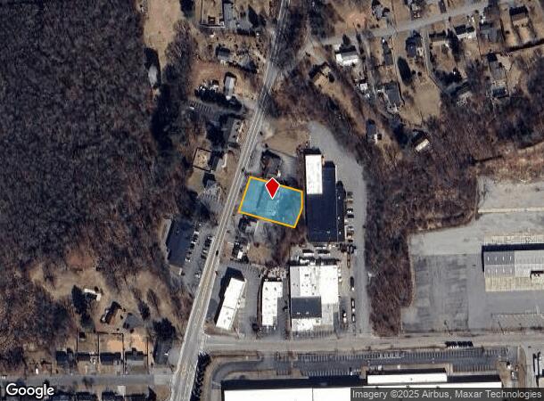
2339 Diamond Hill Rd, Cumberland, RI 02864

NEARBY LISTINGS FOR SALE OR LEASE
Property Detail
2339 Diamond Hill Rd
Commercialbuilding
Providence
X
Rhode Island
25021C0410E
0.52 AC
2025
Lincoln
2025
Providence
011404
Providence-Warwick, RI-MA
3,360 SF
CUMB-000024-000410-000000
DEMOGRAPHICS near 2339 Diamond Hill Rd
1 Mile
3 Mile
5 Mile
2024 Total Population
5,343
34,550
130,395
2029 Population
5,375
34,502
129,150
Pop Growth 2024-2029
+ 0.60%
(0.14%)
(0.95%)
Average Age
43
42
40
2024 Total Households
2,037
13,174
50,731
HH Growth 2024-2029
+ 0.54%
(0.27%)
(1.02%)
Median Household Inc
$126,791
$116,696
$82,720
Avg Household Size
2.60
2.60
2.50
2024 Avg HH Vehicles
2.00
2.00
2.00
Median Home Value
$386,586
$397,220
$370,540
Median Year Built
1978
1973
1966
Nearby Places
Map Layers
Map Styles
 Street
 Aerial
- Restaurants
- Banks
- Shops
- Fitness
- Groceries
PUBLIC TRANSPORTATION
COMMUTER RAIL
Pawtucket/Central Falls (Foxboro Event Service - MBTA, Providence/Stoughton Line - MBTA)
DRIVE
WALK
Distance
Pawtucket/Central Falls (Foxboro Event Service - MBTA, Providence/Stoughton Line - MBTA)
9 min
5.8 mi
South Attleboro (Providence/Stoughton Line - Massachusetts Bay Transportation Authority Commuter Rail (Purple Line))
DRIVE
WALK
Distance
South Attleboro (Providence/Stoughton Line - Massachusetts Bay Transportation Authority Commuter Rail (Purple Line))
10 min
7.0 mi
AIRPORT
Rhode Island Tf Green International
DRIVE
WALK
Distance
Rhode Island Tf Green International
32 min
18.5 mi
Freight Ports
Port of Davisville, RI
DRIVE
WALK
Distance
Port of Davisville, RI
45 min
34.1 mi
Nearby Properties
Address
Land Use
TOTAL SIZE
Lot Size
Zoning
Address
Land Use
TOTAL SIZE
Lot Size
Zoning
741,896 SF
27.75 AC
GU
Address
Land Use
TOTAL SIZE
Lot Size
Zoning
41.01 AC
30
Address
Land Use
TOTAL SIZE
Lot Size
Zoning
26.54 AC
90
Address
Land Use
TOTAL SIZE
Lot Size
Zoning
54.49 AC
RS20
Address
Land Use
TOTAL SIZE
Lot Size
Zoning
4.60 AC
60
Address
Land Use
TOTAL SIZE
Lot Size
Zoning
190,458 SF
16.30 AC
C60
Address
Land Use
TOTAL SIZE
Lot Size
Zoning
341,251 SF
16.22 AC
60
Address
Land Use
TOTAL SIZE
Lot Size
Zoning
115,258 SF
10.08 AC
100
Address
Land Use
TOTAL SIZE
Lot Size
Zoning
105,878 SF
12.05 AC
C60
Address
Land Use
TOTAL SIZE
Lot Size
Zoning
126,073 SF
22.90 AC
C60
Address
Land Use
TOTAL SIZE
Lot Size
Zoning
97,027 SF
12.02 AC
C60
Address
Land Use
TOTAL SIZE
Lot Size
Zoning
6 AC
120
Address
Land Use
TOTAL SIZE
Lot Size
Zoning
89,242 SF
14.65 AC
C60
Address
Land Use
TOTAL SIZE
Lot Size
Zoning
100,019 SF
10.37 AC
120
Address
Land Use
TOTAL SIZE
Lot Size
Zoning
11.87 AC
C60
Address
Land Use
TOTAL SIZE
Lot Size
Zoning
105,384 SF
17.07 AC
120
Address
Land Use
TOTAL SIZE
Lot Size
Zoning
101 AC
90
Address
Land Use
TOTAL SIZE
Lot Size
Zoning
33.95 AC
50
Address
Land Use
TOTAL SIZE
Lot Size
Zoning
132,005 SF
17.07 AC
ML05
Address
Land Use
TOTAL SIZE
Lot Size
Zoning
85,921 SF
34.74 AC
90
Address
Land Use
TOTAL SIZE
Lot Size
Zoning
182,578 SF
8.09 AC
GU
Address
Land Use
TOTAL SIZE
Lot Size
Zoning
48,400 SF
5.32 AC
60
Address
Land Use
TOTAL SIZE
Lot Size
Zoning
83,819 SF
3.37 AC
90
Address
Land Use
TOTAL SIZE
Lot Size
Zoning
18,711 SF
7.15 AC
IC3
Address
Land Use
TOTAL SIZE
Lot Size
Zoning
267,498 SF
13.77 AC
60
Address
Land Use
TOTAL SIZE
Lot Size
Zoning
8.29 AC
50
Address
Land Use
TOTAL SIZE
Lot Size
Zoning
1.05 AC
40
Address
Land Use
TOTAL SIZE
Lot Size
Zoning
44,290 SF
7.87 AC
C60
Address
Land Use
TOTAL SIZE
Lot Size
Zoning
44,590 SF
5.50 AC
ML05
Address
Land Use
TOTAL SIZE
Lot Size
Zoning
2,576 SF
604.70 AC
The World's #1 Commercial Real Estate Marketplace
Connect with us
© 2025 CoStar Group
The information above has been obtained from sources believed reliable. While we do not doubt its accuracy we have not verified it and make no guarantee, warranty or representation about it. It is your responsibility to independently confirm its accuracy and completeness. Any projections, opinions, assumptions, or estimates used are for example only and do not represent the current or future performance of the property. The value of this transaction to you depends on tax and other factors which should be evaluated by your tax, financial, and legal advisors. You and your advisors should conduct a careful, independent investigation of the property to determine to your satisfaction the suitability of the property for your needs.