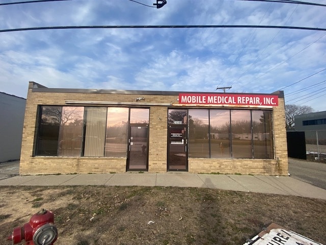
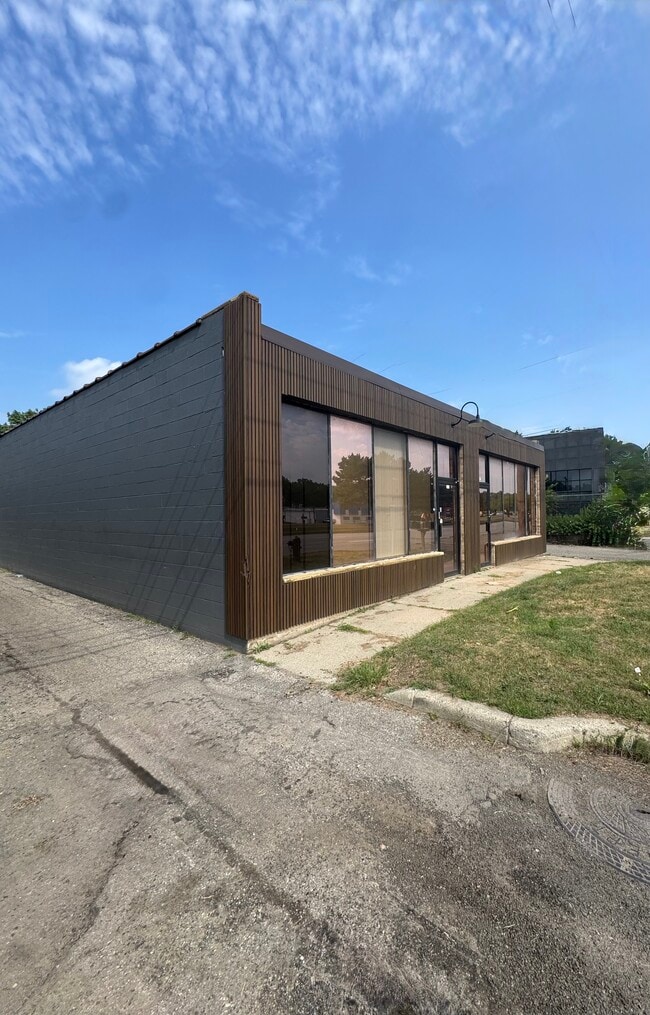
Property Record
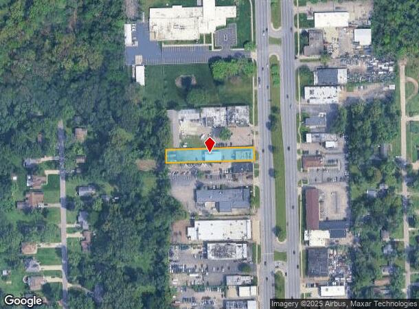
23391 Telegraph Rd, Southfield, MI 48033

Current Lease Availabilities
NEARBY LISTINGS FOR SALE OR LEASE
Property Detail
23391 Telegraph Rd
Detroit-Warren-Dearborn, MI
Churches Acres Sub
24-29-476-013
T1N,R10E,SEC 29 40 CHURCHES ACRES SUBDIVISION LOT 40 & N 8.76 FT OF LOT 41 EXC N 2 FT OF S 52 FTOF E 101.55 FT OF LOT 41
Storebuilding
Oakland
X
Michigan
26163C0060E
40-41
2024
0.52 AC
2022
Southfield
161700
Detroit
5,520 SF
DEMOGRAPHICS near 23391 Telegraph Rd
1 Mile
3 Mile
5 Mile
2024 Total Population
5,291
88,109
261,228
2029 Population
5,188
86,417
256,164
Pop Growth 2024-2029
(1.95%)
(1.92%)
(1.94%)
Average Age
44
42
41
2024 Total Households
2,327
38,580
110,068
HH Growth 2024-2029
(1.93%)
(1.91%)
(1.95%)
Median Household Inc
$58,956
$52,855
$58,353
Avg Household Size
2.20
2.20
2.30
2024 Avg HH Vehicles
2.00
2.00
2.00
Median Home Value
$179,738
$154,264
$170,196
Median Year Built
1969
1962
1959
Nearby Places
Map Layers
Map Styles
 Street
 Aerial
- Restaurants
- Banks
- Shops
- Fitness
- Groceries
PUBLIC TRANSPORTATION
AIRPORT
Detroit City
DRIVE
WALK
Distance
Detroit City
28 min
19.4 mi
Detroit Metro Wayne County
DRIVE
WALK
Distance
Detroit Metro Wayne County
35 min
31.9 mi
Freight Ports
Port of Baltimore
DRIVE
WALK
Distance
Port of Baltimore
1 min
413.0 mi
Nearby Properties
Address
Land Use
TOTAL SIZE
Lot Size
Zoning
Address
Land Use
TOTAL SIZE
Lot Size
Zoning
2,373,792 SF
17.35 AC
RC
Address
Land Use
TOTAL SIZE
Lot Size
Zoning
882,862 SF
8.22 AC
RC
Address
Land Use
TOTAL SIZE
Lot Size
Zoning
588 SF
53.02 AC
RM
Address
Land Use
TOTAL SIZE
Lot Size
Zoning
460,062 SF
10.01 AC
RC
Address
Land Use
TOTAL SIZE
Lot Size
Zoning
592,350 SF
23.64 AC
RC
Address
Land Use
TOTAL SIZE
Lot Size
Zoning
535,287 SF
9.26 AC
RC
Address
Land Use
TOTAL SIZE
Lot Size
Zoning
383,602 SF
36.60 AC
I-1
Address
Land Use
TOTAL SIZE
Lot Size
Zoning
859,104 SF
9.59 AC
RC
Address
Land Use
TOTAL SIZE
Lot Size
Zoning
261,633 SF
12.19 AC
RMM
Address
Land Use
TOTAL SIZE
Lot Size
Zoning
655,519 SF
9.18 AC
ERO
Address
Land Use
TOTAL SIZE
Lot Size
Zoning
170,465 SF
4.84 AC
BV
Address
Land Use
TOTAL SIZE
Lot Size
Zoning
17.19 AC
RC
Address
Land Use
TOTAL SIZE
Lot Size
Zoning
280,500 SF
3.58 AC
RC
Address
Land Use
TOTAL SIZE
Lot Size
Zoning
350,140 SF
27.11 AC
RC
Address
Land Use
TOTAL SIZE
Lot Size
Zoning
248,911 SF
4.55 AC
RC
Address
Land Use
TOTAL SIZE
Lot Size
Zoning
233,598 SF
17.24 AC
RS
Address
Land Use
TOTAL SIZE
Lot Size
Zoning
301,269 SF
25.47 AC
OS
Address
Land Use
TOTAL SIZE
Lot Size
Zoning
405,020 SF
18.74 AC
RMM
Address
Land Use
TOTAL SIZE
Lot Size
Zoning
367,101 SF
37.77 AC
R-E
Address
Land Use
TOTAL SIZE
Lot Size
Zoning
344,960 SF
8.90 AC
RC
Address
Land Use
TOTAL SIZE
Lot Size
Zoning
213,135 SF
6.17 AC
RC
Address
Land Use
TOTAL SIZE
Lot Size
Zoning
325,654 SF
7.45 AC
ERO
Address
Land Use
TOTAL SIZE
Lot Size
Zoning
181,954 SF
Address
Land Use
TOTAL SIZE
Lot Size
Zoning
306,250 SF
14.60 AC
RC
Address
Land Use
TOTAL SIZE
Lot Size
Zoning
209,000 SF
11.21 AC
ERO
Address
Land Use
TOTAL SIZE
Lot Size
Zoning
210 SF
20.52 AC
R-2
Address
Land Use
TOTAL SIZE
Lot Size
Zoning
216 SF
14.26 AC
RC
Address
Land Use
TOTAL SIZE
Lot Size
Zoning
304 SF
6.99 AC
RC
Address
Land Use
TOTAL SIZE
Lot Size
Zoning
288,641 SF
13.56 AC
RMM
Address
Land Use
TOTAL SIZE
Lot Size
Zoning
307,002 SF
14.61 AC
RC
The World's #1 Commercial Real Estate Marketplace
Connect with us
© 2025 CoStar Group
The information above has been obtained from sources believed reliable. While we do not doubt its accuracy we have not verified it and make no guarantee, warranty or representation about it. It is your responsibility to independently confirm its accuracy and completeness. Any projections, opinions, assumptions, or estimates used are for example only and do not represent the current or future performance of the property. The value of this transaction to you depends on tax and other factors which should be evaluated by your tax, financial, and legal advisors. You and your advisors should conduct a careful, independent investigation of the property to determine to your satisfaction the suitability of the property for your needs.